Click to visit the main New York Public Library Homepage
The New York Public Library
Digital Collections
About Digital Collections
Browse
Search only public domain materials
Items
Collections
Divisions
Home
Search
Browse
About
Search only public domain materials
Items
Collections
Divisions
Digital Collections
Using Images
Using Data
Search
Filtered keyword search
Show filters
Hide filters
Show Only Public Domain
topic
Geology
6
Coal mines and mining
4
Real property
4
Anthracite coal mines and mining
3
Administrative and political divisions
2
More
Less
name
Lesley, J. P. (J. Peter), 1819-1903
7
Geological Survey of Pennsylvania
6
Hart, Lane S
6
Ashburner, Charles A. (Charles Albert), 1854-1889
5
Julius Bien & Co
4
More
Less
collection
Maps of North America
23
Lawrence H. Slaughter Collection of English maps, charts, globes, books and atlases
1
Wallach Division Picture Collection
1
place
x
Pennsylvania
New Jersey
5
Schuylkill County
4
Carbon County
3
New York (State)
3
More
Less
genre
Maps
25
Topographic maps
15
Geological maps
4
Cadastral maps
2
Charts
2
More
Less
publisher
Geological Survey of Pennsylvania
4
publisher not identified
3
Fairmount Park Commission?
2
Geological Survey of Pennsylvania?
2
M. A. Lotter
2
More
Less
division
Map Division
24
Wallach Division: Picture Collection
1
type
cartographic
24
still image
1
Date Range
to
25 results found for:
x
Topographic maps
Filtering on:
x
Place
: Pennsylvania
Sort by:
Relevance
Title
Date created
Date digitized
Sequence
A geological and
topographical
sketch
map
note:
Mapping
the Nation (NEH grant, 2015-2018)…
Map
of the Pittsburg & Baltimore Coal
note:
Mapping
the Nation (NEH grant, 2015-2018)…
A geological and
topographical
map
of the New
note:
Mapping
the Nation (NEH grant, 2015-2018)…
m
Topographical
map
of the Wyoming coal field …
note:
NYPL
Map
Div. copy
General plan for the town of …
note:
Topographical
map
by Geo. R. Mackenzie
Topographical
map
of Fairmount Park, Philadelphia …
note:
… catalog of the
Map
Topographical
map
of the coal and iron ore lands
note:
… catalog of the
Map
Topographical
map
in thirty-foot contour
note:
Mapping
the Nation (NEH grant, 2015-2018)…
Topographical
map
of Fairmount Park, Philadelphia …
note:
NYPL
Map
Div. copy: manuscript additions in black
Geological
map
of the environs of Orbisonia
note:
…,
topographer
.
Topographical
map
in ten-foot contour
note:
Mapping
the Nation (NEH grant, 2015-2018)…
Philadelphia and vicinity : P…
note:
…, Chief
Topographer
. H.M
Lloyd's
map
of the Great Oil Region
note:
Specially surveyed for this
map
by B.M. Hanks, A.M
Lloyd's
map
of the Great Oil Region
note:
Specially surveyed for this
map
by our own
m
Topographical
map
of the state of New Jersey
note:
…: Meteorological
map
of the state
Map
of New Jersey and Pennsylvania : exhibiting
note:
… of
maps
described in Ristow's American
maps
A
map
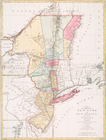
of the provinces of New-York
note:
LC
Maps
of North America, 1750-1789, 1048
A
map
of the provinces of New-York
note:
LC
Maps
of North America, 1750-1789, 1048
m
Topographical
map
of the state of Pennsylvania
note:
…, and inset
maps
.
Map
of Presqu'ile Bay or Erie Harbor …
note:
… and carto-bibliography of
maps
, entry 401 (27-2) H.doc. 2,
map
2
Geological and
topographical
map
note:
… geologist ;
topographical
Second Geological Survey of P…
note:
…
maps
, Southern Coal
Second Geological Survey of P…
note:
Mapping
the Nation (NEH grant, 2015-2018)…
m
Post route
map
of the states of Pennsylvania
note:
…,
topographer
of P.O. Dept
Gettysburg and vicinity, cons…
note:
Printed on border: "A
topographical
map
End of results
|
Top