Click to visit the main New York Public Library Homepage
The New York Public Library
Digital Collections
About Digital Collections
Browse
Search only public domain materials
Items
Collections
Divisions
Home
Search
Browse
About
Search only public domain materials
Items
Collections
Divisions
Digital Collections
Using Images
Using Data
Search
Filtered search
Show filters
Hide filters
Show Only Public Domain
topic
Hydrographic surveying
1
Real property
1
name
Commission on Boundary Lines between Delaware, Maryland, and Pennsylvania (1850)
1
Dawson, William, Jr
1
Delisle, Chs
1
Gilman, E
1
Graham, J. D. (James Duncan), 1799-1865
1
More
Less
collection
Maps of North America
4
Maps of New York City and State
1
place
Maryland
2
Delaware
1
Delaware -- Boundaries -- Maryland -- Maps
1
Delaware -- Boundaries -- Pennsylvania -- Maps
1
Fishers Island (Conn. and N.Y.)
1
More
Less
genre
Maps
5
publisher
Commission on Boundary Lines between Delaware, Maryland, and Pennsylvania?,
1
For the Potomac Manufacturing Company?
1
General Land Office?,
1
The Survey?,
1
s.n.,
1
division
Map Division
5
type
cartographic
5
Date Range
to
5 results found
Filtering on:
x
Place term
: Washington? :
Sort by:
Title
Date created
Date digitized
Sequence
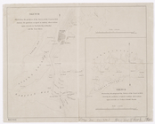
Sketch illustrating the progr…
Map showing a portion of the …
Map of the city of Washington…
Plan of part of Weverton
Map of the United States show…