Click to visit the main New York Public Library Homepage
The New York Public Library
Digital Collections
About Digital Collections
Browse
Search only public domain materials
Items
Collections
Divisions
Home
Search
Browse
About
Search only public domain materials
Items
Collections
Divisions
Digital Collections
Using Images
Using Data
Search
Filtered keyword search
Show filters
Hide filters
Show Only Public Domain
topic
Real property
184
Maps
14
name
G.W. Bromley & Co
415
Bromley, George Washington
288
Bromley, Walter Scott
288
collection
Atlases of New York City
331
Atlases of the United States
85
place
New York (State)
188
New York (N.Y.)
148
Bronx (New York, N.Y.)
141
Manhattan (New York, N.Y.)
93
New York
93
More
Less
genre
Maps
413
Atlases
85
Index maps
37
Outline maps
10
Indexes
4
More
Less
publisher
x
G.W. Bromley & Co
division
Map Division
416
type
cartographic
413
text
6
Date Range
to
416 results found for:
x
North Hempstead (N.Y. : Town) -- Maps
Filtering on:
x
Publisher
: G.W. Bromley & Co.
Sort by:
Relevance
Title
Date created
Date digitized
Sequence
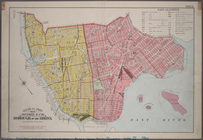
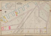
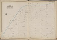
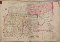
Outline and Index
Map
, Sections 9 and 10
note:
Includes 37 pages of text and 19
maps
.
Outline and Index
Map
, Sections 9 and 10
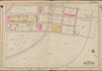
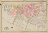
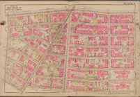
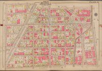
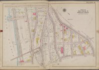
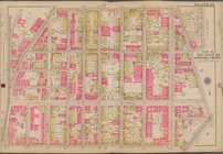
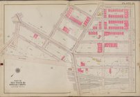
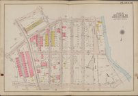
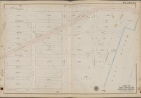
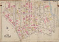
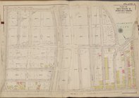
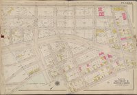
Plate 1 [
Map
bounded by E. 135th St
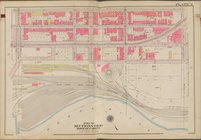
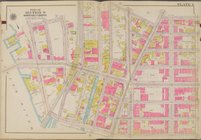
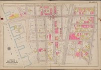
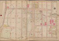
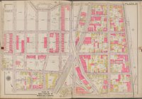
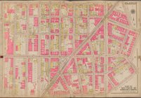
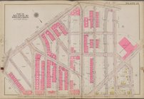
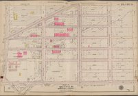
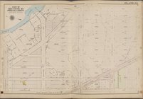
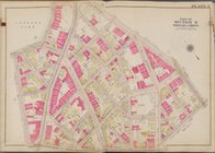
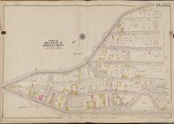
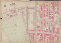
Plate 2 [
Map
bounded by E. 135th St
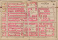
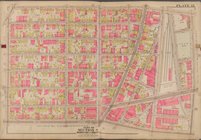
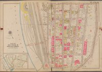
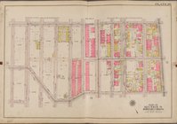
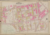
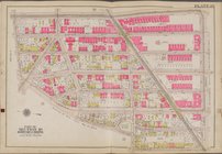
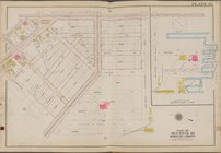
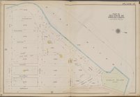
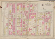
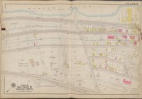
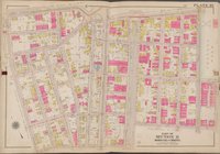
Plate 3 [
Map
bounded by E. 135th St
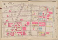
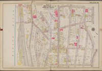
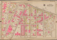
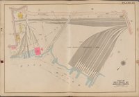
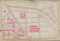
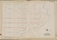
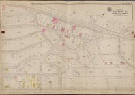
Plate 4 [
Map
bounded by E. 141st St., E
Plate 5 [
Map
bounded by E. 142nd St
Plate 6 [
Map
bounded by E. 141st St
Plate 7 [
Map
bounded by Dater St., E
Plate 8 [
Map
bounded by E. 149th St
Plate 9 [
Map
bounded by E. 150th St
Plate 10 [
Map
bounded by Harlem River, E
Plate 11 [
Map
bounded by Gerard Ave., E
Plate 12 [
Map
bounded by E. 156th St
Plate 13 [
Map
bounded by E. 163rd St
Plate 14 [
Map
bounded by E. 166th St
Plate 15 [
Map
bounded by W. 166th St
Plate 16 [
Map
bounded by W. 169th St
Plate 17 [
Map
bounded by Washington
Plate 18 [
Map
bounded by E. 169th St
Plate 19 [
Map
bounded by E. 167th St
collection:
Plate 19 [
Map
bounded by E. 167th St., 3
Plate 20 [
Map
bounded by E. 169th St
collection:
Plate 20 [
Map
bounded by E. 169th St., 3
Plate 21 [
Map
bounded by E. 169th St
Plate 22 [
Map
bounded by E. 166th St
Plate 23 [
Map
bounded by E. 161st St
Plate 24 [
Map
bounded by E. 152nd St
Plate 25 [
Map
bounded by Whitlock Ave
Plate 26 [
Map
bounded by Dawson St
Plate 27 [
Map
bounded by Hunts Point Ave
Plate 28 [
Map
bounded by Southern Blvd
Plate 29 [
Map
bounded by Bronx River
Plate 30 [
Map
bounded by Garrison Ave
Plate 31 [
Map
bounded by Longfellow Ave
Plate 32 [
Map
bounded by Tiffany St
Plate 33 [
Map
bounded by Longfellow Ave
Plate 34 [
Map
bounded by Farragut St
Plate 35 [
Map
bounded by Farragut St
Plate 36 [
Map
bounded by Bronx River
Plate 37 [
Map
bounded by East River
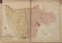
Outline and Index
Map
, Sections 11, 12
Plate 1 [
Map
bounded by E. 172nd St
Plate 2 [
Map
bounded by Wilkins Ave
Plate 3 [
Map
bounded by E. 171st St
Plate 4 [
Map
bounded by E. 172nd St
Plate 5 [
Map
bounded by Boscobel Ave
Plate 6 [
Map
bounded by Harlem River, W
Plate 7 [
Map
bounded by Aqueduct Ave
Plate 8 [
Map
bounded by Jerome Ave
Plate 9 [
Map
bounded by E. 173rd St., E
Plate 10 [
Map
bounded by E. Tremont Ave
1
2
Previous
Next
1
2
Previous
Next