Click to visit the main New York Public Library Homepage
The New York Public Library
Digital Collections
About Digital Collections
Browse
Search only public domain materials
Items
Collections
Divisions
Home
Search
Browse
About
Search only public domain materials
Items
Collections
Divisions
Digital Collections
Using Images
Using Data
Search
Filtered keyword search
Show filters
Hide filters
Show Only Public Domain
topic
Indian trails
12
Indians of North America
12
name
A.R. Ohman Map Co
12
Bolton, Reginald Pelham, 1856-1942
12
Museum of the American Indian, Heye Foundation
12
Ohman, August R
12
collection
Maps of New York City and State
12
place
New York
12
New York (N.Y.)
12
New York (State)
12
Bronx (New York, N.Y.)
4
Brooklyn (New York, N.Y.)
4
More
Less
genre
Maps
12
publisher
x
Museum of the American Indian, Heye Foundation
division
Map Division
12
type
cartographic
12
Date Range
to
12 results found for:
x
Ohman Map Co
Filtering on:
x
Publisher
: Museum of the American Indian, Heye Foundation
Sort by:
Relevance
Title
Date created
Date digitized
Sequence
Yorkville and East Harlem in …
collection:
Maps
of New York City and State
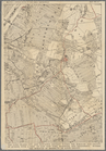
Upper Manhattan, comprising t…
collection:
Maps
of New York City and State
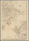
The southeastern part of the …
collection:
Maps
of New York City and State
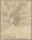
Greater New York and contigou…
collection:
Maps
of New York City and State
Werpoes, a village of the Man…
collection:
Maps
of New York City and State
Southern part of the borough …
collection:
Maps
of New York City and State
The southwestern part of the …
collection:
Maps
of New York City and State
Southeastern part of the boro…
collection:
Maps
of New York City and State
The lower end of Manhattan Is…
collection:
Maps
of New York City and State
The Long Island City and Newt…
collection:
Maps
of New York City and State
The northwesterly part of the…
collection:
Maps
of New York City and State
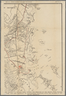
The district of Pelham Neck, …
collection:
Maps
of New York City and State
End of results
|
Top