Click to visit the main New York Public Library Homepage
The New York Public Library
Digital Collections
About Digital Collections
Browse
Search only public domain materials
Items
Collections
Divisions
Home
Search
Browse
About
Search only public domain materials
Items
Collections
Divisions
Digital Collections
Using Images
Using Data
Search
Filtered keyword search
Show filters
Hide filters
Show Only Public Domain
topic
Real property
20
Railroads
17
History
13
Landowners
9
Geology
8
More
Less
name
Ackerman Lithr
3
Hayward, George, approximately 1800-
3
Boston (Mass.). Engineering Department
2
Cleveland Iron Mining Company
2
Daniels, John H., 1828-1901
2
More
Less
collection
Maps of North America
70
Maps of New York City and State
19
Maps of North and South America
1
place
New York (State)
17
Michigan
16
Massachusetts
9
New York
8
United States
8
More
Less
genre
Maps
90
Cadastral maps
15
Geological maps
6
Bathymetric maps
3
Nautical charts
3
More
Less
publisher
x
publisher not identified
Lith. by Berggoetz & Co
1
Robert A. Welcke, Photo-Lith
1
lith. by James B. Lyon
1
division
Map Division
90
type
cartographic
90
still image
2
text
2
Date Range
to
90 results found for:
x
Scales
Filtering on:
x
Publisher
: publisher not identified
Sort by:
Relevance
Title
Date created
Date digitized
Sequence
m
Hudson River vehicular tunnel…
note:
Scales
not given.
Map of the town of Huron, Mic…
note:
Scales
differ (W 82°27ʹ59ʺ--W 82°23ʹ55ʺ/N
Florida
note:
…, [
Scale
approximately
m
Data for population from cens…
note:
Scale
1:36,000. 300 foot
scale
map (W 74°01
m
Map of the Grand Rapids and I…
note:
Scale
not given (W 88°14ʹ--W 82°07ʹ/N 48°18
Geological sketch of Philadel…
note:
This is a larger and larger-
scale
version of map
Part of New Jersey : embracin…
note:
Bar
scale
and verbal statement of
scale
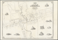
Map of the village of William…
note:
Scale
1:1,980.
Scale
2 chains and 50
Plan of Boston: prepared unde…
note:
… of South Boston. [
Scale
Map of the territory of the […
note:
…; printed
scale
ratio and
scale
bar pasted over
Plan of the Village of Marque…
abstract:
….
Scale
[1:63,360.] 1 mile
Plan of Boston: corrected und…
note:
… of East Boston. [
Scale
Map of the town of Fairhaven,…
note:
… and Oxford villages.
Scale
Section and diagram illustrat…
note:
Scale
approximately 1:350,000. Vertical
scale
Mapa de la provincia de Pinar…
note:
Scale
given in km and leguas cubanas.
NE sheet of map of North Amer…
note:
Scale
approximately 1:1,600,000 (W 74°46ʹ00ʺ--W
Springfield, Ill. 1892
note:
Scale
not given (W 89°46ʹ23ʺ--W 89°34ʹ06ʺ/N
Map of the county of Kings, s…
note:
Scale
not given (W 74°02ʹ34ʺ--W 73°50ʹ00ʺ/N
Guide map to the Brooklyn and…
note:
Scale
not given.
A geological map of a part of…
note:
…
scale
approximately
Railroads of Minneapolis and …
note:
Scale
1:1,900,800. 30 miles to 1 inch (W
m
Map of Cambridge in the vicin…
note:
…, on a
scale
of 209 feet to 1
Map of part of Jersey City, …
note:
Scale
not given (W 74°03ʹ--W 74°01ʹ/N 40°43
Map of the town of Ipswich, c…
note:
…. [
Scale
1:6,633].
m
Map showing Indian reservatio…
note:
Scale
approximately 1:7,500,000 (W 126°--W 86°/N
Plan of the entrance into Cap…
abstract:
… to a small
scale
& placed E
Map of the state of Missouri …
note:
Scale
approximately 1:2,200,000 (W 101°30ʹ--W
Map of the territory of Minne…
note:
Scale
not given (W 98°55ʹ--W 88°14ʹ/N 50°10
Map of the country which was …
note:
Scale
[ca. 1:2,000,000] (W 74°00ʹ--W
Grand Rapids, Michigan 1868
note:
Not drawn to
scale
(W 85°45ʹ05ʺ--W 85°34
m
Vicinity of the Rapidan and R…
note:
Scale
not given (W 78°00ʹ55ʺ--W 77°26ʹ49ʺ/N
Map of the tertiary of Essex …
note:
Scale
not given (W 74°20ʹ--W 73°09ʹ/N 44°39
Map of Jackson Park : showing…
note:
Scale
approximately 1:4,800 (W 87°36ʹ25ʺ--W
A plan of New York Island, pa…
note:
Scale
approximately 1:85,000 (W 74°07ʹ40ʺ--W
m
Bureau of roads
abstract:
… at right.
Scale
Chicago : correctly copied fr…
note:
Scale
1:7,200. 600 feet to an inch (W
Map of Livingston Manor anno …
note:
Scale
of furlongs (approximately 4 furlongs
Map of central Keweenaw Penin…
note:
Scale
not given (W 88°41ʹ--W 88°15ʹ/N 47°17
Yorktown, armament of batteri…
note:
Scale
approximately 1:20,000 (W 76°34ʹ13ʺ--W
Map of the state of Wisconsin…
note:
Scale
approximately 1:2,800,000 (W 92°53ʹ--W 86°14
Chengwatana, Pine County, M.T…
note:
Scale
not given (W 92°56ʹ--W 92°55ʹ/N 45°51
Universale della parte del mo…
note:
Scale
not given (W 157°31ʹ00ʺ--W 6°46ʹ00ʺ/N
Chart of the coast of Georgia
note:
Scale
approximately 1:370,000 (W 81°59ʹ--W 76°45
Americae septentrionalis pars…
note:
Scale
[ca. 1:13,200,000] (W 100°--W 42°/N
A map of the new governments …
abstract:
… of Pensacola. [
Scale
A Plan of the Straits of St. …
note:
Scale
approximately 1:800,000 (W 86°26ʹ--W 81°58
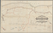
Western Division of the Erie …
note:
…,
scale
3600 feet
Map of the town of Natick, Mi…
note:
Inset: Natick Village.
Scale
Map of the country thirty mil…
note:
Scale
1:255,000.
Extract from Borden's map of …
note:
…, Superintendent.
Scale
1:158,400