Click to visit the main New York Public Library Homepage
The New York Public Library
Digital Collections
About Digital Collections
Browse
Search only public domain materials
Items
Collections
Divisions
Home
Search
Browse
About
Search only public domain materials
Items
Collections
Divisions
Digital Collections
Using Images
Using Data
Search
Filtered keyword search
Show filters
Hide filters
Show Only Public Domain
topic
x
Railroads
Administrative and political divisions
139
Canals
68
Local transit
48
Roads
48
More
Less
name
Rand McNally and Company
36
G.W. & C.B. Colton & Co
26
United States. General Land Office
20
United States. Post Office Department
18
Nicholson, W. L
15
More
Less
collection
Maps of New York City and State
226
Maps of North America
209
Robert N. Dennis collection of stereoscopic views
19
Detroit Publishing Company postcards
5
Atlases of the United States
2
More
Less
place
New York (State)
245
New York
128
New York (N.Y.)
108
Manhattan (New York, N.Y.)
73
United States
59
More
Less
genre
Maps
438
Photographs
19
Stereographs
19
Cadastral maps
13
Tourist maps
7
More
Less
publisher
publisher not identified
24
G.W. & C.B. Colton & Co
22
The Company
13
Rand, McNally & Co
12
Department of the Interior, General Land Office
11
More
Less
division
Map Division
436
Wallach Division: Photography Collection
24
Wallach Division: Print Collection
3
Manuscripts and Archives Division
2
type
cartographic
437
still image
29
text
5
Date Range
to
465 results found for:
x
United States Circuit Court (New York : Southern District)
Filtering on:
x
Rights
: Public Domain
x
Topic
: Railroads
Sort by:
Relevance
Title
Date created
Date digitized
Sequence
United
States
use:
… partner (e.g.,
New
York
… &
southern
states
use:
… partner (e.g.,
New
York
… &
Southern
States
use:
… partner (e.g.,
New
York
United
States
of America
use:
… partner (e.g.,
New
York
Disturnell's
new
map of the
United
use:
… partner (e.g.,
New
York
Disturnell's
new
map of the
United
use:
… partner (e.g.,
New
York
m
United
States
of America, 1834
use:
… partner (e.g.,
New
York
m
Map of the
United
States
and territories
use:
… partner (e.g.,
New
York
Southern
New
England
use:
… partner (e.g.,
New
York
Lloyd's
new
map of the
United
States
use:
… partner (e.g.,
New
York
The
new
South-West, map of the
United
use:
… partner (e.g.,
New
York
m
Financial
district
map of
New
York
City …
use:
… partner (e.g.,
New
York
… map of the
United
States
use:
… partner (e.g.,
New
York
Topographical map,
United
States
use:
… partner (e.g.,
New
York
m
Goldthwait's map of the
United
States
& Canada
use:
… partner (e.g.,
New
York
m
New
map of the
state
of
New
York
use:
… partner (e.g.,
New
York
Map of the
State
of
New
-
York
use:
… partner (e.g.,
New
York
Map of the
state
of
New
York
use:
… partner (e.g.,
New
York
Map of the
State
of
New
York
use:
… partner (e.g.,
New
York
Map of the
State
of
New
York
use:
… partner (e.g.,
New
York
…'s
new
rail road map of the
United
States
use:
… partner (e.g.,
New
York
m
New
national map of the
United
States
showing
use:
… partner (e.g.,
New
York
m
Watson's
new
county and railroad map of the
United
use:
… partner (e.g.,
New
York
… of the
United
States
use:
… partner (e.g.,
New
York
… of the
United
States
use:
… partner (e.g.,
New
York
m
General railway map of the
United
States
and Canada
use:
… partner (e.g.,
New
York
… of the territory of the [
U
]nite[d
States
]
use:
… partner (e.g.,
New
York
… proposed route of
circuit
use:
… partner (e.g.,
New
York
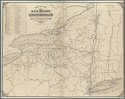
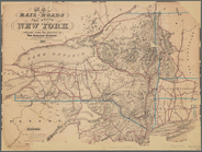
… of the railroads of the
State
of
New
York
use:
… partner (e.g.,
New
York
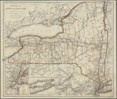
Engineers map of the
state
of
New
York
use:
… partner (e.g.,
New
York
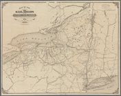
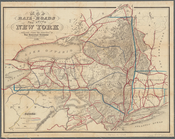
Railroad map of the
State
of
New
York
use:
… partner (e.g.,
New
York
… of the
United
States
, Mexico, and the
states
of Central America
use:
… partner (e.g.,
New
York
Lloyd's map of the
Southern
States
, showing
use:
… partner (e.g.,
New
York
… standard map of
New
York
- Philadelphia
district
use:
… partner (e.g.,
New
York
m
… the railroads in the
United
States
in operation
use:
… partner (e.g.,
New
York
m
… and commercial map of the
United
States
and Canada
use:
… partner (e.g.,
New
York
Map of the
United
States
of America showing
use:
… partner (e.g.,
New
York
… associations of the
United
States
use:
… partner (e.g.,
New
York
m
… & commercial map of the
United
States
& Canada
use:
… partner (e.g.,
New
York
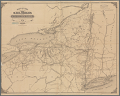
… roads of the
state
of
New
York
use:
… partner (e.g.,
New
York
… roads of the
state
of
New
York
use:
… partner (e.g.,
New
York
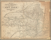
…-roads of the
State
of
New
York
use:
… partner (e.g.,
New
York
… roads of the
state
of
New
York
use:
… partner (e.g.,
New
York
m
…-roads of the
state
of
New
York
use:
… partner (e.g.,
New
York
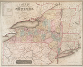
Map of the
state
of
New
-
York
use:
… partner (e.g.,
New
York
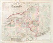
Map of the
state
of
New
-
York
use:
… partner (e.g.,
New
York
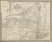
…-roads of the
State
of
New
York
use:
… partner (e.g.,
New
York
…-roads of the
state
of
New
York
use:
… partner (e.g.,
New
York
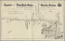
Profiles of the
New
York
State
canals
use:
… partner (e.g.,
New
York
… roads of the
State
of
New
York
use:
… partner (e.g.,
New
York
1
2
Previous
Next
1
2
Previous
Next