Click to visit the main New York Public Library Homepage
The New York Public Library
Digital Collections
About Digital Collections
Browse
Search only public domain materials
Items
Collections
Divisions
Home
Search
Browse
About
Search only public domain materials
Items
Collections
Divisions
Digital Collections
Using Images
Using Data
Search
Filtered keyword search
Show filters
Hide filters
Show Only Public Domain
topic
Real property
744
Fire insurance
429
Cities & towns
427
Maps
61
Administrative and political divisions
49
More
Less
name
Sanborn Map Company
427
G.W. Bromley & Co
192
Ullitz, Hugo
86
E.B. Hyde & Co
81
E. Belcher Hyde Map Company
73
More
Less
collection
Atlases of New York City
774
Maps of North America
218
Bancker plans
98
Maps of New York City and State
85
Atlases of the United States
68
More
Less
place
New York (State)
804
New York
260
Bronx (New York, N.Y.)
168
Brooklyn (New York, N.Y.)
113
New York (N.Y.)
94
More
Less
genre
Maps
1323
Surveys
98
land surveys
90
Atlases
67
Topographic maps
46
More
Less
publisher
Sanborn Map Company
428
G.W. Bromley & Co
182
E. Belcher Hyde
81
The Division
29
Printed for Robert Sayer, No. 53, Fleet-Street
22
More
Less
division
Map Division
1199
Manuscripts and Archives Division
98
General Research Division
16
Wallach Division: Print Collection
5
Schomburg Jean Blackwell Hutson Research and Reference Division
3
More
Less
type
x
cartographic
text
35
still image
21
Date Range
to
1,325 results found for:
x
10
Filtering on:
x
Rights
: Public Domain
x
Type
: cartographic
Sort by:
Relevance
Title
Date created
Date digitized
Sequence
….
10
.
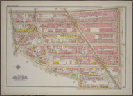
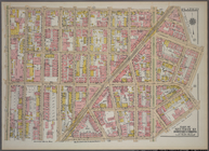
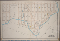
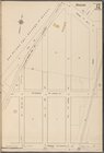
Queens V.
10
, Plate No.
10
[Map bounded
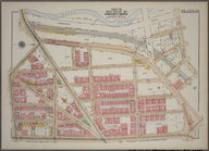
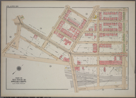
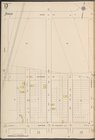
Brooklyn V.
10
, Plate No.
10
[Map
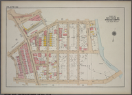
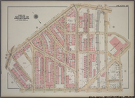
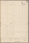
Bronx, V.
10
, Plate No.
10
[Map bounded
parent:
a658f190-c5fb-012f-a
10
f-58d385a7bc34
….
10
… 1598g. Tekst str.
10
Palmerstone's Reef Islands [P…
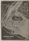
Niagara Falls and vicinity
parent:
c33fa9d0-c5ed-012f-
10
d5-58d385a7bc34
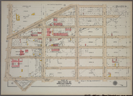
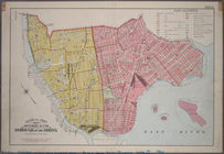
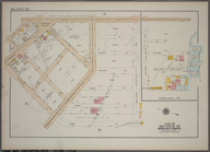
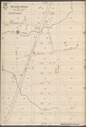
Outline & Index Map: Sections 9 and
10
, Borough
Plate 35, Part of Section
10
, Borough
Plate 36, Part of Section
10
, Borough
Plate 37, Part of Section
10
, Borough
…, Double Page Plate No.
10
; Part of Wards 6,
10
Plate 1, Part of Section
10
, Borough
Plate 6, Part of Section
10
, Borough
Plate
10
, Part of Section 9, Borough
Plate 21, Part of Section
10
, Borough
Plate 22, Part of Section
10
, Borough
Plate 25, Part of Section
10
, Borough
Plate 28, Part of Section
10
, Borough
Plate 29, Part of Section
10
, Borough
Plate 30, Part of Section
10
, Borough
Plate 31, Part of Section
10
, Borough
Plate 33, Part of Section
10
, Borough
Plate 34, Part of Section
10
, Borough
m
10
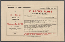
Bronx Plots suitable for Builders ripe
parent:
f
10
c73d0-32bc-0131-7448-58d385a7bbd0
Plate 7, Part of Section
10
, Borough
Plate 9, Part of Section
10
, Borough
Plate 23, Part of Section
10
, Borough
Plate 26, Part of Section
10
, Borough
Plate 27, Part of Section
10
, Borough
Outline and Index Map, Sections 9 and
10
Plate 19: Part of Section
10
, Borough
Plate 32: Part of Section
10
, Burrough
Brooklyn V.
10
, Plate No. 19 [Map
Brooklyn V.
10
, Plate No. 25 [Map
Brooklyn V.
10
, Plate No. 37 [Map
Queens V.
10
, Plate No. 2 [Map bounded
Queens V.
10
, Plate No. 3 [Map bounded
Queens V.
10
, Plate No. 5 [Map bounded
Queens V.
10
, Plate No. 6 [Map bounded
Queens V.
10
, Plate No. 7 [Map bounded
Queens V.
10
, Plate No. 9 [Map bounded
Queens V.
10
, Plate No. 11 [Map bounded
Queens V.
10
, Plate No. 12 [Map bounded
Queens V.
10
, Plate No. 13 [Map bounded
Queens V.
10
, Plate No. 14 [Map bounded
Queens V.
10
, Plate No. 15 [Map bounded
Queens V.
10
, Plate No. 16 [Map bounded
Queens V.
10
, Plate No. 17 [Map bounded
1
2
3
4
5
6
Previous
Next
1
2
3
4
5
6
Previous
Next