Click to visit the main New York Public Library Homepage
The New York Public Library
Digital Collections
About Digital Collections
Browse
Search only public domain materials
Items
Collections
Divisions
Home
Search
Browse
About
Search only public domain materials
Items
Collections
Divisions
Digital Collections
Using Images
Using Data
Search
Filtered keyword search
Show filters
Hide filters
Show Only Public Domain
topic
x
Nautical charts
Atlases
1
Atlases, British
1
Coasts
1
name
Robert Sayer and John Bennett (Firm)
2
Seller, John, active 1658-1698
2
Clerk, James, active 1680-1695
1
Darby, John, 1624 or 1625-1704
1
Fisher, Joshua, 1707-1783
1
More
Less
collection
x
Lawrence H. Slaughter Collection of English maps, charts, globes, books and atlases
place
Maps
3
Hudson River Estuary (N.Y. and N.J.)
2
New England
2
New Jersey
2
Atlantic Coast (Middle Atlantic States)
1
More
Less
genre
Maps
6
publisher
Printed for Robt. Sayer & John Bennett, sea chart & map-sellers ..
2
And are to be sold at his shopps in Wapping at the Hermitage and in Exchange-Alley near the Royall-Exchange ..
1
Printed by John Darby for the author, and are to be sold at his shop at the Hermitage in Wapping,
1
Printed for Robert Sayer, map & sea chartseller, No. 53 Fleet Street
1
Sold by W & J Mount & T. Page on Tower Hill
1
division
Map Division
6
type
cartographic
6
Date Range
to
6 results found for:
x
Seas
Filtering on:
x
Collection
: Lawrence H. Slaughter Collection of English maps, charts, globes, books and atlases
x
Topic
: Nautical charts
For more collection details, visit the
Lawrence H. Slaughter Collection of English maps, charts, globes, books and atlases collection page
.
Sort by:
Relevance
Title
Date created
Date digitized
Sequence
A general chart of the West I…
collection:
…, The
sea
-atlas: being a book
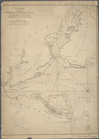
Chart of the entrance of Huds…
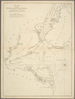
Chart of the entrance of Huds…
A chart of the
sea
coast of New Foundland
A chart of Delaware Bay and R…
A chart of the
sea
coasts of New-England