Click to visit the main New York Public Library Homepage
The New York Public Library
Digital Collections
About Digital Collections
Browse
Search only public domain materials
Items
Collections
Divisions
Home
Search
Browse
About
Search only public domain materials
Items
Collections
Divisions
Digital Collections
Using Images
Using Data
Search
Filtered keyword search
Show filters
Hide filters
Show Only Public Domain
topic
Astronomy, 1681
52
Geography
52
Mathematics
52
Nautical charts
3
Colonies
1
name
Flamsteed, John, 1646-1719
52
Godbid, A
52
Hanway, William
52
Moore, Jonas, Sir, 1617-1679
52
Perkins, Peter, -1680
52
More
Less
collection
x
Lawrence H. Slaughter Collection of English maps, charts, globes, books and atlases
place
Virginia -- Maps -- Early works to 1800
5
Maryland -- Maps -- Early works to 1800
4
Middle Atlantic States -- Maps -- Early works to 1800
4
America
3
Maps
3
More
Less
genre
Maps
69
publisher
Printed by A. Godbid and J. Playford, for R. Scott, bookseller
52
Davis & Force,
2
Printed by A. Godbid and J. Playford, for R. Scott, bookseller,
2
Printed for Robt. Sayer at No. 53 in Fleet Street, & Thos. Jefferys at the corner of St. Martins Lane, Charing Cross,
2
Sold by A. Dury, Dukes Court, St. Martins Lane
2
More
Less
division
Map Division
69
type
x
cartographic
Date Range
to
69 results found for:
x
Peters
Filtering on:
x
Collection
: Lawrence H. Slaughter Collection of English maps, charts, globes, books and atlases
x
Type
: cartographic
For more collection details, visit the
Lawrence H. Slaughter Collection of English maps, charts, globes, books and atlases collection page
.
Sort by:
Relevance
Title
Date created
Date digitized
Sequence
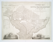
A correct map of the city of …
note:
… of January 1820 by
Peter
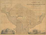
A correct map of the city of …
note:
… of January 1820 by
Peter
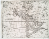
Americae descriptio nova
note:
From
Peter
Heylin's Cosmographie. 1652.
A map of the British dominion…
note:
by
Peter
Bell, geographer, 1772.
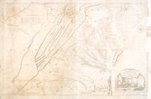
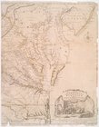
A map of the most inhabited p…
note:
drawn by Joshua Fry &
Peter
Jefferson in 1775.
m
A map of the most inhabited p…
note:
drawn by Joshua Fry &
Peter
Jefferson in 1775.
A map of the most inhabited p…
note:
drawn by Joshua Fry &
Peter
Jefferson in 1775.
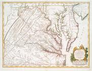
A map of the most inhabited p…
note:
drawn by Joshua Fry &
Peter
Jefferson in 1751
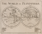
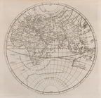
The world in planisphere.
Africa, Europe and Asia.
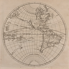
America.
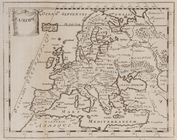
Europe.
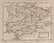
Spaine.
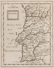
Portugall.
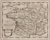
France.
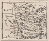
Savoy.
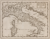
Italie.
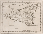
Sicilia.
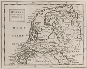
Holland or the United Provinc…
Germany.
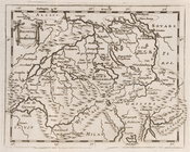
Helvetia, or Swisserland.
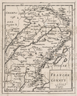
Franche Connty.
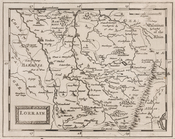
Lorrain.
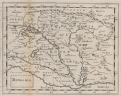
Hungaria.
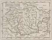
Transilvania, Walachia, Molda…
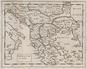
Turquie in Europe.
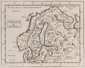
Swedland and Norway.
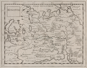
Moscovia.
Poland.
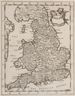
England.
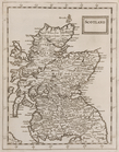
Scotland.
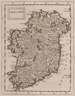
Ireland.
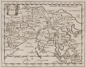
Asia.
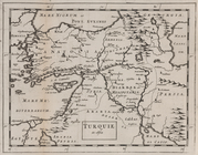
Turquie in Asia.
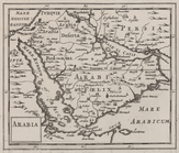
Arabia.
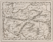
Persia.
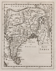
East India.
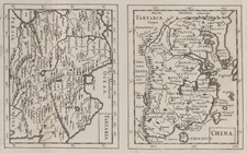
China ; Tartaria.
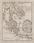
Siam, Malacca and the Indian …
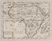
Africa.
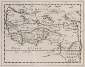
Guinea & Nigrita.
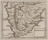
Monomotapa.
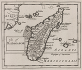
Isle of Madagascar.
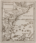
Zanguebar.
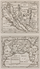
New Mexico ; Florida.
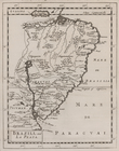
Brazill and La Plata.
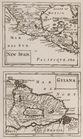
New Spain ; Guiana.
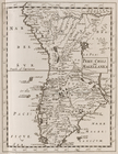
Peru, Chili and Magellanica.
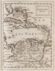
Leeward Islands.
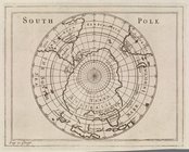
South Pole.