Click to visit the main New York Public Library Homepage
The New York Public Library
Digital Collections
About Digital Collections
Browse
Search only public domain materials
Items
Collections
Divisions
Home
Search
Browse
About
Search only public domain materials
Items
Collections
Divisions
Digital Collections
Using Images
Using Data
Search
Filtered keyword search
Show filters
Hide filters
Show Only Public Domain
topic
Nautical charts
19
Magnetic declination
4
Colonies
2
Discovery and exploration
2
Science
2
More
Less
name
Halley, Edmond, 1656-1742
4
Seller, Jeremiah
4
Moll, Herman, -1732
3
Price, Charles, 1679?-1733
3
Rich. Mount & Tho. Page
3
More
Less
collection
x
Lawrence H. Slaughter Collection of English maps, charts, globes, books and atlases
place
Atlantic Ocean
21
North Atlantic Ocean
15
Atlantic Ocean -- Maps -- Early works to 1800
9
North Atlantic Ocean -- Maps -- Early works to 1800
9
America
4
More
Less
genre
Maps
41
publisher
The Society,
2
By Ier. Seller and Ch. Price, hydrographers to the Queen at the Hermitage staires,
1
Chez Gerard Jollain, ruë St. Jacques a la ville de Cologne
1
Chez Jean Cóvens et Corneille Mortier, geographes
1
Chez Pierre Mortier libraire
1
More
Less
division
Map Division
41
type
cartographic
41
text
1
Date Range
to
41 results found for:
x
Atlantic Ocean
Filtering on:
x
Collection
: Lawrence H. Slaughter Collection of English maps, charts, globes, books and atlases
For more collection details, visit the
Lawrence H. Slaughter Collection of English maps, charts, globes, books and atlases collection page
.
Sort by:
Relevance
Title
Date created
Date digitized
Sequence
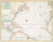
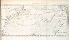
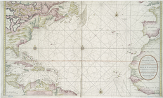
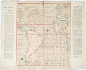
… map of the
Atlantic
or Western
Ocean
.
Ocean
Atlantique, ou, Mer du Nord : ou
note:
Covers the
Atlantic
Ocean
from N 56º to S 6º.
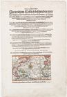
Annual passage of the herring…
note:
Map of North
Atlantic
Ocean
.
Ocean
Atlantique, ou, Mer du Nord : ou
note:
Covers the
Atlantic
Ocean
from N 56º to S 6º. …
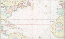
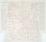
A chart of the
Atlantic
Ocean
. I sheet.
note:
…
Atlantic
Seaboard.
[A Chart of the
Atlantic
or Western
Ocean
]
note:
…
Atlantic
Seaboard.
The Western
Ocean
.
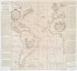
note:
Chart of the
Atlantic
Ocean
with rhumb
Map of the North
Atlantic
Ocean
to accompany
note:
…
Atlantic
Seaboard.
A Chart of the
Atlantic
or Western
Ocean
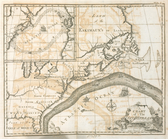
A New generall chart for the …
note:
Covers the
Atlantic
Ocean
between N 550
A Generall chart for the West…
note:
Covers
Atlantic
Ocean
between N 550
…
Ocean
reduced
note:
Covers
Atlantic
Ocean
between N 620
A new generall chart for the …
note:
Covers the
Atlantic
Ocean
between N 56º…
A new chart of the
Atlantic
or Western
Ocean
note:
Covers North
Atlantic
Ocean
.
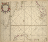
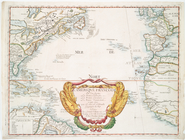
A Generall chart of the Western
Ocean
.
note:
…
Atlantic
Seaboard.
…
Atlantic
or Western
Ocean
.
Terra nova, ac maris tractus …
note:
Covers the
Atlantic
Ocean
west of the Azores
Chart of the
Atlantic
Ocean
.
note:
…
Atlantic
Seaboard.
Paskaert waer in de graden de…
note:
Chart of
Atlantic
Ocean
.
Nieuwe wassende graade zee ka…
note:
…
Atlantic
Seaboard.
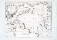
Mare del Nort.
note:
Covers North
Atlantic
Ocean
including
A new generall chart for the …
note:
Covers the
Atlantic
Ocean
between N 550
Nieuwe wassende graade zee ka…
L'Ameriqve françoise, ou son …
note:
Covers North
Atlantic
Ocean
and adjacent
… and Southern
Oceans
: …
note:
Covers North and South
Atlantic
Oceans
.
… & Southern
Oceans
: shewing
note:
Covers North and South
Atlantic
Oceans
.
A general chart of the West I…
note:
Covers the
Atlantic
Ocean
, adjacent
… in the western & southern
oceans
note:
Shows North and South
Atlantic
Oceans
A view of ye general & coasti…
note:
…
Atlantic
Seaboard.
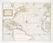
Mare del Nord
note:
Appears in Vincenzo Coronelli's
Atlante
Veneto.
A new generall chart for the …
note:
Covers the
Atlantic
Ocean
between N 56º…
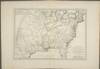
Carte de la Louisiane cours d…
abstract:
… the
Atlantic
Ocean
to the Rio
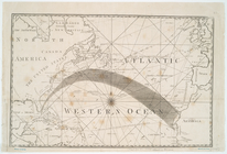
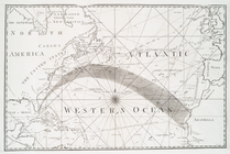
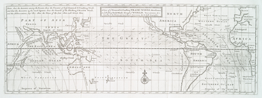
A chart of the Gulf Stream
note:
…
Atlantic
Seaboard.
Accuratissima totius terrarum…
note:
…
Atlantic
Ocean
to the North
m
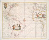
A chart of North and South Am…
note:
… of the
Atlantic
Ocean
Carte de la Louisiane et du c…
note:
… the
Atlantic
Ocean
and Hudson
A chart of North and South Am…
note:
… of the
Atlantic
Ocean
A new and accurate map of the…
note:
… Harbour -- The
Atlantic
Ocean
-- Fort Frederick
A chart of Delaware Bay and R…
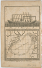
A chart of the Atlantick
Ocean
from Buttons
The Bay and river of Delaware
note:
…
Atlantic
Seaboard.
End of results
|
Top