Click to visit the main New York Public Library Homepage
The New York Public Library
Digital Collections
About Digital Collections
Browse
Search only public domain materials
Items
Collections
Divisions
Home
Search
Browse
About
Search only public domain materials
Items
Collections
Divisions
Digital Collections
Using Images
Using Data
Search
Filtered keyword search
Show filters
Hide filters
Show Only Public Domain
topic
Administrative and political divisions
2
Nautical charts
1
name
De Witt, Simeon, 1756-1834
2
Holland, Samuel, 1728-1801
2
Pownall, Thomas, 1722-1805
2
Broenner, Harry Lodowick
1
Contger, Henry
1
More
Less
collection
x
Lawrence H. Slaughter Collection of English maps, charts, globes, books and atlases
place
New York (State)
4
Northeastern States
2
Lower Bay (N.Y. and N.J.)
1
New Jersey
1
New York (State) -- Maps
1
More
Less
genre
Maps
4
publisher
Printed for Robt. Sayer & John Bennett ..
1
Published by Harry Lodowick Broenner ..
1
S. De Witt
1
[S. De Witt?],
1
division
Map Division
4
type
cartographic
4
Date Range
to
4 results found for:
x
New York (State). Surveyor General
Filtering on:
x
Collection
: Lawrence H. Slaughter Collection of English maps, charts, globes, books and atlases
For more collection details, visit the
Lawrence H. Slaughter Collection of English maps, charts, globes, books and atlases collection page
.
Sort by:
Relevance
Title
Date created
Date digitized
Sequence
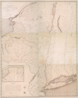
A map of the
State
of
New
York
use:
… partner (e.g.,
New
York
m
The provinces of
New
York
, and
New
use:
… partner (e.g.,
New
York
The provinces of
New
York
, and
New
use:
… partner (e.g.,
New
York
m
Map of the
state
of
New
York
use:
… partner (e.g.,
New
York