Click to visit the main New York Public Library Homepage
The New York Public Library
Digital Collections
About Digital Collections
Browse
Search only public domain materials
Items
Collections
Divisions
Home
Search
Browse
About
Search only public domain materials
Items
Collections
Divisions
Digital Collections
Using Images
Using Data
Search
Filtered keyword search
Show filters
Hide filters
Show Only Public Domain
topic
Real property
18
Landowners
11
History
8
Administrative and political divisions
7
Nautical charts
6
More
Less
name
Hassler, F. R. (Ferdinand Rudolph), 1770-1843
5
United States Coast Survey
5
Bache, A. D. (Alexander Dallas), 1806-1867
3
Benham, Henry Washington, 1813-1884
3
Knight, John, approximately 1802-1872
3
More
Less
collection
x
Maps of New York City and State
place
New York (State)
50
New York
19
New York (N.Y.)
17
Brooklyn (New York, N.Y.)
13
Manhattan (New York, N.Y.)
9
More
Less
genre
Maps
66
Cadastral maps
9
Manuscript maps
3
Bathymetric maps
2
Geological maps
2
More
Less
publisher
publisher not identified
7
U.S. Coast Survey office
3
Geological Survey of the State of New York
2
publisher unknown
2
J. Riker, Jr
1
More
Less
division
Map Division
66
type
x
cartographic
text
1
Date Range
to
66 results found for:
x
6
Filtering on:
x
Collection
: Maps of New York City and State
x
Type
: cartographic
For more collection details, visit the
Maps of New York City and State collection page
.
Sort by:
Relevance
Title
Date created
Date digitized
Sequence
m
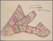
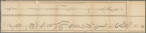
Maps of the 4, 5,
6
, 7 & 8 senatorial
parent:
6
cea9e80-c5aa-012f-63d
6
-58d385a7bc34
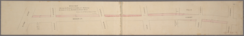
Rule map showing the property…
parent:
6
cea9e80-c5aa-012f-63d
6
-58d385a7bc34
m
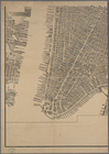
Bird's eye view of New York C…
parent:
6
cea9e80-c5aa-012f-63d
6
-58d385a7bc34
m
Cyclists' road map of New Yor…
parent:
6
cea9e80-c5aa-012f-63d
6
-58d385a7bc34
m
Part of Wards 1, 2, 3, 4, 5 &
6
, New
parent:
6
cea9e80-c5aa-012f-63d
6
-58d385a7bc34
m
Diagrams of the New-York and …
parent:
a202b2e0-c5a
6
-012f-9190-58d385a7bc34
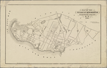
Map of the village of New Bri…
parent:
6
cea9e80-c5aa-012f-63d
6
-58d385a7bc34
Wall St. New York City, U.S.A…
parent:
6
cea9e80-c5aa-012f-63d
6
-58d385a7bc34
m
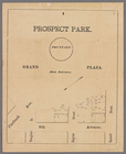
Prospect Park, plaza lots
parent:
6
cea9e80-c5aa-012f-63d
6
-58d385a7bc34
m
Data for population from cens…
parent:
79a2e2e0-3863-013b-4a
6
c-0242ac110002
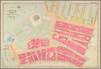
Plan of streets etc. on the L…
parent:
6
cea9e80-c5aa-012f-63d
6
-58d385a7bc34
m
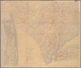
Map of New-York Bay and Harbo…
parent:
6
cea9e80-c5aa-012f-63d
6
-58d385a7bc34
m
Map of the city of New-York e…
parent:
de74d050-c5aa-012f-2bc
6
-58d385a7bc34
Map of Ogdensburgh
parent:
74855300-0af
6
-0134-cad2-00505686a51c
Ticonderoga and its dependenc…
parent:
a1a9d830-c5a
6
-012f-00ec-58d385a7bc34
City of Niagara Falls: the po…
parent:
b1e47a40-0b07-0134-
6
deb-00505686a51c
m
Map of the village of Astoria…
parent:
5166adc0-0cc
6
-0131-064e-58d385a7bbd0
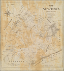
Map of Newtown, Long Island: …
parent:
51908220-0cc
6
-0131-46a8-58d385a7bbd0
m
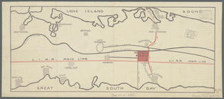
Map showing the route for a p…
parent:
6
cea9e80-c5aa-012f-63d
6
-58d385a7bc34
m
Map of Waverly Park lots loca…
parent:
c1f704d0-1b84-0134-b1a
6
-00505686a51c
m
New map of St. Lawrence Count…
parent:
a1a9d830-c5a
6
-012f-00ec-58d385a7bc34
Grouping of troops and other …
parent:
6
cea9e80-c5aa-012f-63d
6
-58d385a7bc34
Plan of the attack on forts C…
parent:
a1a9d830-c5a
6
-012f-00ec-58d385a7bc34
Map showing route of proposed…
parent:
6
cea9e80-c5aa-012f-63d
6
-58d385a7bc34
Position de l'armée Américain…
parent:
c0a597c0-deac-0135-a7bf-0975d
6
a5c443
Flushing
parent:
6
cea9e80-c5aa-012f-63d
6
-58d385a7bc34
Map of the town of Eastcheste…
parent:
a1a9d830-c5a
6
-012f-00ec-58d385a7bc34
m
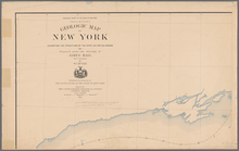
Preliminary geologic map of N…
parent:
a202b2e0-c5a
6
-012f-9190-58d385a7bc34
Grundriss des nördlichen Thei…
parent:
c12df860-deba-0135-3720-55af
6
dd2ef96
A sketch of the siege of Fort…
parent:
a1a9d830-c5a
6
-012f-00ec-58d385a7bc34
m
Hammond's standard map of the…
parent:
6
cea9e80-c5aa-012f-63d
6
-58d385a7bc34
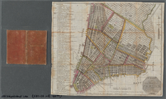
Plan of the city of New-York
parent:
6
cea9e80-c5aa-012f-63d
6
-58d385a7bc34
m
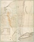
Map of the state of New York
parent:
aa5e2200-c5a
6
-012f-a7a0-58d385a7bc34
Plan of the easterly part of …
parent:
a1a9d830-c5a
6
-012f-00ec-58d385a7bc34
Plan exhibiting the system of…
parent:
6
cea9e80-c5aa-012f-63d
6
-58d385a7bc34
m
Higginson's plan of the city …
parent:
6
cea9e80-c5aa-012f-63d
6
-58d385a7bc34
Central Park Planning Map No.
6
: Bounded
parent:
6
cea9e80-c5aa-012f-63d
6
-58d385a7bc34
Map of Brooklyn at the time o…
parent:
a1a9d830-c5a
6
-012f-00ec-58d385a7bc34
A map of a tract of land in t…
parent:
a1a9d830-c5a
6
-012f-00ec-58d385a7bc34
m
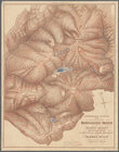
Map of the northern portion o…
parent:
9aa0fdc0-f948-0130-
6
f33-58d385a7b928
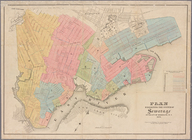
Map of the consolidated city …
parent:
6
cea9e80-c5aa-012f-63d
6
-58d385a7bc34
m
Map of Tioga County, New York…
parent:
a1a9d830-c5a
6
-012f-00ec-58d385a7bc34
Adirondack Survey, 1873, seco…
parent:
6
c6644c0-a28d-0133-1986-00505686a51c
m
Library map 1908
parent:
6
cea9e80-c5aa-012f-63d
6
-58d385a7bc34
m
Map of Kings County N.Y.
parent:
6
cea9e80-c5aa-012f-63d
6
-58d385a7bc34
Plan of the position taken by…
parent:
a1a9d830-c5a
6
-012f-00ec-58d385a7bc34
Map of part of the Manor of P…
parent:
a1a9d830-c5a
6
-012f-00ec-58d385a7bc34
Map showing location of lands…
parent:
6
cea9e80-c5aa-012f-63d
6
-58d385a7bc34
m
Preliminary geologic map of N…
parent:
a202b2e0-c5a
6
-012f-9190-58d385a7bc34
m
City & county map of New York…
parent:
6
cea9e80-c5aa-012f-63d
6
-58d385a7bc34