Click to visit the main New York Public Library Homepage
The New York Public Library
Digital Collections
About Digital Collections
Browse
Search only public domain materials
Items
Collections
Divisions
Home
Search
Browse
About
Search only public domain materials
Items
Collections
Divisions
Digital Collections
Using Images
Using Data
Search
Filtered keyword search
Show filters
Hide filters
Show Only Public Domain
topic
Landowners
23
Real property
20
Railroads
18
Administrative and political divisions
13
Aqueducts
12
More
Less
name
G.W. & C.B. Colton & Co
8
J.B. Beers & Co
6
Pelham Manor and Huguenot Heights Association
4
Stephens Brothers & Co
4
Bourquin, F. (Frederick), 1808-
3
More
Less
collection
x
Maps of New York City and State
place
New York (State)
64
Westchester County (N.Y.)
42
Westchester County
25
New York
18
New York (N.Y.)
17
More
Less
genre
Maps
73
Cadastral maps
14
Road maps
4
Manuscript maps
3
Topographic maps
2
More
Less
publisher
G.W. & C.B. Colton & Co
6
J.B. Beers & Co
6
publisher not identified
5
State Board of Health
3
Croton Aqueduct Board
2
More
Less
division
Map Division
72
Manuscripts and Archives Division
1
type
cartographic
73
still image
1
text
1
Date Range
to
73 results found for:
x
Westchester County (N.Y.)
Filtering on:
x
Collection
: Maps of New York City and State
For more collection details, visit the
Maps of New York City and State collection page
.
Sort by:
Relevance
Title
Date created
Date digitized
Sequence
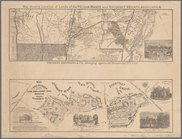
Driving road chart of
Westchester
County
note:
…., Atlas of
Westchester
County
, New York, New
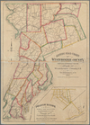
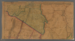
Map of
Westchester
County
,
N
.
Y
.
collection:
Map of
Westchester
County
,
N.Y
.
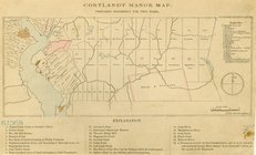
Cortlandt Manor map : prepare…
note:
Covers northern
Westchester
County
,
N.Y
.
…,
Westchester
Co.,
N
.
Y
.
collection:
…,
Westchester
Co.,
N.Y
.
… erected within the
county
of
Westchester
note:
… of
Westchester
County
, New York
m
… part of
West
-Chester
County
,
N
.
Y
.
note:
…ʹ/
N
40°56ʹ--
N
40°47ʹ)…
m
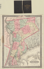
Colton's map of the
county
of
Westchester
Colton's map of the
county
of
Westchester
note:
…. Covers
Westchester
County
(
N.Y
.) to Harlem
m
… of
Westchester
,
Westchester
County
,
N
.
Y
collection:
… of
Westchester
,
Westchester
County
,
N.Y
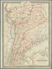
Colton's map of the
county
of
Westchester
note:
…. Covers
Westchester
County
(
N.Y
.) to Harlem
Map showing location of lands…
note:
…, Pelham,
Westchester
County
,
N.Y
."…
… York and
Westchester
County
under
note:
… 74°01ʹ17ʺ--W 73°51ʹ35ʺ/
N
40°54ʹ50ʺ--
N
40°41ʹ59ʺ)…
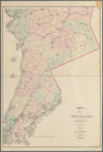
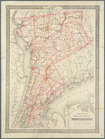
Map of the
county
of
Westchester
Northern coast of Long Island…
note:
…,
Westchester
Co.,
N.Y
Map showing location of lands…
note:
…, Pelham,
Westchester
County
,
N.Y
."…
m
… of
Westchester
County
N
.
Y
. …
note:
… 73°43ʹ09ʺ/
N
40°59ʹ58ʺ--
N
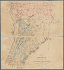
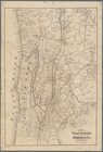
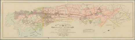
Road map of
Westchester
Co.,
N
.
Y
.
note:
Stevens & Morris, eng.,
N.Y
.
… and Morrisania, Weschester Co.,
N
.
Y
.
note:
…. Beers & Co.
County
atlas of
Westchester
. New York, 1872.
… Broadway,
N
.
Y
. City
note:
… Manor,
N.Y
. -- "Huguenot
m
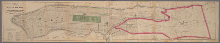
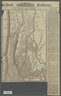
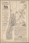
What annexation would accompl…
note:
… in
Westchester
Co. west
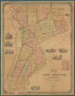
Map of West Chester
County
, New York
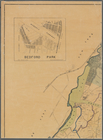
Map of the Manor of Scarsdale
note:
… of
Westchester
County
, New York
Plan von den Operationen der …
note:
… 74°01ʹ19ʺ--W 73°40ʹ28ʺ/
N
41°18ʹ00ʺ--
N
40°50ʹ56ʺ).
m
… and environs,
Westchester
Co.,
N
.
Y
.
collection:
… and environs,
Westchester
Co.,
N.Y
.
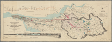
… watershed:
Westchester
County
, pt. A [showing
…:
Westchester
County
, pt. B
Geological map of a part of s…
note:
…. Albany,
N.Y
., 1895.
Operations after the evacuati…
abstract:
… of
Westchester
Co.,
N.Y
. from Tarrytown to Harlem,
N.Y
… of
Westchester
County
adjacent to the City and
County
of New
… of Philipsburg in the
County
of
Westchester
and State of New
Plate I. Map of the watershed…
… in the
counties
of New York and
Westchester
, State of New York
note:
…, and
Westchester
Co.
Map showing location of lands…
note:
…,
N.Y
.
… in the
county
of
Westchester
,
N
.
Y
. …
abstract:
… in the
County
of
Westchester
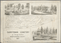
… at Sleepy Hollow,
West
-Chester
County
,
N
.
Y
.
collection:
…,
West-Chester
County
,
N.Y
.
m
Map of the City of New York a…
note:
… 74°17ʹ19ʺ--W 73°41ʹ19ʺ/
N
40°54ʹ07ʺ--
N
40°29ʹ03ʺ).
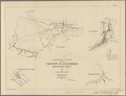
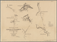
Map of the route of the new C…
note:
… York,
N.Y
.) and southern Dutchess
County
m
Map of the City of New York a…
abstract:
…ʹ--W 73°42ʹ/
N
40°56ʹ--
N
m
Stony Point and Verplanck's P…
Map of the country thirty thr…
note:
…. Atwood,
N.Y
.
m
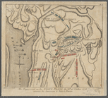
The engagement on the White P…
topic:
…,
N.Y
., 1776
Map of the 23rd and 24th ward…
note:
… 73°42ʹ59ʺ/
N
40°54ʹ56ʺ--
N
…, Elmsford,
Westchester
County
,
N
.
Y
.
note:
N
.F. Barrett, landscape engineer ; L. E
A plan of the operations of t…
topic:
…,
N.Y
., 1776
Map of the country thirty thr…
note:
…. Atwood,
N.Y
.
A plan of the country from Fr…
topic:
…,
N.Y
., 1776
A plan of the operations of t…
topic:
…,
N.Y
., 1776
…,
Westchester
County
, New York
m
Map of upper New York City an…
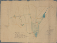
Town of Greenburgh,
Westchester
Co.,
N
.
Y
.
note:
… of Greenburgh,
Westchester
Co.,
N.Y
. -- Harts Corners