Click to visit the main New York Public Library Homepage
The New York Public Library
Digital Collections
About Digital Collections
Browse
Search only public domain materials
Items
Collections
Divisions
Home
Search
Browse
About
Search only public domain materials
Items
Collections
Divisions
Digital Collections
Using Images
Using Data
Search
Filtered keyword search
Show filters
Hide filters
Show Only Public Domain
topic
Atlases, British
2
Geography
2
Neptune (Roman deity)
1
name
Thornton, Samuel
8
Dunn, Samuel, d. 1794
2
Sayer, Robert, 1725-1794
2
Mitchell, S. Augustus (Samuel Augustus), 1792-1868
1
collection
x
Atlases, gazetteers, guidebooks and other books
place
Ireland
6
Atlantic Ocean
2
Great Britain
2
Irish Sea
2
Cork (Ireland : County)
1
More
Less
genre
Maps
11
Nautical charts
8
publisher
Printed for Robert Sayer, No. 53, Fleet-Street
2
S. A. Mitchell, jr
1
division
Map Division
11
type
cartographic
11
Date Range
to
11 results found for:
x
Ireland, Samuel
Filtering on:
x
Collection
: Atlases, gazetteers, guidebooks and other books
For more collection details, visit the
Atlases, gazetteers, guidebooks and other books collection page
.
Sort by:
Relevance
Title
Date created
Date digitized
Sequence
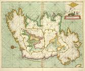
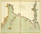
A chart of the sea coast of
IRELAND
from
… of
IRELAND
… of
IRELAND
from LOUGH SWILLY
collection:
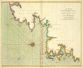
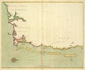
A chart of the NORTH-WEST coast of
IRELAND
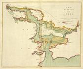
The SOUTH-WEST coast of
IRELAND
from
… and
Ireland
; with the adjacent
note:
By
Samuel
Dunn, Mathematician.
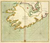
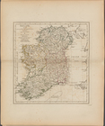
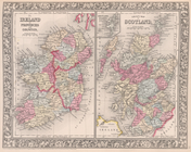
Ireland
, divided into its four provinces
note:
By
Samuel
Dunn, Mathematician.
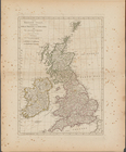
The county of Waterford
The Harbour of Corke.
… and
IRELAND
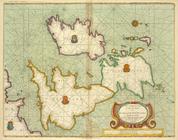
A chart of the BAY OF GALLOWA…
… [inset] ;
Ireland
End of results
|
Top