Click to visit the main New York Public Library Homepage
The New York Public Library
Digital Collections
About Digital Collections
Browse
Search only public domain materials
Items
Collections
Divisions
Home
Search
Browse
About
Search only public domain materials
Items
Collections
Divisions
Digital Collections
Using Images
Using Data
Search
Filtered search
Show filters
Hide filters
Show Only Public Domain
collection
Atlases of New York City
1
genre
Maps
1
publisher
Perris & Browne
1
division
Map Division
1
type
cartographic
1
Date Range
to
1 result found
Filtering on:
x
Title
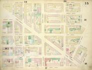
: Plate 18: Map bounded by Spring Street, Clarke Street, Sullivan Street, Grand Street, Thompson Street, Laight Street, West Street; Including Canal Street, Dominick Street, Broome Street, Watts Street, Desbrosses Street, Grand Street, Vestry Street, Washington Street, Greenwich Street, Renwick Street, Hudson Street, Varick Street
Sort by:
Title
Date created
Date digitized
Sequence
Plate 18: Map bounded by Spri…