Click to visit the main New York Public Library Homepage
The New York Public Library
Digital Collections
About Digital Collections
Browse
Search only public domain materials
Items
Collections
Divisions
Home
Search
Browse
About
Search only public domain materials
Items
Collections
Divisions
Digital Collections
Using Images
Using Data
Search
Filtered search
Show filters
Hide filters
Show Only Public Domain
topic
x
Real property
Landowners
64
Administrative and political divisions
14
Railroads
14
Estate
9
More
Less
name
Dripps, M. (Matthew)
15
Miller & Co
14
Welcke, Robert A
9
James Bleecker & Sons
5
Smith, Edwin
4
More
Less
collection
Maps of New York City and State
135
place
New York (State)
134
New York
112
New York (N.Y.)
52
Brooklyn (New York, N.Y.)
44
Manhattan (New York, N.Y.)
25
More
Less
genre
Maps
135
Cadastral maps
42
Manuscript maps
8
Aerial views
2
Facsimiles
1
publisher
M. Dripps
11
publisher not identified
10
publisher unknown
8
s.n
7
E. Belcher Hyde
2
More
Less
division
Map Division
135
type
cartographic
134
text
2
still image
1
Date Range
to
135 results found
Filtering on:
x
Parent
: New York City||6cea9e80-c5aa-012f-63d6-58d385a7bc34
x
Topic
: Real property
Sort by:
Title
Date created
Date digitized
Sequence
m
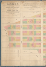
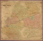
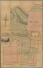
Map of property belonging to …
Map of lots belonging to the …
Map of Brooklyn Manor
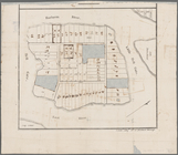
Map of Flatbush Meadows : sit…
Tracts and farms with street …
Rosedale Square, Rosedale : 4…
Map of Jamaica in the 4th war…
Map of property New York Dock…
Map of Kissena Park, third wa…
Block sketch 1679, New York C…
East River Heights, first war…
Map of Bellaire Estates : own…
Hollis Terrace addition no. 1…
Map of 272 lots in the 30th w…
Map of Jamaica Fells : fourth…
m
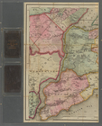
Map of the borough of Queens,…
Borough Park Company
m
Sea Gate, New York Harbor
Map of Elmhurst Square : situ…
Plan of the great meadows of …
Property in the towns of Cast…
Map of property in the 19th w…
m
Topographical map of New York…
m
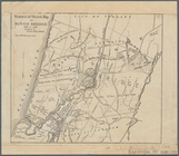
Map of the City of Brooklyn a…
m
Peremptory sale of a suburban…
Flushing
m
Driving road chart of the cou…
Block no. 86 : confidential r…
Livingston Heights : Livingto…
Map of portion of greater New…
m
Lands of the Harlaem Canal Co…
Map of the port & vicinity of…
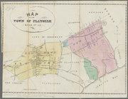
Map of the town of Flatbush, …
m
Map of Kings and part of Quee…
Map of Great Barn Island, New…
Map of the "Hunter Fly Farm" …
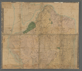
Topographical map of New York…
Historical sketch map of King…
m
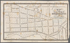
Map of the town of Morrisania…
Map of Highbridgeville in the…
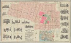
Map of Garden City, Queens Co…
Map of the lower village of M…
Map of Kings and part of Quee…
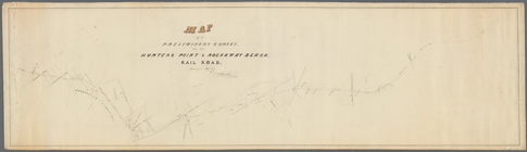
Map of a preliminary survey f…
Map of 163 sections or villa …
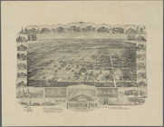
National Prohibition Park, St…
Map of property at New Bright…
m
Map of Staten Island, Richmon…
m
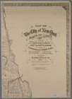
Map of the City of New York n…
m
Map of Staten Island (Richmon…