Click to visit the main New York Public Library Homepage
The New York Public Library
Digital Collections
About Digital Collections
Browse
Search only public domain materials
Items
Collections
Divisions
Home
Search
Browse
About
Search only public domain materials
Items
Collections
Divisions
Digital Collections
Using Images
Using Data
Search
Filtered search
Show filters
Hide filters
Show Only Public Domain
topic
Business enterprises
31
Real property
31
name
Beers, D. G. (Daniel G.)
31
Beers, S. N
31
Stone & Stewart
31
collection
Atlases of the United States
31
place
New York (State)
31
Schoharie County
31
Schoharie County (N.Y.)
31
genre
Atlases
31
Maps
26
Prints
1
Title pages
1
publisher
Stone & Stewart
31
division
Map Division
31
type
cartographic
27
text
4
Date Range
to
31 results found
Filtering on:
x
Parent
: New topographical atlas of Schoharie Co., New York. From actual surveys by S.N. & D.G. Beers and assistants.||ee38f010-c5f9-012f-1207-58d385a7bc34
Sort by:
Title
Date created
Date digitized
Sequence
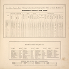
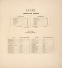
Acres of Land, Population, Dw…
Argusville Business Directory…
Blenheim [Township]
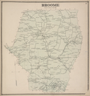
Broome [Township]
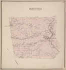
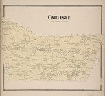
Carlisie [Township]
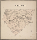
Cobleskill [Township]
Cobleskill Center [Village]; …
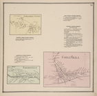
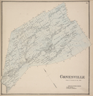
Conesville [Township]; Manor …
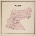
Esperance [Township]
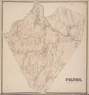
Fulton. [Township]
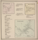
Fultonham. [Village]; Schohar…
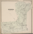
Gilboa [Township]
Index
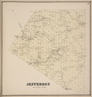
Jefferson [Township]
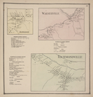
Jefferson [Village]; Jefferso…
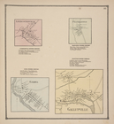
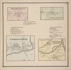
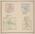
Leesville [Village]; Leesvill…
Livingstonville [Village]; Li…
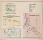
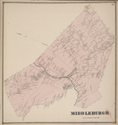
Middleburgh [Township]
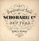
New topographical atlas of Sc…
North Blenheim [Village]; Nor…
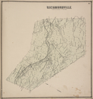
Richmondville [Township]
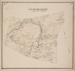
Schoharie [Township]
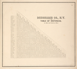
Schoharie Co., N.Y. Table of …
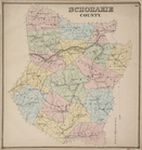
Schoharie County
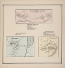
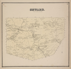
Seward [Township]
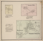
Seward Valley [Village]; Sewa…
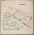
Sharon [Township]
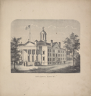
State Capitol, Albany, N.Y.
Stone Bridge [Village]; Stone…
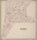
Summit [Township]
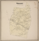
Wright [Township]
End of results
|
Top