Click to visit the main New York Public Library Homepage
The New York Public Library
Digital Collections
About Digital Collections
Browse
Search only public domain materials
Items
Collections
Divisions
Home
Search
Browse
About
Search only public domain materials
Items
Collections
Divisions
Digital Collections
Using Images
Using Data
Search
Filtered keyword search
Show filters
Hide filters
Show Only Public Domain
topic
x
City planning
Social conditions
942
Streets
11
Piers
10
Real property
10
More
Less
name
M.I.T. Press
942
New York (N.Y.). City Planning Commission
942
New York (N.Y.). Common Council
78
Valentine, D. T. (David Thomas), 1801-1869
14
Hayward, George, b. ca. 1800
10
More
Less
collection
Atlases of New York City
942
Maps of New York City and State
126
Maps of North America
18
A plan of the city of Hartford
5
City of Alexandria town planning scheme
3
More
Less
place
New York (N.Y.)
1065
New York (State)
993
New York
965
Central Park (New York, N.Y.)
63
Manhattan (New York, N.Y.)
55
More
Less
genre
Maps
1098
Manuscript maps
12
Cadastral maps
6
Plans
6
Blueprints
2
More
Less
publisher
MIT Press
942
publisher not identified
6
Case, Lockwood & Brainard Co
5
Government press
3
producer not identified
3
More
Less
division
Map Division
1087
General Research Division
12
Rare Book Division
2
type
still image
946
cartographic
158
Date Range
to
Looking for this collection?
Maps of New York City and State
2,059 items
1,101 results found for:
x
maps
Filtering on:
x
Topic
: City planning
Sort by:
Relevance
Title
Date created
Date digitized
Sequence
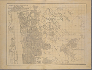
The Brooklyn of the future : …
collection:
Maps
of New York City and State
General plan of the city of H…
Diagrammatic plan for a moder…
General plan of the city of H…
Plan of the central section o…
Suggested type of layout for …
Commission on building distri…
collection:
Maps
of New York City and State
New-York and vicinity as prop…
topic:
Manuscript
maps
Map
of the Harlem River and Spuyten Duyvil
m
Plans for the improvement of …
collection:
Maps
of New York City and State
Map
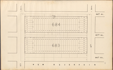
of the 23rd and 24th wards of the City
collection:
Map
of the 23rd and 24th wards
Sevilla
Vilna Litvaniae
Plan d'ensemble de la cité ou…
Plan d'ensemble de la cité ou…
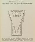
Setback principle
image:
ps_
map
_164
General plan for the town of …
note:
Topographical
map
by Geo. R. Mackenzie
Map
of the Melrose addition to Roanoke City
note:
Prepared by G. Wm. Baist,
Map
Publisher.
m
Map
of Roanoke, Virginia …
note:
Prepared by G. Wm. Baist, surveyor, and
map
Map
of Roanoke, Virginia …
note:
Mapping
the Nation (NEH grant, 2015-2018)…
Map
of New Covington, in St. Tammany
note:
Mapping
the Nation (NEH grant, 2015-2018)…
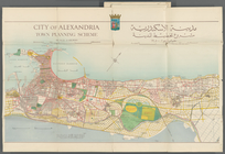
City of Alexandria Town Plann…
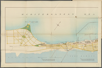
Mediterranean Sea. Lake Maryu…
Alexandria Municipality, 8th …
Map
of the city of Worcester showing
note:
Mapping
the Nation (NEH grant, 2015-2018)…
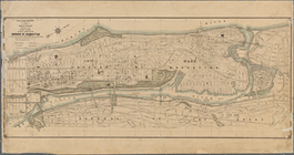
Improvement of Back Bay: show…
note:
Mapping
the Nation (NEH grant, 2015-2018)…
Proposed parks and parkways: …
note:
Mapping
the Nation (NEH grant, 2015-2018)…
Plan for the occupation of fl…
note:
Mapping
the Nation (NEH grant, 2015-2018)…
Plan of Public Garden: showin…
note:
Mapping
the Nation (NEH grant, 2015-2018)…
Map
of park
note:
Mapping
the Nation (NEH grant, 2015-2018)…
Back Bay park
note:
Mapping
the Nation (NEH grant, 2015-2018)…
Plan of burnt district (by fi…
note:
Mapping
the Nation (NEH grant, 2015-2018)…
Proposed improvement of Back …
note:
Mapping
the Nation (NEH grant, 2015-2018)…
Plan of Boston and its vicini…
note:
Mapping
the Nation (NEH grant, 2015-2018)…
Preliminary plan for Wood Isl…
note:
Includes key
map
and 4 section views
Charles River embankment, sec…
note:
Partial cadastral
map
showing property
City of Lynn: [Massachusetts]
note:
Mapping
the Nation (NEH grant, 2015-2018)…
Central Park Planning
Map
No. 6: Bounded
Central Park Planning
Map
: Bounded
Central Park Planning
Map
No. 2: Bounded
Central Park Planning
Map
: Bounded
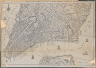
Plan of the City of New York.…
collection:
Other
Maps
and Illustrations
m
Manuscript
map
of New York City between
Map
of the City of New York showing
Map
of the 23rd and 24th wards of the City
collection:
Map
of the 23rd and 24th wards
Central Park Planning
Map
: Bounded
collection:
Central Park Planning
Map
: Bounded by 98
A New & Accurate Plan of the …
note:
….; Copied from a
Map
Map
or plan showing the street system in the 12th
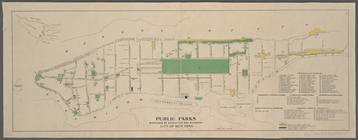
Public parks boroughs of Manh…
note:
Inset
map
of Staten Island and vicinity.
Central Park Planning
Map
No. 28
1
2
3
4
5
Previous
Next
1
2
3
4
5
Previous
Next