Click to visit the main New York Public Library Homepage
The New York Public Library
Digital Collections
About Digital Collections
Browse
Search only public domain materials
Items
Collections
Divisions
Home
Search
Browse
About
Search only public domain materials
Items
Collections
Divisions
Digital Collections
Using Images
Using Data
Search
Filtered keyword search
Show filters
Hide filters
Show Only Public Domain
topic
x
Landowners
Real property
84
Administrative and political divisions
17
Railroads
11
Buildings
10
More
Less
name
Warner & Foote
15
Bourquin, F. (Frederick), 1808-
14
Worley & Bracher
10
Bracher, Wm. (William)
9
Walling, Henry Francis, 1825-1888
8
More
Less
collection
Maps of North America
75
Maps of New York City and State
52
Maps of South America
1
place
New York (State)
51
New York (N.Y.)
21
New York
19
Manhattan (New York, N.Y.)
16
Georgia
13
More
Less
genre
Maps
128
Cadastral maps
83
Manuscript maps
11
Wall maps
4
Aerial views
2
More
Less
publisher
Published by Warner & Foote
11
publisher not identified
9
producer not identified
5
M. Dripps
4
Topographical Engineer's Office
4
More
Less
division
Map Division
127
Manuscripts and Archives Division
1
type
cartographic
127
still image
5
text
2
Date Range
to
128 results found for:
x
Scales
Filtering on:
x
Topic
: Landowners
Sort by:
Relevance
Title
Date created
Date digitized
Sequence
Nieuwe kaart van Suriname : v…
note:
Scale
[ca. 1:455,000] (W 55°16ʹ--W
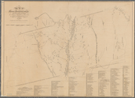
A map of the Manor Renselaerw…
note:
Scale
1:158,400. 2 1/2 miles to one inch
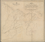
Map of the head waters of the…
note:
Also published at smaller
scale
m
The City of Stockton and vici…
abstract:
… of the Burkett Tract.
Scale
Map of Leavenworth, Kansas
note:
Scale
1:12,000. 1000 ft. to inch (W
Map of New Orleans and Jeffer…
note:
Scale
not given (W 90°09ʹ--W 90°01ʹ/N 30°00
Plan of the city of New Orlea…
note:
Scale
approximately 1:48,000 (W 90°08ʹ--W 89°37
Plan of the town of Newton in…
note:
Scale
approximately 1:19,800 (W 71°16ʹ15ʺ--W
Map of the town of Blackstone…
abstract:
… Village.
Scale
[1:5,940] -- Blackstone Village.
Scale
Map of the town of Concord, M…
note:
… village (
scale
1:6,400
Map of the town of Fairhaven,…
note:
… and Oxford villages.
Scale
Map of the town of Taunton: w…
abstract:
… of the Village of Taunton. [
Scale
Map of the city of Waltham, M…
note:
Includes inset of: "Waltham" [
scale
m
Map of the town of Norton, Br…
note:
Includes inset: "Norton Centre." [
Scale
Map of the town of Natick, Mi…
note:
Inset: Natick Village.
Scale
Map of the town of Ipswich, c…
note:
…. [
Scale
1:6,633].
Sketch of the claims to land …
note:
Scale
approximately 1:3,000 (W 84°22ʹ37ʺ--W
Map of a portion of Point Ke…
note:
Scale
1:63,360. One mile to an inch (W
Map of the mouth of St. Clair…
note:
Scale
not given (W 82°50ʹ--W 82°20ʹ/N 42°44
Map of Rochester, Olmsted Co.…
note:
Scale
1:3,960. 20 rods to an inch (W
Map of Lake Minnetonka : show…
note:
Scale
1:21,120. Three inches to one mile
Map of the city of Saint Paul…
note:
Scale
1:4,200. 350 feet to an inch (W
m
Abbott's map of the city of M…
note:
Scale
1:6,000. 500 ft. to the inch (W
m
Map of Goodhue County, Minnes…
note:
Scale
1:36,206. 1 3/4 inches to the mile
m
Map of Hennepin County, Minne…
note:
Scale
, 1:38,000. 1 3/8 inches to the mile
m
Map of LeSueur County, Minnes…
note:
Scale
1:31,680. 2 inches to the mile (W
m
Map of McLeod County, Minneso…
note:
Scale
1:31,680. 2 inches to the mile (W
m
Map of Meeker County, Minneso…
note:
Scale
1:36,206. 1 3/4 inches to the mile
m
Map of Ramsey and Washington …
note:
Scale
1:36,206. 1 3/4 inches to the mile
m
Map of Scott County, Minnesot…
note:
Scale
1:31,680. 2 inches to the mile (W
m
Map of Sibley County, Minneso…
note:
Scale
approximately 1:39,000 (W 94°39ʹ--W 93°44
m
Map of Stearns County, Minnes…
note:
Scale
1:36,206. 1 3/4 inches to the mile
m
Map of Bates County, Missouri
note:
Scale
1:42,240. 1 3/4 inches to the mile
m
Map of Johnson County, Missou…
note:
Scale
1:42,240. 1 3/4 inches to the mile
m
Map of Pettis County, Missour…
note:
Scale
1:31,680. 2 inches to the mile (W
Map of St. Joseph, Mo. and vi…
note:
Scale
1:9,600. 800 feet to an inch (W
m
Map of Rockingham Co., New Ha…
note:
Scale
1:50,688. 1 1/4 in. to 1 mile (W
A map of the town of New-ark …
note:
Scale
approximately 1:11,900 (W 74°15ʹ04ʺ--W
m
City of Toledo, Lucas Co., Oh…
note:
Scale
approximately 1:6,600 (W 83°35ʹ13ʺ--W
m
A map of Schuylkill County, P…
note:
Scale
approximately 1:100,000 (W 76°42'05"--W
Lands of the Tremont Petroleu…
abstract:
… 5 enlarged-
scale
Map of Pittsburgh and its env…
note:
Scale
approximately 1:5,900 (W 80°01ʹ39ʺ--W
Map of the survey of Wissahic…
note:
Scale
1:9,600. 800 ft. to an inch (W
m
To the honourable House of Re…
note:
Scale
1:19,800. 100 perches to an inch (W
A map of Philadelphia and par…
note:
Scale
approximately 1:65,000 (W 75°17ʹ01ʺ--W
Map of Conanicut Island, oppo…
note:
Scale
approximately 1:14,500 (W 71°35ʹ--W 71°20
Map of the Rhode Island state…
note:
Scale
1:4,800. 400 ft. to the inch (W
A compleat map of North-Carol…
note:
Scale
approximately 1:550,000; British miles 69
A map of St. Augustine & vici…
note:
Scale
approximately 1:22,500 (W 81°20ʹ41ʺ--W
Topographical map of lands be…
note:
Scale
approximately 1:20,000 (W 88°22ʹ31ʺ--W