Click to visit the main New York Public Library Homepage
The New York Public Library
Digital Collections
About Digital Collections
Browse
Search only public domain materials
Items
Collections
Divisions
Home
Search
Browse
About
Search only public domain materials
Items
Collections
Divisions
Digital Collections
Using Images
Using Data
Search
Filtered keyword search
Show filters
Hide filters
Show Only Public Domain
topic
x
Administrative and political divisions
Railroads
36
Real property
19
Landowners
18
Roads
12
More
Less
name
United States. General Land Office
32
Julius Bien & Co
15
Roeser, C. (Charles)
15
Rand McNally and Company
14
Bien, Julius, 1826-1909
13
More
Less
collection
Maps of North America
166
Maps of New York City and State
10
Maps of Asia
1
Maps of Europe
1
place
Pennsylvania
25
Philadelphia (Pa.)
17
North Carolina
16
Philadelphia
14
South Carolina
13
More
Less
genre
Maps
178
Cadastral maps
10
Illustrations
5
Road maps
3
Diagrams
2
More
Less
publisher
General Land Office
14
Department of the Interior, General Land Office
11
publisher not identified
7
Rand, McNally & Co
5
Rand, McNally & Co., map publishers and engravers
5
More
Less
division
Map Division
178
type
x
cartographic
still image
9
text
2
Date Range
to
178 results found for:
x
17
Filtering on:
x
Topic
: Administrative and political divisions
x
Type
: cartographic
Sort by:
Relevance
Title
Date created
Date digitized
Sequence
Geer's map of the city of Har…
Rand, McNally & Co.'s new sec…
abstract:
… (
17
cm
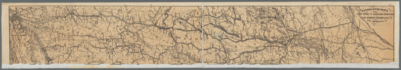
Hudson River route: New York …
Rand, McNally & Co.'s Missouri
abstract:
… (62 pages ;
17
cm).
Map of Rochester
A map of the colonies of Conn…
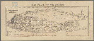
Long Island for the summer
Rand, McNally & Co.'s Indiana
abstract:
… with index (62 p. ;
17
cm
Map of the city of St. Louis …
parent:
fa66b380-c8b4-0135-
17
ac-5d343f84ee33
Map of Rhode Island and Provi…
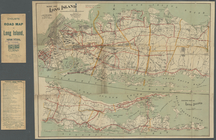
Map of Long Island
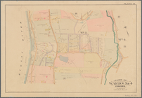
Part of Wards 3 & 4, Yonkers
note:
…. Robinson, 1889. plate
17
.
m
Map of the city of St. Louis,…
m
A topographical map of Lincol…
m
New map of the city of Philad…
m
A topographical map of Lincol…
m
Map of Clinton Co., New York:…
Rollandet's guide map and str…
m
The State of New York: from n…
note:
…, Albany" [
17
cm diameter].
m
Map of Rockingham Co., New Ha…
An accurate map of North and …
note:
….
17
-7626]
Tenth census of the United St…
Map of Pennsylvania showing p…
Rand, McNally & Co's Pennsylv…
Plan of Boston comprising a p…
note:
… 1:
17
,600] -- Plan of East
Plan of Boston comprising a p…
note:
… approximately 1:
17
,600] -- Plan
Map of Chester Co., Pennsylva…
A new and accurate map of Nor…
Pennsylvania
Map of the state of Vermont
Map of Providence
Rhode Island
Half of an unidentified map s…
Oregon
Map of Nashville, Tennessee
North and South Carolina
Map of Chattanooga, Tenn.
The state of North Carolina :…
The state of Rhode-Island
Map of Oregon territory : pro…
Map of the city of Nashville …
Colton's new topographical ma…
State of Illinois
Map of the state of Texas [an…
Map of Lafayette Co.: [Wiscon…
Johnson's Ohio
The state of Rhode-Island
Map of North Carolina and Sou…
Map of the states of North & …
County & township map of the …