Click to visit the main New York Public Library Homepage
The New York Public Library
Digital Collections
About Digital Collections
Browse
Search only public domain materials
Items
Collections
Divisions
Home
Search
Browse
About
Search only public domain materials
Items
Collections
Divisions
Digital Collections
Using Images
Using Data
Search
Filtered keyword search
Show filters
Hide filters
Show Only Public Domain
topic
x
Administrative and political divisions
Landowners
3
Local transit
3
Piers
2
Real property
2
More
Less
name
Abbott, E. T. (Edward T.), 1847-1938
1
Abbott, W. S. M
1
Charles Magnus & Co
1
Charles Shober & Co
1
Cotton, J. P
1
More
Less
collection
Maps of North America
4
Maps of New York City and State
3
place
Manhattan (New York, N.Y.)
3
New York (N.Y.)
3
New York (State)
3
Brooklyn (New York, N.Y.)
2
Central Park (New York, N.Y.)
1
More
Less
genre
Maps
7
Cadastral maps
2
publisher
B.M. Norman
1
C.E. Hammett, Jr
1
Charles Magnus & Co
1
Chs. Magnus
1
Published by C. Wright Davison
1
More
Less
division
Map Division
7
type
x
cartographic
Date Range
to
7 results found for:
x
Ward, Charles
Filtering on:
x
Topic
: Administrative and political divisions
x
Type
: cartographic
Sort by:
Relevance
Title
Date created
Date digitized
Sequence
New-York : Map of the consoli…
note:
Shows
ward
boundaries, railroads
m
Norman's plan of New Orleans …
abstract:
Shows city
ward
and district boundary lines
m
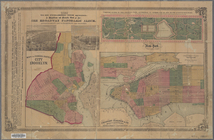
Abbott's map of the city of M…
abstract:
… shows
ward
boundaries
m
Chicago
abstract:
…. Includes inset showing
ward
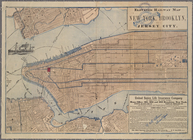
Elevated railway map of New Y…
note:
Shows
wards
, piers, ferry lines and radial
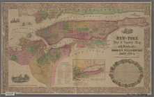
New-York city and county map …
abstract:
Shows
wards
, streets, public buildings
Map of Newport, R.I.
note:
Shows city
wards
, streets, railroads