Click to visit the main New York Public Library Homepage
The New York Public Library
Digital Collections
About Digital Collections
Browse
Search only public domain materials
Items
Collections
Divisions
Home
Search
Browse
About
Search only public domain materials
Items
Collections
Divisions
Digital Collections
Using Images
Using Data
Search
Filtered keyword search
Show filters
Hide filters
Show Only Public Domain
topic
x
Cities & towns
Fire insurance
4839
Real property
4839
Mountains
3
Buildings
2
More
Less
name
Sanborn Map Company
4839
Bierstadt Brothers
2
Hagino, Yoshiyuki
2
Hayakawa, Junzaburô
2
Inobe, Shigeo
2
More
Less
collection
Atlases of New York City
4839
Robert N. Dennis collection of stereoscopic views
16
Detroit Publishing Company postcards
2
Kokushi daijiten
2
Narrative of travels and discoveries in Northern and Central Africa, in the years 1822, 1823, and 1824. Vol I & II
1
More
Less
place
New York (State)
4843
New Hampshire
15
Center Harbor (N.H.)
3
Coos County (N.H.)
3
New York
3
More
Less
genre
Maps
4837
Photographs
18
Stereographs
16
Prints
4
Title pages
4
More
Less
publisher
Sanborn Map Company
4839
Detroit Publishing Company
2
Yoshikawa Kôbunkan
2
G. Tofani
1
John Murray
1
More
Less
division
Map Division
4839
Wallach Division: Photography Collection
19
General Research Division
3
Schomburg Jean Blackwell Hutson Research and Reference Division
1
Schomburg Manuscripts, Archives and Rare Books Division
1
More
Less
type
cartographic
4837
still image
23
text
4
Date Range
to
4,864 results found for:
x
Niagara Canal (N.Y. : Proposed) -- Maps
Filtering on:
x
Topic
: Cities & towns
Sort by:
Relevance
Title
Date created
Date digitized
Sequence
…,
N
.
Y
., Sanborn
Map
Co
collection:
…,
N.Y
., Sanborn
Map
Co
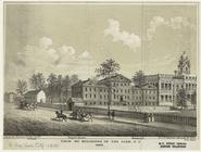
View of buildings in the park,
N
.
Y
., 1809
note:
…, 171 Pearl St.
N.Y
m
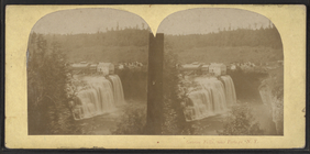
Genesee Falls, near Portage,
N
.
Y
.
note:
…; a "canalduct" (Genesee
Canal
…. 68 [
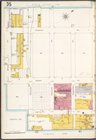
Map
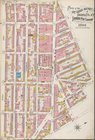
bounded by
Canal
, Bay, Harrison
…, Plate No. 41 [
Map
…,
N
.
Y
.
… No. 48 [
Map
bounded by Newtown Ave.,
Proposed
St
Map
bounded by Warehouse Ave.,
Canal
Ave
…. 35 [
Map
bounded
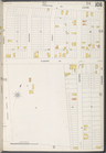
… No. 106 [
Map
bounded
m
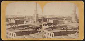
Bird's-eye view of
N
.
Y
. City, from Obs
collection:
Bird's-eye view of
N.Y
. City, from Obs
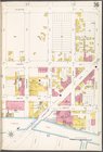
…. 36 [
Map
bounded
… No. 44 [
Map
bounded by
Proposed
Street, Newtown
…, Plate No. 58 [
Map
…, Plate No. 23 [
Map
…, Plate No. 30 [
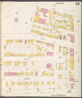
Map
bounded by Bowery,
Canal
…, Plate No. 32 [
Map
bounded by
Canal
St
… [
Map
bounded by Willabout
Canal
, Flushing
…, Plate No. 14 (1917) [
Map
…, Plate No. 14 (1921) [
Map
…, Plate No. 10 [
Map
…, Plate No. 15 [
Map
…, Plate No. 49 [
Map
…, Plate No. 50 [
Map
…, Plate No. 52 [
Map
…, Plate No. 1 [
Map
bounded by
N
. 6th St., Kent Ave
…, Plate No. 2 [
Map
bounded by East River,
N
. 9th St
…, Plate No. 12 [
Map
bounded by Kent Ave.,
N
collection:
…, Plate No. 12 [
Map
bounded by Kent Ave.,
N
. 6
…, Plate No. 13 [
Map
bounded by Kent Ave.,
N
collection:
…, Plate No. 13 [
Map
bounded by Kent Ave.,
N
. 9
…, Plate No. 14 [
Map
bounded by Kent Ave.,
N
…, Plate No. 17 [
Map
bounded by Bedford Ave.,
N
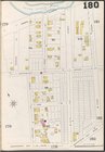
… Plate No. 180 [
Map
bounded by
Canal
Ave., W
… [
Map
bounded by Newtown
…, Plate No. 54 [
Map
…, Plate No. 55 [
Map
…, Plate No. 56 [
Map
… [
Map
bounded
… [
Map
bounded by Broome
61)
N
.-Novgorod.62)
N
.-Novgorod. Kreml.
Map
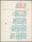
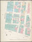
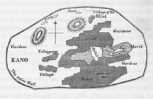
of the city of Kano
… No. 14 [
Map
bounded by High St.,
N
.17th St
collection:
… No. 14 [
Map
bounded by High St.,
N
.17th St., 5
… [
Map
bounded by Wythe
… Plate No. 179 [
Map
bounded by
Canal
Ave
…. 49 [
Map
bounded
collection:
…. 49 [
Map
bounded by 7
…, Plate No. 31 [
Map
m
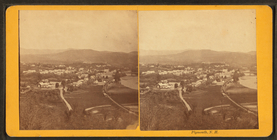
Plymouth,
N
.H.
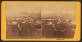
m
Plymouth,
N
.H.
… [
Map
bounded by Wythe Ave.,
N
. 1st St., East
… [
Map
bounded by Driggs St.,
N
. 5th St
…, Plate No. 18 [
Map
bounded by Bedford Ave.,
N
1
2
3
4
5
6
7
8
9
10
…
19
20
Previous
Next
1
2
3
4
5
6
7
8
9
10
…
19
20
Previous
Next