Click to visit the main New York Public Library Homepage
The New York Public Library
Digital Collections
About Digital Collections
Browse
Search only public domain materials
Items
Collections
Divisions
Home
Search
Browse
About
Search only public domain materials
Items
Collections
Divisions
Digital Collections
Using Images
Using Data
Search
Filtered keyword search
Show filters
Hide filters
Show Only Public Domain
topic
x
Fire insurance
Real property
5027
Cities & towns
4839
Cities and towns
2
name
Sanborn Map Company
4923
Perris, William
105
I.B. Culver & Co
31
Spielmann & Brush (Firm)
28
Higginson, J. H. (Publisher)
21
collection
Atlases of New York City
5046
Atlases of the United States
61
Maps of New York City and State
1
place
New York (State)
5049
New York
208
Manhattan (New York, N.Y.)
106
Staten Island (New York, N.Y.)
81
Jersey City
59
More
Less
genre
Maps
5103
Atlases
61
Title pages
12
Index maps
7
publisher
Sanborn Map Company
4841
William Perris
105
Sanborn Map Co
82
I.B. Culver & Co
31
Spielmann & Brush,
28
More
Less
division
Map Division
5108
type
cartographic
5102
text
13
Date Range
to
5,108 results found for:
x
Niagara Canal (N.Y. : Proposed) -- Maps
Filtering on:
x
Topic
: Fire insurance
Sort by:
Relevance
Title
Date created
Date digitized
Sequence
…,
N
.
Y
., Sanborn
Map
Co
collection:
…,
N.Y
., Sanborn
Map
Co
Map
bounded by
Canal
Street, Centre
Map
bounded
…. 68 [
Map
bounded by
Canal
, Bay, Harrison
…, Plate No. 41 [
Map
…, Plate No. 14 [
Map
bounded by
Canal
, Bay]
… No. 48 [
Map
bounded by Newtown Ave.,
Proposed
St
Map
bounded by Warehouse Ave.,
Canal
Ave
…. 35 [
Map
bounded
Map
bounded
… No. 106 [
Map
bounded
Map
bounded
…. 36 [
Map
bounded
… No. 44 [
Map
bounded by
Proposed
Street, Newtown
…, Plate No. 58 [
Map
…, Plate No. 23 [
Map
…, Plate No. 30 [
Map
bounded by Bowery,
Canal
…, Plate No. 32 [
Map
bounded by
Canal
St
Index
Map
Index
Map
Key
Map
… [
Map
bounded by Willabout
Canal
, Flushing
…, Plate No. 14 (1917) [
Map
…, Plate No. 14 (1921) [
Map
…, Plate No. 10 [
Map
…, Plate No. 15 [
Map
…, Plate No. 49 [
Map
…, Plate No. 50 [
Map
…, Plate No. 52 [
Map
…, Plate No. 1 [
Map
bounded by
N
. 6th St., Kent Ave
…, Plate No. 2 [
Map
bounded by East River,
N
. 9th St
…, Plate No. 12 [
Map
bounded by Kent Ave.,
N
collection:
…, Plate No. 12 [
Map
bounded by Kent Ave.,
N
. 6
…, Plate No. 13 [
Map
bounded by Kent Ave.,
N
collection:
…, Plate No. 13 [
Map
bounded by Kent Ave.,
N
. 9
…, Plate No. 14 [
Map
bounded by Kent Ave.,
N
…, Plate No. 17 [
Map
bounded by Bedford Ave.,
N
Map
bounded by Vestry Street,
Canal
… Plate No. 180 [
Map
bounded by
Canal
Ave., W
… [
Map
bounded by Newtown
…, Plate No. 54 [
Map
…, Plate No. 55 [
Map
…, Plate No. 56 [
Map
… [
Map
bounded
… [
Map
bounded by Broome
… No. 14 [
Map
bounded by High St.,
N
.17th St
collection:
… No. 14 [
Map
bounded by High St.,
N
.17th St., 5
… [
Map
bounded by Wythe
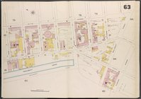
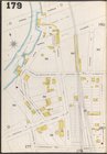
… Plate No. 179 [
Map
bounded by
Canal
Ave
…. 49 [
Map
bounded
collection:
…. 49 [
Map
bounded by 7
…, Plate No. 31 [
Map
… [
Map
bounded by Wythe Ave.,
N
. 1st St., East
… [
Map
bounded by Driggs St.,
N
. 5th St
1
2
3
4
5
6
7
8
9
10
…
20
21
Previous
Next
1
2
3
4
5
6
7
8
9
10
…
20
21
Previous
Next