Click to visit the main New York Public Library Homepage
The New York Public Library
Digital Collections
About Digital Collections
Browse
Search only public domain materials
Items
Collections
Divisions
Home
Search
Browse
About
Search only public domain materials
Items
Collections
Divisions
Digital Collections
Using Images
Using Data
Search
Filtered keyword search
Show filters
Hide filters
Show Only Public Domain
topic
x
Indian reservations
Railroads
21
Administrative and political divisions
15
Military reservations
13
Indians of North America
12
More
Less
name
United States. General Land Office
22
Roeser, C. (Charles)
11
Bien, Julius, 1826-1909
10
Julius Bien & Co
9
Williamson, James Alexander, 1829-1902
7
More
Less
collection
Maps of North America
40
Maps of New York City and State
1
place
New Mexico
8
United States
7
West (U.S.)
6
Arizona
4
Wisconsin
4
More
Less
genre
Maps
41
Topographic maps
1
publisher
General Land Office
12
Department of the Interior, General Land Office
10
Government Printing Office
3
Surveyor General's Office
2
W.J. Keeler
2
More
Less
division
Map Division
41
type
x
cartographic
text
2
still image
1
Date Range
to
41 results found for:
x
Yucatan (Mexico : State) -- History
Filtering on:
x
Topic
: Indian reservations
x
Type
: cartographic
Sort by:
Relevance
Title
Date created
Date digitized
Sequence
Territory of New
Mexico
…
Territory of New
Mexico
…
Territory of New
Mexico
…
State
of Kansas …
State
of Kansas …
m
State
of California …
State
of Wisconsin …
State
of Oregon …
State
of Wyoming …
State
of Nevada
State
of Oregon …
State
of Nevada
State
of Michigan …
m
State
of California …
State
of Colorado …
State
of Idaho …
State
of Wisconsin …
Sketch of public surveys in New
Mexico
note:
…
Mexico
, September 1st
Sketch of public surveys in New
Mexico
note:
…
Mexico
, July 12th, 1861
… of the territories of New
Mexico
Map of the
state
of Wisconsin …
Map of the
state
of Wisconsin …
Map of the
state
of Kansas …
Map of the
state
of Montana …
Map of the
state
of Ohio …
County map of the
state
of Texas
m
Map of the United
States
and territories
note:
… to the United
States
, 1868 [with
A geographically correct map of the
state
… of the
state
of Colorado …
… of the United
States
…, in New
Mexico
, Colorado
…
States
… of the United
States
m
…
States
from
m
…
States
from
m
…
States
from
m
…
States
west of the 84th
…
States
west of the 84th
…
States
west of the 84th
m
Map of the United
States
and territories
note:
… to the United
States
, 1868 [with
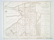
… in the
state
of New York
note:
Covers far western New York
State
.
End of results
|
Top