Click to visit the main New York Public Library Homepage
The New York Public Library
Digital Collections
About Digital Collections
Browse
Search only public domain materials
Items
Collections
Divisions
Home
Search
Browse
About
Search only public domain materials
Items
Collections
Divisions
Digital Collections
Using Images
Using Data
Search
Filtered keyword search
Show filters
Hide filters
Show Only Public Domain
topic
x
Landowners
Real property
98
Maps
15
Land grants
10
Administrative and political divisions
9
More
Less
name
Bourquin, F. (Frederick), 1808-
8
Alexander, James, 1691-1756
6
Warner & Foote
6
Bracher, Wm. (William)
5
Worley & Bracher
5
More
Less
collection
Maps of North America
81
Maps of New York City and State
36
Lawrence H. Slaughter Collection of English maps, charts, globes, books and atlases
1
place
New York (State)
36
New Jersey
16
Pennsylvania
10
California
8
Massachusetts
7
More
Less
genre
Maps
118
Cadastral maps
71
Manuscript maps
23
Surveys
15
Illustrations
8
More
Less
publisher
publisher not identified
21
Published by Warner & Foote
5
producer not identified
5
Dakin Pub. Co
2
Lith. of Jones & Newman
2
More
Less
division
Map Division
118
type
cartographic
118
still image
7
text
4
Date Range
to
118 results found for:
x
Land grants
Filtering on:
x
Topic
: Landowners
Sort by:
Relevance
Title
Date created
Date digitized
Sequence
Map of French & English
grants
on Lake
note:
Mapping the Nation (NEH
grant
, 2015-2018)…
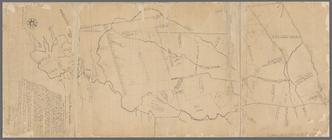
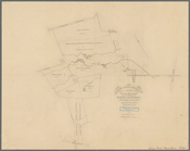
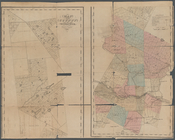
Map of the Manor of Scarsdale
note:
Shows roads,
land
tracts (some numbered
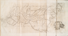
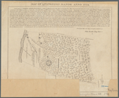
A plan of the Manor of Philip…
note:
Shows townships, roads,
land
tracts (some
m
Map of original
grants
and farms
note:
…. Macarthy, Original
grants
Map of part of the Manor of P…
note:
Mapping the Nation (NEH
grant
, 2015-2018)…
A map of part of the
land
in the Royal
Grant
note:
Mapping the Nation (NEH
grant
, 2015-2018)…
Untitled manuscript map of Gr…
note:
Mapping the Nation (NEH
grant
, 2015-2018)…
Map of the head waters of the…
note:
Mapping the Nation (NEH
grant
, 2015-2018)…
Map of the head waters of the…
note:
Mapping the Nation (NEH
grant
, 2015-2018)…
Map no. III : [to accompany A…
note:
… the occupants of
lands
m
… and the original city
grants
of
lands
under water made
note:
… lines of water
grants
m
Huguenot Park, Westchester Co…
note:
…"Officers of the Huguenot Park
Land
Land
given to the town of Quincy, [Mass
note:
Mapping the Nation (NEH
grant
, 2015-2018)…
Map of Baker City, Oregon
note:
Mapping the Nation (NEH
grant
, 2015-2018)…
Private claims at Michilimack…
note:
Mapping the Nation (NEH
grant
, 2015-2018)…
m
Return of
land
note:
Mapping the Nation (NEH
grant
, 2015-2018)…
m
Three maps of the property kn…
note:
Mapping the Nation (NEH
grant
, 2015-2018)…
m
Map of McLeod County, Minneso…
note:
Library of Congress.
Land
ownership maps
m
Map of Ramsey and Washington …
note:
Library of Congress.
Land
ownership maps
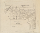
Map of Richland, Oswego Co. N…
note:
… (named), individual
land
Sketch of the claims to
land
note:
Mapping the Nation (NEH
grant
, 2015-2018)…
Albany Rural Cemetery, 1884: …
note:
Mapping the Nation (NEH
grant
, 2015-2018)…
m
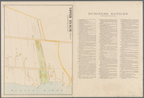
Upper Nyack
note:
… numbers, and
land
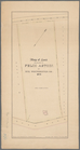
Map of
land
belonging to Felix Astoin
note:
Mapping the Nation (NEH
grant
, 2015-2018)…
Plan of extension of Devonshi…
note:
…"
Land
taken by taken by the Otis Place
Cattaraugus Reservation of th…
note:
Also shows roads, railroads, sections,
land
Plan of extension of Devonshi…
note:
…"
Land
taken by the Otis & Winthrop Place
A plan of the
land
belonging to the Bedford
note:
Mapping the Nation (NEH
grant
, 2015-2018)…
Ancient Windham County: names…
note:
Shows township boundaries, paths,
land
Plan of the Country Club
Land
Association
note:
Mapping the Nation (NEH
grant
, 2015-2018)…
m
… & survey of there
land
near
note:
Mapping the Nation (NEH
grant
, 2015-2018)…
m
A plan of 8 acres
land
survey'd 23d Octr
note:
Mapping the Nation (NEH
grant
, 2015-2018)…
m
Draughts of
land
in Amwell in Hunterdon, Ocbr
note:
Mapping the Nation (NEH
grant
, 2015-2018)…
m
Map of Belknap County, New Ha…
note:
Mapping the Nation (NEH
grant
, 2015-2018)…
A plan of the salt marsh and …
note:
… of
land
with acreage
Map of the City of San Jose
note:
Mapping the Nation (NEH
grant
, 2015-2018)…
m
…, 1752 (survey of
land
note:
Mapping the Nation (NEH
grant
, 2015-2018)…
m
… (survey of
land
owned
note:
Mapping the Nation (NEH
grant
, 2015-2018)…
m
Draught of 8 3/4 acres of
land
survey'd
note:
Mapping the Nation (NEH
grant
, 2015-2018)…
Map of Dobbs Ferry and Hastin…
note:
Mapping the Nation (NEH
grant
, 2015-2018) …
A map of the original allotments of
land
note:
Mapping the Nation (NEH
grant
, 2015-2018)…
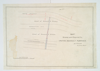
Map showing
land
required for Croton
note:
National Endowment for the Humanities
Grant
for Access
Map of the county of Herkimer
note:
…, churches,
land
parcels
m
… of
land
near Allentown
note:
Mapping the Nation (NEH
grant
, 2015-2018)…
Map of Woodbury County, Iowa …
note:
Library of Congress.
Land
ownership maps
m
… of
land
of Samuel
note:
Mapping the Nation (NEH
grant
, 2015-2018)…
m
…'s
land
in Greenwich
note:
Mapping the Nation (NEH
grant
, 2015-2018)…
m
Jon. Jewel's draught for 105 of
land
note:
Mapping the Nation (NEH
grant
, 2015-2018)…
m
… Embly for
land
in Amwell
note:
Mapping the Nation (NEH
grant
, 2015-2018)…
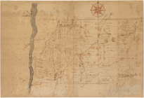
Map of Livingston Manor anno …
note:
Tract of
land
bounded by Hudson River