Click to visit the main New York Public Library Homepage
The New York Public Library
Digital Collections
About Digital Collections
Browse
Search only public domain materials
Items
Collections
Divisions
Home
Search
Browse
About
Search only public domain materials
Items
Collections
Divisions
Digital Collections
Using Images
Using Data
Search
Filtered keyword search
Show filters
Hide filters
Show Only Public Domain
topic
x
Landowners
Real property
84
Administrative and political divisions
17
Railroads
11
Buildings
10
More
Less
name
Warner & Foote
15
Bourquin, F. (Frederick), 1808-
14
Worley & Bracher
10
Bracher, Wm. (William)
9
Walling, Henry Francis, 1825-1888
8
More
Less
collection
Maps of North America
75
Maps of New York City and State
52
Maps of South America
1
place
New York (State)
51
New York (N.Y.)
21
New York
19
Manhattan (New York, N.Y.)
16
Georgia
13
More
Less
genre
Maps
128
Cadastral maps
83
Manuscript maps
11
Wall maps
4
Aerial views
2
More
Less
publisher
Published by Warner & Foote
11
publisher not identified
9
producer not identified
5
M. Dripps
4
Topographical Engineer's Office
4
More
Less
division
Map Division
127
Manuscripts and Archives Division
1
type
cartographic
127
still image
5
text
2
Date Range
to
128 results found for:
x
Scales
Filtering on:
x
Topic
: Landowners
Sort by:
Relevance
Title
Date created
Date digitized
Sequence
m
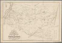
Map of Haywood County, Tenn. …
abstract:
…: Stanton. [
Scale
1:4,950
A map of the towns of Livings…
note:
… the original on a
scale
of 80
Map of the town of Blackstone…
abstract:
… Village.
Scale
[1:5,940] -- Blackstone Village.
Scale
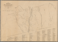
A map of the Manor Renselaerw…
note:
Scale
1:158,400. 2 1/2 miles to one inch
Plan of the town of Newton in…
note:
Scale
approximately 1:19,800 (W 71°16ʹ15ʺ--W
A map of Philadelphia and par…
note:
Scale
approximately 1:65,000 (W 75°17ʹ01ʺ--W
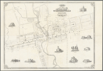
Map of the village of William…
note:
Scale
1:1,980.
Scale
2 chains and 50
Map of the city of Nauvoo : d…
note:
Scale
1:9,900.
Scale
50 rods
Livingston Heights : Livingto…
note:
Scale
not given (W 74°06ʹ40ʺ--W 74°06ʹ19ʺ/N
m
Position Army Cumbld., June 2…
note:
Scale
1:63,360. 1 inch per mile (W 84°39ʹ…
Map of the town of Fairhaven,…
note:
… and Oxford villages.
Scale
Map of Lake Minnetonka : show…
note:
Scale
1:21,120. Three inches to one mile
m
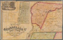
Map of Rensselaer Co., New Yo…
note:
… -- City of Troy.
Scale
1:7,920. "
Scale
of village
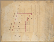
Map of Old Jan's land & the B…
note:
Scale
1:9,900. 50 rods to 1 inch. (W
Manuscript map of lots at cor…
note:
Scale
not given. (W 74°00ʹ35ʺ--W 74°00ʹ32ʺ/N
Block no. 86 : confidential r…
note:
Scale
not given.
Lebanon: [Maine]
note:
… Lebanon. [
Scale
1:9,900].
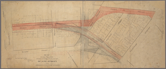
Map shewing a plan for the wi…
note:
Scale
not given (W 74°00ʹ21ʺ--W 74°00ʹ07ʺ/N
m
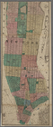
Map of the city of New York.
note:
Scale
approximately 1:17,000. (W 74°01ʹ22ʺ--W
Map of the town of Ipswich, c…
note:
…. [
Scale
1:6,633].
Map of the town of Taunton: w…
abstract:
… of the Village of Taunton. [
Scale
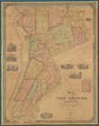
New York and vicinity
abstract:
….
Scale
approximately
Town of Greenburgh, Westchest…
note:
Inset maps,
scale
: 1:5,940: Ashford, town
Map of West Chester County, N…
note:
Scale
[ca. 1:52,500]
Lands of the Tremont Petroleu…
abstract:
… 5 enlarged-
scale
m
Map of the town of Norton, Br…
note:
Includes inset: "Norton Centre." [
Scale
Map of Livingston Manor anno …
note:
Scale
of furlongs (approximately 4 furlongs
Part of Paulding County, Geor…
note:
Scale
1:31,680. 2 inches to 1 mile (W 84°53
Map of the Rhode Island state…
note:
Scale
1:4,800. 400 ft. to the inch (W
Information map, Hd. Qrs. 20 …
note:
Scale
1:63,360. 1 inch = 1 mile (W 84°41ʹ…
Property in the towns of Cast…
note:
Scale
approximately 1:840 (W 74°06ʹ44ʺ--W
m
Map of the southern part of W…
note:
Scale
approximately 12,700 (W 73°56ʹ--W 73°42
m
Map of Delaware County, Iowa …
note:
Scale
1:36,206. 1 3/4 inches to the mile
Map of land to be acquired un…
note:
Scale
[ca. 1:700] (W 74°00ʹ50ʺ--W 74°00
Information map only, H. Qrs.…
note:
Scale
1:63,360. 1 inch per mile (W 84°43ʹ…
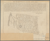
Untitled manuscript map of Gr…
note:
Scale
not given (W 74°02ʹ47ʺ--W 73°27ʹ44ʺ/N
Map of the town of Natick, Mi…
note:
Inset: Natick Village.
Scale
Nieuwe kaart van Suriname : v…
note:
Scale
[ca. 1:455,000] (W 55°16ʹ--W
Tracts and farms with street …
note:
Scale
not given.
Block sketch 1679, New York C…
note:
Scale
not given.
m
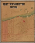
Fort Washington section.
note:
Scale
[ca. 1:2,425].
Plan of the Brunswick lots in…
note:
Scale
not given (W 70°01ʹ20ʺ--W 69°48ʹ30ʺ/N
Map of the town of Concord, M…
note:
… village (
scale
1:6,400
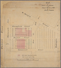
Map of property in the 19th w…
note:
Scale
[ca. 1:490].
m
Map of the City of New York n…
note:
Scale
[1:7,200]. 600 feet to an in. (W
Information map of part of Ge…
note:
Scale
[1:31,680]. 2 in. to 1 mile (W
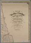
Map of the cities of New York…
note:
Scale
[ca. 1:23,000] (W 74°01ʹ--W 73°53ʹ/N
Part of Paulding County, Geor…
note:
Scale
approximately 1:31,680 (W 84°53ʹ--W 84°44
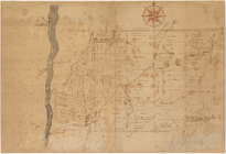
Manuscript map of the area we…
note:
Scale
1:126,720. 1/2 inch per mile (W
Map of the city of Saint Paul…
note:
Scale
1:4,200. 350 feet to an inch (W