Click to visit the main New York Public Library Homepage
The New York Public Library
Digital Collections
About Digital Collections
Browse
Search only public domain materials
Items
Collections
Divisions
Home
Search
Browse
About
Search only public domain materials
Items
Collections
Divisions
Digital Collections
Using Images
Using Data
Search
Filtered keyword search
Show filters
Hide filters
Show Only Public Domain
topic
x
Nautical charts
Navigation
22
Coasts
18
Harbors
17
Rivers
7
More
Less
name
United States Coast Survey
105
Bache, A. D. (Alexander Dallas), 1806-1867
98
Maffitt, John Newland, 1819-1886
24
Mathiot, G
21
Boutelle, C. O. (Charles Otis)
15
More
Less
collection
Maps of North America
124
Lawrence H. Slaughter Collection of English maps, charts, globes, books and atlases
2
Maps of Europe
1
place
Virginia
21
South Carolina
20
Florida
19
North Carolina
18
Atlantic Ocean
15
More
Less
genre
Maps
127
Nautical charts
116
Bathymetric maps
75
Early works to 1800
1
Illustrations
1
More
Less
publisher
U.S. Coast Survey
55
U.S. Coast Survey Office
33
United States Coast Survey
11
publisher not identified
5
Coast Survey Office
2
More
Less
division
Map Division
127
type
x
cartographic
still image
2
Date Range
to
127 results found for:
x
17
Filtering on:
x
Topic
: Nautical charts
x
Type
: cartographic
Sort by:
Relevance
Title
Date created
Date digitized
Sequence
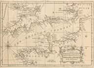
A chart of the English Channe…
m
The provinces of New York, an…
note:
No. "
17
" stamped on verso, upper right
Coastal chart of the Massachu…
note:
From: The Atlantic Neptune, vol. III sheet
17
Preliminary chart of Bull's B…
parent:
8177cfd0-423d-0135-67ce-
17
d16359f88d
Reconnaissance of the entranc…
Baye de la Delaware avec les …
note:
NYPL copy has ms. note on verso:
17
.
Mare Island Straits, Californ…
America, N.W. Coast, Strait o…
note:
… Nb. E 16 or
17
miles.
Unfinished proof of Narragans…
Plan of the entrance into Cap…
Preliminary chart of Hampton …
Rhode - Island, 2e feuille
Sketch of the coast of North …
Reconnaissance of Hatteras In…
Sketch F, no. 6, showing the …
A map and chart of those part…
Tybee Bay and Calibogue Sound…
Atlantic Coast, Chesapeake en…
Preliminary chart of Calibogu…
Coast chart no. 48, Cape Fear…
Preliminary chart of Hatteras…
Ocilla River, Florida
first:
0b137a00-13da-0135-2473-
17
e9a2bf4f7f
Chart of the Columbia River f…
Preliminary chart of Frying P…
Reconnaissance of the entranc…
A draught of Port Royal Harbo…
Reconnoissance of Cape Canave…
Reconnoissance of the entranc…
Hydrographic reconnaissance o…
Charleston harbour, S. Ca. : …
parent:
d518e550-5438-0135-9eca-
17
dbc9a450cb
Preliminary survey of the ent…
Chart of Narraganset Bay : su…
Preliminary sketch of Cherrys…
Sketch of Ocracoke Inlet, Nor…
Stono Inlet, South Carolina
Preliminary reconnaissance of…
Preliminary chart of the sea …
Preliminary Chart of entrance…
Preliminary sketch of Chincot…
Map of comparison of Maffitt'…
Preliminary chart of St. Mark…
Preliminary reconnaissance of…
Reconnaissance of the bar and…
Norfolk harbor, Virginia : fr…
Reconnaissance of entrance & …
Preliminary survey of Turtle …
Preliminary chart of Rappahan…
Reconnaissance of Tampa Bay, …
Reconnaissance of Coffin's Pa…
m
Preliminary chart of Port Roy…