Click to visit the main New York Public Library Homepage
The New York Public Library
Digital Collections
About Digital Collections
Browse
Search only public domain materials
Items
Collections
Divisions
Home
Search
Browse
About
Search only public domain materials
Items
Collections
Divisions
Digital Collections
Using Images
Using Data
Search
Filtered keyword search
Show filters
Hide filters
Show Only Public Domain
topic
x
Nautical charts
Harbors
50
Coasts
38
Navigation
29
Rivers
7
More
Less
name
United States Coast Survey
195
Bache, A. D. (Alexander Dallas), 1806-1867
169
Mathiot, G
47
Alden, James, 1810-1877
31
Maffitt, John Newland, 1819-1886
24
More
Less
collection
Maps of North America
211
Maps of New York City and State
19
Lawrence H. Slaughter Collection of English maps, charts, globes, books and atlases
7
I. N. Phelps Stokes Collection of American Historical Prints
3
Cartographic materials from the Emmet collection of manuscripts etc. relating to American history
1
More
Less
place
Massachusetts
26
California
25
Atlantic Ocean
22
Virginia
22
Florida
20
More
Less
genre
Maps
242
Nautical charts
194
Bathymetric maps
96
Prints
4
Illustrations
3
More
Less
publisher
U.S. Coast Survey
95
U.S. Coast Survey Office
51
United States Coast Survey
20
The Survey
6
Coast Survey Office
5
More
Less
division
Map Division
239
Wallach Division: Print Collection
3
type
x
cartographic
still image
9
text
1
Date Range
to
242 results found for:
x
D. C
Filtering on:
x
Topic
: Nautical charts
x
Type
: cartographic
Sort by:
Relevance
Title
Date created
Date digitized
Sequence
1889, Larchmont Harbor, N.Y.:…
parent:
a1a9
d
830-
c
5a6-012f-00ec-58
d
385a7bc34
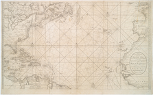
A chart of the English Channe…
parent:
64b36fa0-
c
6bf-012f-
c
94b-58
d
385a7bc34
Preliminary chart of the sea …
parent:
f58affb0-
c
52a-012f-56dd-3
c
075448cc4b
Mouth of Chester River : (Har…
parent:
54
c
27df0-
c
52b-012f-8018-3
c
075448cc4b
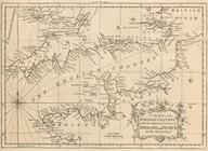
Part of New England New York …
parent:
2b650540-
c
5ed-012f-3079-58
d
385a7bc34
Preliminary chart of Ship and…
parent:
87229fd0-
c
52b-012f-390
d
-3
c
075448cc4b
Preliminary chart of Calibogu…
parent:
4162e680-
c
52b-012f-
c
2dc-3
c
075448cc4b
Nieuwe wassende Graade Zee ka…
parent:
2cfcb490-
c
5ed-012f-
c
1ab-58
d
385a7bc34
Mouth of Chester River : (Har…
parent:
54312bb0-
c
52b-012f-b8e9-3
c
075448cc4b
Pascaarte van Nieu Nederlandt…
parent:
1e24e460-
c
5ed-012f-5a1b-58
d
385a7bc34
Preliminary chart of the sea …
parent:
4162e680-
c
52b-012f-
c
2dc-3
c
075448cc4b
m
Preliminary chart of Savannah…
parent:
38
d
829
c
0-01
c
4-0135-fab3-03
d
47e8626e8
St. Helena Sound, South Carol…
parent:
4162e680-
c
52b-012f-
c
2dc-3
c
075448cc4b
Little Egg Harbor
parent:
6026
d
090-
c
52b-012f-3261-3
c
075448cc4b
Little Egg Harbor
parent:
6026
d
090-
c
52b-012f-3261-3
c
075448cc4b
… deszelffs vasie kusten als
d
parent:
37
d
78a10-
c
5
d
5-012f-2ab1-58
d
385a7bc34
m
Preliminary chart of Port Roy…
parent:
4162e680-
c
52b-012f-
c
2dc-3
c
075448cc4b
Preliminary chart of Port Roy…
parent:
4162e680-
c
52b-012f-
c
2dc-3
c
075448cc4b
Preliminary chart of Port Roy…
parent:
aa122800-4ec9-0135-85bc-7
d
43
c
14cf172
Preliminary chart of the sea …
parent:
87229fd0-
c
52b-012f-390
d
-3
c
075448cc4b
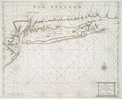
Long Island Sound (western sh…
parent:
a1a9
d
830-
c
5a6-012f-00ec-58
d
385a7bc34
Preliminary sketch of Beaufor…
parent:
61
c
0
d
430-4001-0135-4a98-011747
d
5
c
1a2
Reconnaissance of Coffin's Pa…
parent:
44
d
20660-13
d
0-0135-4ccb-019af78b5
c
4a
Preliminary chart of St. Mark…
parent:
793
c
8630-16f2-0135-4246-6765cf2aaff7
The harbor of Wood's Hole, Ma…
parent:
30
d
2
c
2e0-6bce-0134-65e7-00505686a51
c
Reconnaissance of Port Townsh…
parent:
43460af0-310a-0136-94f8-79cd2bbae77
c
Preliminary chart of western …
parent:
4162e680-
c
52b-012f-
c
2dc-3
c
075448cc4b
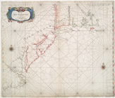
Middle part of the southern c…
parent:
a1a9
d
830-
c
5a6-012f-00ec-58
d
385a7bc34
Reconnoissance of the entranc…
parent:
87229fd0-
c
52b-012f-390
d
-3
c
075448cc4b
Reconnaissance of the bar and…
parent:
cf02eeb0-16ef-0135-6b1e-251
c
5e10288
c
Preliminary chart of St. Andr…
parent:
30262ab0-13f9-0135-b66
c
-077ac48cd231
m
Charleston Harbour and the ad…
parent:
acfa6a20-539b-0135-9257-0099
c
5cc6ba3
Preliminary chart of Cedar Ke…
parent:
c
1
d
2ef30-13
d
2-0135-
d
440-3f4da83e2bb8
St. Mary's River and Fernandi…
parent:
61bfcf90-16f7-0135-3cc2-00
c
15915f2a5
Albemarle Sound, N. Carolina,…
parent:
52a622
d
0-b144-0132-78
c
9-58
d
385a7bbd0
Cat and Ship Island harbors :…
parent:
4162e680-
c
52b-012f-
c
2dc-3
c
075448cc4b
Preliminary sketch of Cherrys…
parent:
87229fd0-
c
52b-012f-390
d
-3
c
075448cc4b
Map of comparison of Maffitt'…
parent:
c
3ca1f80-543
d
-0135-04
d
2-437cce734145
Entrance to Columbia River, O…
parent:
4162e680-
c
52b-012f-
c
2dc-3
c
075448cc4b
Reconnaissance of Romerly Mar…
parent:
3b2ec720-b143-0132-959
c
-58
d
385a7bbd0
Preliminary survey of Winyah …
parent:
4162e680-
c
52b-012f-
c
2dc-3
c
075448cc4b
Preliminary chart of Beaufort…
parent:
52a622
d
0-b144-0132-78
c
9-58
d
385a7bbd0
Alaska Peninsula and Aleutian…
parent:
d
4fe8590-b142-0132-
d
8
c
1-58
d
385a7bbd0
Preliminary chart of entrance…
parent:
4162e680-
c
52b-012f-
c
2dc-3
c
075448cc4b
Boston Harbor, Massachusetts
parent:
01155650-97e5-0134-2547-00505686a51
c
Albemarle Sound, N. Carolina,…
parent:
78423
d
90-3ff5-0135-e7
c
6-0
d
7a3815a372
Harbors of Captain's Island E…
parent:
e1af2
c
00-327a-0134-747
c
-00505686a51
c
Preliminary chart of Winyah B…
parent:
4162e680-
c
52b-012f-
c
2dc-3
c
075448cc4b
Preliminary chart of lower pa…
parent:
52a622
d
0-b144-0132-78
c
9-58
d
385a7bbd0
Preliminary chart of North Ed…
parent:
4162e680-
c
52b-012f-
c
2dc-3
c
075448cc4b