Click to visit the main New York Public Library Homepage
The New York Public Library
Digital Collections
About Digital Collections
Browse
Search only public domain materials
Items
Collections
Divisions
Home
Search
Browse
About
Search only public domain materials
Items
Collections
Divisions
Digital Collections
Using Images
Using Data
Search
Filtered keyword search
Show filters
Hide filters
Show Only Public Domain
topic
x
Nautical charts
Coasts
3
Harbors
3
Bays
1
Navigation
1
name
Throop, John Peter Van Ness, 1794-approximately 1861
10
United States Coast Survey
10
Bache, A. D. (Alexander Dallas), 1806-1867
8
Mathiot, G
5
Alden, James, 1810-1877
3
More
Less
collection
Maps of North America
13
Lawrence H. Slaughter Collection of English maps, charts, globes, books and atlases
3
Maps of New York City and State
1
place
New York (N.Y.)
3
North Carolina
3
Oregon
3
Alaska
2
Alaska Peninsula (Alaska)
2
More
Less
genre
Maps
17
Nautical charts
11
Bathymetric maps
5
Topographic maps
1
coastal charts
1
publisher
U.S. Coast Survey
4
U.S. Coast Survey Office
4
Sold by A. Dury, Dukes Court, St. Martins Lane
2
The United States Coast and Geodetic Survey
2
U. S. Coast Survey Office
2
More
Less
division
Map Division
17
type
x
cartographic
Date Range
to
17 results found for:
x
Peters
Filtering on:
x
Topic
: Nautical charts
x
Type
: cartographic
Sort by:
Relevance
Title
Date created
Date digitized
Sequence
Hawaiian or Sandwich Islands
Alaska Peninsula and Aleutian…
Alaska Peninsula and Aleutian…
Long Island Sound from New Yo…
note:
… / by
Peter
J. Guthorn. 1984
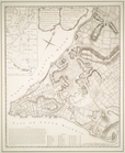
A plan of the city of New-Yor…
Long Island Sound from New Yo…
note:
… / by
Peter
J. Guthorn. 1984
A plan of the city of New-Yor…
Preliminary chart of Portland…
Preliminary chart of Monomoy …
Reconnaissance of the western…
Preliminary survey of harbors…
Preliminary chart of Muskeget…
Preliminary chart of lower pa…
Reconnaissance of the western…
Preliminary chart of entrance…
Preliminary chart of Frying P…
Preliminary chart of Beaufort…
End of results
|
Top