Click to visit the main New York Public Library Homepage
The New York Public Library
Digital Collections
About Digital Collections
Browse
Search only public domain materials
Items
Collections
Divisions
Home
Search
Browse
About
Search only public domain materials
Items
Collections
Divisions
Digital Collections
Using Images
Using Data
Search
Filtered keyword search
Show filters
Hide filters
Show Only Public Domain
topic
x
Nautical charts
Coasts
15
Harbors
8
Waterways
2
Atlases
1
More
Less
name
United States Coast Survey
12
Bache, A. D. (Alexander Dallas), 1806-1867
9
Ferguson, James, 1710-1776
8
Blunt, Edmund M. (Edmund March), 1770-1862
7
Hassler, F. R. (Ferdinand Rudolph), 1770-1843
7
More
Less
collection
Maps of North America
19
Lawrence H. Slaughter Collection of English maps, charts, globes, books and atlases
17
Maps of New York City and State
11
John H. Levine Collection
3
I. N. Phelps Stokes Collection of American Historical Prints
1
place
Maps
16
New Jersey
15
Atlantic Coast (Middle Atlantic States)
13
New York (N.Y.)
11
New York Harbor (N.Y. and N.J.)
10
More
Less
genre
Maps
51
Nautical charts
1
Prints
1
publisher
Survey of the Coast of the United States
3
The Survey
3
Chez P. Mortier
2
Depot general de la marine
2
E. & G.W. Blunt
2
More
Less
division
Map Division
50
Wallach Division: Print Collection
1
type
cartographic
51
Date Range
to
51 results found for:
x
Middle Atlantic States
Filtering on:
x
Topic
: Nautical charts
Sort by:
Relevance
Title
Date created
Date digitized
Sequence
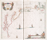
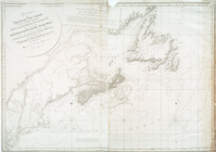
A new chart of the coast of N…
note:
… to Early Maps of the
Middle
Atlantic
Seaboard.
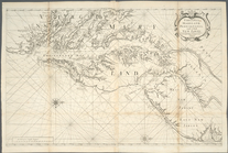
Pas caerte van Nieu Nederland…
Virginia, Maryland, Pennsilva…
note:
Distinguished from later
states
by northern
Virginia, Maryland, Pennsilva…
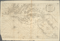
Pas caarte van Nieu Nederlandt
note:
… to Early Maps of the
Middle
Atlantic
Seaboard.
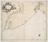
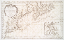
A chart of the Atlantick Ocea…
m
The north eastern coast of No…
note:
…, of the
stat[e
] of New York."…
The coast of the United
States
of North
note:
…, of the
state
of New York."…
Pas kaart van de zee kusten v…
note:
… of the
Middle
Atlantic
Seaboard.
Paskaerte van de zuydt en Noo…
A chart of the sea coasts of …
note:
… to Early Maps of the
Middle
Atlantic
Seaboard.
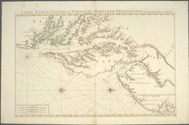
Carte particuliere de Virgini…
note:
… to Early Maps of the
Middle
Atlantic
Seaboard.
Carte particuliere de Virgini…
note:
… to Early Maps of the
Middle
Atlantic
Seaboard.
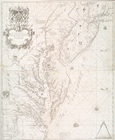
A new map of Virginia, Maryla…
note:
… to Early Maps of the
Middle
Atlantic
Seaboard.
A chart of the coast of Ameri…
note:
… to Early Maps of the
Middle
Atlantic
Seaboard.
New York Harbor and entrance …
note:
… to Early Maps of the
Middle
Atlantic
Seaboard.
Chart of the entrance to Ches…
note:
… to Early Maps of the
Middle
Atlantic
Seaboard.
Nautical chart of Little Egg …
note:
… to Early Maps of the
Middle
Atlantic
Seaboard.
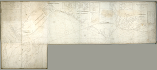
To the members of the Nautica…
note:
Covers
Atlantic
Coast of U.S. from New
Carte réduite des côtes orien…
note:
… to Early Maps of the
Middle
Atlantic
Seaboard.
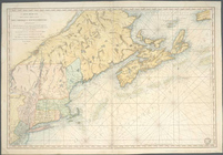
The coast of Nova Scotia, New…
note:
Mixed
State
A map and chart of those part…
note:
… to Early Maps of the
Middle
Atlantic
Seaboard.
…
States
of North America
note:
… to Early Maps of the
Middle
Atlantic
Seaboard.
Carte reduite des costes orie…
note:
… to Early Maps of the
Middle
Atlantic
Seaboard.
Chart of the mouth of Susqueh…
note:
… to Early Maps of the
Middle
Atlantic
Seaboard.
Middle
part of Long Island Sound …
note:
…
States
; A.D. Bache
Carte réduite des côtes orien…
note:
… to Early Maps of the
Middle
Atlantic
Seaboard.
m
Oyster Bay and Huntington, Hu…
note:
… to Early Maps of the
Middle
Atlantic
Seaboard.
A draught of New York and Per…
note:
… to Early Maps of the
Middle
Atlantic
Seaboard.
A draught of New York from th…
note:
…. This
state
appears in eds
A new and accurate chart (fro…
note:
… to Early Maps of the
Middle
Atlantic
Seaboard.
A chart of New York Harbour :…
note:
Appears in Des Barres's
Atlantic
Neptune.
m
A new and accurate chart of t…
note:
… to Early Maps of the
Middle
Atlantic
Seaboard.
Mouth of Chester River : (Har…
note:
… to Early Maps of the
Middle
Atlantic
Seaboard.
Long Island Sound from New Yo…
note:
… of the
state
of N. York."…
Long Island Sound from New Yo…
note:
… of the
state
of N. York."…
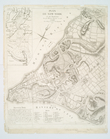
Plan de New-York et des envir…
note:
… to Early Maps of the
Middle
Atlantic
Seaboard.
Little Egg Harbor
note:
… to Early Maps of the
Middle
Atlantic
Seaboard.
Little Egg Harbor
note:
… to Early Maps of the
Middle
Atlantic
Seaboard.
The harbor of Annapolis
note:
… to Early Maps of the
Middle
Atlantic
Seaboard.
m
Map of New-York Bay and Harbo…
note:
… to Early Maps of the
Middle
Atlantic
Seaboard.
A sketch of the operations of…
note:
… to Early Maps of the
Middle
Atlantic
Seaboard.
A chart of the bar of Sandy H…
note:
… to Early Maps of the
Middle
Atlantic
Seaboard.
The harbor of Annapolis
note:
… to Early Maps of the
Middle
Atlantic
Seaboard.
Mouth of Chester River : (Har…
note:
… to Early Maps of the
Middle
Atlantic
Seaboard.
m
Map of New-York Bay and Harbo…
note:
… to Early Maps of the
Middle
Atlantic
Seaboard.
A chart of Delaware Bay and R…
note:
… to Early Maps of the
Middle
Atlantic
Seaboard.
[A chart of New York Island &…
note:
2nd
state
according to LC Maps of North
A chart of New York Island & …
note:
… to Early Maps of the
Middle
Atlantic
Seaboard.
Map of New-York Bay and Harbo…
note:
… to Early Maps of the
Middle
Atlantic
Seaboard.