Click to visit the main New York Public Library Homepage
The New York Public Library
Digital Collections
About Digital Collections
Browse
Search only public domain materials
Items
Collections
Divisions
Home
Search
Browse
About
Search only public domain materials
Items
Collections
Divisions
Digital Collections
Using Images
Using Data
Search
Filtered keyword search
Show filters
Hide filters
Show Only Public Domain
topic
x
Railroads
Administrative and political divisions
58
Local transit
39
Railroads, Elevated
32
Ferries
25
More
Less
name
Rand McNally and Company
34
G.W. & C.B. Colton & Co
12
Colton, G. Woolworth (George Woolworth), 1827-1901
9
United States. General Land Office
9
United States. Post Office Department
9
More
Less
collection
Maps of New York City and State
138
Maps of North America
99
Maps of North and South America
1
place
New York (State)
131
New York
90
New York (N.Y.)
69
New York Metropolitan Area
49
Manhattan (New York, N.Y.)
44
More
Less
genre
Maps
238
Cadastral maps
9
Mass transit
6
Aerial views
3
Tourist maps
3
More
Less
publisher
publisher not identified
17
The Company
14
G.W. & C.B. Colton & Co
12
Rand, McNally & Co
12
Post Office Department
6
More
Less
division
Map Division
237
Manuscripts and Archives Division
1
type
cartographic
237
still image
1
Date Range
to
238 results found for:
x
Scales
Filtering on:
x
Topic
: Railroads
Sort by:
Relevance
Title
Date created
Date digitized
Sequence
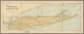
Map of boroughs of Manhattan …
note:
Scales
differ (W 74°03ʹ31ʺ--W 71°49ʹ43ʺ/N
Map of the town of Huron, Mic…
note:
Scales
differ (W 82°27ʹ59ʺ--W 82°23ʹ55ʺ/N
… on a reduced
scale
/ engraved
note:
Scale
[ca. 1:24,000]. (W 74°02ʹ56ʺ--W 73°57
Transportation routes between…
note:
… in South America" (
scale
Post route map of the state o…
note:
Scale
approximately 1:950,000 (W 106°38ʹ--W
m
Map of the Grand Rapids and I…
note:
Scale
not given (W 88°14ʹ--W 82°07ʹ/N 48°18
Railroad map of New England &…
note:
Scale
not given on map;
scale
from
Map of New England and the pr…
note:
… around Boston ] [
scale
m
Rand, McNally & Co.'s complet…
note:
… borough [
scale
1:12,000].
Railroads in Manhattan, Jerse…
note:
Scale
1:15,840,
scale
4" - 1 mile ; (W
m
Rand, McNally & Co.'s map sho…
note:
Scale
1:506,880. 8 miles to 1 inch (W 77°32
Map of the territory of the […
note:
…; printed
scale
ratio and
scale
bar pasted over
Mapa de la ciudad de Nueva Yo…
note:
Includes inset: Greater New York [
Scale
Plan of the Village of Marque…
abstract:
….
Scale
[1:63,360.] 1 mile
m
Street guide of Manhattan and…
note:
….] (
scale
1:18,000).
Greater New York and Long Isl…
note:
Scale
not given.
Greater New York City
note:
Scale
approximately 1:100,000 (W 74°16ʹ48ʺ--W
Map of New York City region a…
note:
Scale
not given (W 75°10ʹ--W 71°49ʹ/N 41°23
Springfield, Ill. 1892
note:
Scale
not given (W 89°46ʹ23ʺ--W 89°34ʹ06ʺ/N
m
The Matthews-Northrup up-to-d…
note:
Includes inset of Alaska,
scale
1 in. = 450
Map of Long Island showing th…
note:
Scale
[ca. 1:245,000].
Erie Railroad suburban lines
note:
Scale
not given.
Transportation lines connecti…
note:
Scale
not given (W 74°11ʹ47ʺ--W 73°58ʹ30ʺ/N
Map of the suburban territory…
note:
Scale
approximately 1:350,000 (W 74°11ʹ32ʺ--W
Profiles of the New York Stat…
note:
… and rail roads, 1886.
Scale
Map of New York City and vici…
note:
Scale
approximately 1:120,000. (W 74°18ʹ48ʺ--W
Map of Hudson & Manhattan Rai…
note:
Scale
not given.
m
New York und Umgegend
note:
Scale
1:40,000 (W 74°12ʹ08ʺ--W 73°52ʹ26ʺ/N
Greater New York and its harb…
note:
Scale
approximately 1:130,000 (W 74°17ʹ--W 73°41
Railroad map of Wisconsin : p…
note:
Scale
not given (W 92°53ʹ--W 86°14ʹ/N 47°18
Birdseye view of greater New …
note:
Scale
not given.
Railroads of Minneapolis and …
note:
Scale
1:1,900,800. 30 miles to 1 inch (W
Map of the Hackensack & New Y…
note:
Scale
not given (W 74°12ʹ15ʺ--W 73°47ʹ35ʺ/N
Proposed site on Staten Islan…
note:
Scale
not given (W 74°20ʹ56ʺ--W 73°54ʹ09ʺ/N
Railroad map of Wisconsin
note:
Scale
1:760,320. 1 inch = 12 miles (W
m
Hagstom's map of Long Island …
note:
Scale
approximately 1:130,000 (W 74°04ʹ--W 71°48
American Automobile Associati…
note:
Scale
approximately 1:150,000 (W 74°31ʹ--W 73°30
Port of New York Authority : …
note:
Scale
1:125,000 (W 74°32ʹ--W 73°42ʹ/N 41°07
m
Freight map of the metropolit…
note:
Scale
approximately 1:75,000 (W 74°24ʹ--W 73°37
Map of part of Jersey City, …
note:
Scale
not given (W 74°03ʹ--W 74°01ʹ/N 40°43
Street guide of Brooklyn : wi…
note:
Scale
approximately 1:36,500.
m
Map of New York City (Manhatt…
note:
Bronx map at different
scale
.
Hammond's handy reference map…
note:
Scale
approxmately 1:24,000.
m
The Bridgman's new map of the…
note:
Scale
approximately 1:90,000. (W 74°16ʹ04ʺ--W
Brooklyn
note:
Scale
approximately 1:21,000 (W 74°02ʹ54ʺ--W
New York and vicinity
abstract:
….
Scale
approximately
Railroad map of Wisconsin
note:
Scale
1:760,320. 1 inch = 12 miles (W 93
Complete railway map designed…
note:
… on an enlarged
scale
.
Map of the territory of Minne…
note:
Scale
not given (W 98°55ʹ--W 88°14ʹ/N 50°10
The Matthews-Northrup up-to-d…
note:
Scale
approximately 1:25,000 (W 74°02ʹ33ʺ--W