Click to visit the main New York Public Library Homepage
The New York Public Library
Digital Collections
About Digital Collections
Browse
Search only public domain materials
Items
Collections
Divisions
Home
Search
Browse
About
Search only public domain materials
Items
Collections
Divisions
Digital Collections
Using Images
Using Data
Search
Filtered keyword search
Show filters
Hide filters
Show Only Public Domain
topic
x
Real property
Business enterprises
467
Description and travel
156
History
91
Landowners
51
More
Less
name
Beers, F. W. (Frederick W.)
319
D.G. Beers & Co
155
F.W. Beers & Co
148
Beers, D. G. (Daniel G.)
142
Everts, Ensign & Everts
132
More
Less
collection
Atlases of the United States
1744
Atlases of New York City
90
Maps of North America
15
Maps of New York City and State
5
Lawrence H. Slaughter Collection of English maps, charts, globes, books and atlases
1
place
New York (State)
1613
Westchester County (N.Y.)
187
New Jersey
175
Erie County
151
Erie County (N.Y.)
148
More
Less
genre
Atlases
1741
Maps
1687
Prints
69
Cadastral maps
38
Title pages
16
More
Less
publisher
F. W. Beers & Co
148
E. Belcher-Hyde
112
Century Map Company
111
Andreas, Baskin & Burr
90
G.W. Bromley & Co
89
More
Less
division
Map Division
1826
Milstein Division
29
type
cartographic
1753
text
107
still image
6
Date Range
to
1,855 results found for:
x
county atlas
Filtering on:
x
Topic
: Real property
Sort by:
Relevance
Title
Date created
Date digitized
Sequence
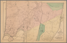
Saratoga Springs [Township]
collection:
Atlases
of the United States
Schuylerville Business Direct…
collection:
Atlases
of the United States
Saratoga [Township]
collection:
Atlases
of the United States
Stillwater [Township]
collection:
Atlases
of the United States
References; Waterford [Villag…
collection:
Atlases
of the United States
Waterford [Township]
collection:
Atlases
of the United States
Beechers Hollow [Village]; Be…
collection:
Atlases
of the United States
Wilton [Township]
collection:
Atlases
of the United States
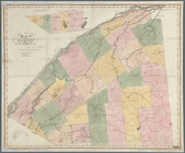
Map of Saratoga
County
collection:
Atlases
of the United States
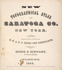
New topographical
atlas
of Saratoga Co
collection:
Atlases
of the United States
Residence of James Carrigan, …
collection:
Atlases
of the United States
Index
collection:
Atlases
of the United States
… of Saratoga
County
, New York
collection:
Atlases
of the United States
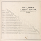
Table of Distances in Saratoga
County
collection:
Atlases
of the United States
Ballston [Township]
collection:
Atlases
of the United States
Ballston Spa Business Directo…
collection:
Atlases
of the United States
Charlton [Township]
collection:
Atlases
of the United States
Grangerville [Village]; Grang…
collection:
Atlases
of the United States
Clifton Park [Township]
collection:
Atlases
of the United States
Corinth [Township]; Palmer Fa…
collection:
Atlases
of the United States
Clifton Park [Village]; Clift…
collection:
Atlases
of the United States
Day Corners Business Director…
collection:
Atlases
of the United States
Edinburgh [Township]
collection:
Atlases
of the United States
Crescent [Village]; Crescent …
collection:
Atlases
of the United States
Galway [Township]; Yorks Corn…
collection:
Atlases
of the United States
Greenfield [Township]; Pages …
collection:
Atlases
of the United States
Bloodville [Village]; Bloodvi…
collection:
Atlases
of the United States
Hadley [Township]; Hadley Bus…
collection:
Atlases
of the United States
Half Moon [Township]
collection:
Atlases
of the United States
Factory Village [Village]; Fa…
collection:
Atlases
of the United States
Malta [Township]
collection:
Atlases
of the United States
Burnt Hills [Village]; Burnt …
collection:
Atlases
of the United States
Milton [Township]
collection:
Atlases
of the United States
Moreau [Township]
collection:
Atlases
of the United States
Conklingville [Village]; Conk…
collection:
Atlases
of the United States
Northumberland [Township]
collection:
Atlases
of the United States
Providence [Township]; Hagedo…
collection:
Atlases
of the United States
References; Saratoga Springs …
collection:
Atlases
of the United States
m
Map number sixteen : [Berkele…
abstract:
…, Pleasanton, Alameda
County
First District Anne Arundel
County
note:
Appears in "
Atlas
of 15 Miles Around
Eighth District Anne Arundel
County
note:
Appears in "
Atlas
of 15 Miles Around
Southern part of Yonkers, and…
note:
From : J.B. Beers & Co.
County
atlas
Portions of 2nd, 3rd, and 4th…
note:
From : J.B. Beers & Co.
County
atlas
Portions of 1st, 2nd, and 3rd…
note:
From : J.B. Beers & Co.
County
atlas
North Berwick: [Maine]
note:
Probably from: the
Atlas
of York
County
North Berwick: [Maine]. Limin…
note:
Probably from: the
Atlas
of York
County
Map of the
County
of St. Lawrence
note:
… of the
County
printed on top
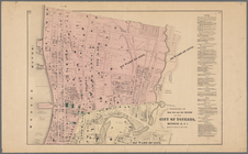
Town of Greenburgh, Westchest…
note:
Appears in:
Atlas
of Westchester
County
, by Beers
m
Draughts of land in Amwell in…
m
…, Hunterdon
County
, May 5
1
2
3
4
5
6
7
8
Previous
Next
1
2
3
4
5
6
7
8
Previous
Next