Click to visit the main New York Public Library Homepage
The New York Public Library
Digital Collections
About Digital Collections
Browse
Search only public domain materials
Items
Collections
Divisions
Home
Search
Browse
About
Search only public domain materials
Items
Collections
Divisions
Digital Collections
Using Images
Using Data
Search
Filtered keyword search
Show filters
Hide filters
Show Only Public Domain
topic
Real property
608
Fire insurance
289
Cities & towns
285
Maps
55
Administrative and political divisions
47
More
Less
name
Sanborn Map Company
287
G.W. Bromley & Co
179
Ullitz, Hugo
85
E.B. Hyde & Co
79
E. Belcher Hyde Map Company
71
More
Less
collection
Atlases of New York City
708
Maps of North America
167
Maps of New York City and State
73
Atlases of the United States
64
Lawrence H. Slaughter Collection of English maps, charts, globes, books and atlases
27
More
Less
place
New York (State)
635
New York
260
New York (N.Y.)
205
Bronx (New York, N.Y.)
156
Brooklyn (New York, N.Y.)
115
More
Less
genre
Maps
1109
Atlases
62
Cadastral maps
45
Prints
23
Nautical charts
13
More
Less
publisher
Sanborn Map Company
288
G.W. Bromley & Co
172
E. Belcher Hyde
76
M.B. Brown Printing & Binding Co.,
38
New York (N.Y.). Dept. of City Planning
37
More
Less
division
Map Division
1049
Wallach Division: Print Collection
26
General Research Division
9
Manuscripts and Archives Division
8
Schomburg Jean Blackwell Hutson Research and Reference Division
5
More
Less
type
x
cartographic
still image
24
text
20
Date Range
to
1,109 results found for:
x
9
Filtering on:
x
Type
: cartographic
Sort by:
Relevance
Title
Date created
Date digitized
Sequence
Carte des Isles de L'Amerique…
first:
510d47da-7207-a3d
9
-e040-e00a18064a99
Carte de L'Isle de Saint-Domi…
first:
510d47da-7209-a3d
9
-e040-e00a18064a99
m
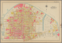
Map of Brooklyn
parent:
6cea
9
e80-c5aa-012f-63d6-58d385a7bc34
… York, 1922, chapter
9
parent:
6cea
9
e80-c5aa-012f-63d6-58d385a7bc34
Opening Hell Gate at a cost o…
parent:
a45be3b0-8896-013b-8ac
9
-0242ac110003
Railroad suburbs between Holl…
parent:
6cea
9
e80-c5aa-012f-63d6-58d385a7bc34
m
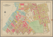
Map of the city of Brooklyn, …
parent:
6cea
9
e80-c5aa-012f-63d6-58d385a7bc34
Map of the Harlem River and S…
parent:
6cea
9
e80-c5aa-012f-63d6-58d385a7bc34
m
Taunton new guide map and dir…
parent:
6cea
9
e80-c5aa-012f-63d6-58d385a7bc34
Design for laying out the gro…
parent:
6cea
9
e80-c5aa-012f-63d6-58d385a7bc34
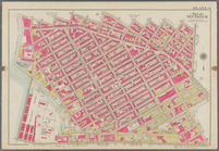
Map of the enlarged city of B…
parent:
6cea
9
e80-c5aa-012f-63d6-58d385a7bc34
m
Map of the City of Brooklyn a…
parent:
6cea
9
e80-c5aa-012f-63d6-58d385a7bc34
The Narrows tunnel : chart of…
parent:
6cea
9
e80-c5aa-012f-63d6-58d385a7bc34
A landmark map of City Hall P…
parent:
6cea
9
e80-c5aa-012f-63d6-58d385a7bc34
m
Map
9
- Manhattan, Brooklyn, and Queens
first:
2de70440-805d-013a-b
9
a0-0242ac110003
m
… which broke out about
9
parent:
6cea
9
e80-c5aa-012f-63d6-58d385a7bc34
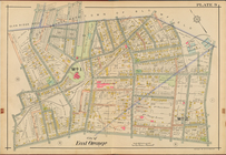
City of East Orange, Double Page Plate No.
9
m
Map of Washington County, New…
parent:
a1a
9
d830-c5a6-012f-00ec-58d385a7bc34
A perspective view of Lake Ge…
parent:
a1a
9
d830-c5a6-012f-00ec-58d385a7bc34
Plan de la ville Tartare de P…
Carte routière de l'Indochine…
Atlas des enfans..., XVI
parent:
cee
9
ee10-a59c-0137-7e6f-0b59784b3bde
Atlas des enfans..., XV
parent:
cee
9
ee10-a59c-0137-7e6f-0b59784b3bde
Plan of extension of Devonshi…
first:
406cb470-97b8-0134-be
9
f-00505686a51c
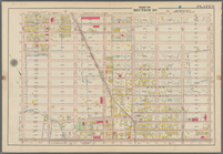
Bounded by 72nd Street, 21st …
first:
91dc8ee0-8624-0137-09be-5be
9
c141a31c
Bounded by Newton Creek (Sene…
Bounded by Teneyck Street, Mo…
Bounded by Bayard Street, Gra…
Bounded by Calyer Street, Fro…
parent:
b
9
b864c0-c5f7-012f-5910-58d385a7bc34
Bounded by Commercial Street,…
Bounded by Noble St., Manhatt…
Bounded by S. 11th Street, Be…
collection:
Plate
9
Topographical map of Fairmoun…
abstract:
… of 1:
9
,600 or 800 feet to 1
m
Missouri
first:
dc0c7c50-c6fb-0135-5e
9
b-256f6ba1b85d
Map of Texas and the countrie…
note:
… Division , v.
9
, page 531
Map of the survey of Wissahic…
note:
Scale 1:
9
,600. 800 ft. to an inch (W
A.R. Roessler's latest map of…
note:
… Division , v.
9
, page 533
m
Revised map of the state of T…
note:
… Division , v.
9
, page 533
… in section no.
9
from 1848
first:
a67f0fb0-bc30-0135-46da-6f
9
c3020f024
m
Post route map of the state o…
parent:
2b7b22a0-d300-0135-f79e-0731253f
9
f7f
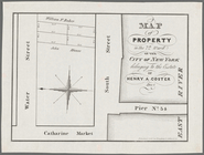
Map of property in the 9th wa…
parent:
b
9
d5c1f0-35bb-0136-44ca-06121bd98efa
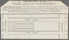
Chancery sale, valuable prope…
parent:
b
9
d5c1f0-35bb-0136-44ca-06121bd98efa
Map of property in the 7th Wa…
parent:
e5af
9
d00-35bb-0136-ebc0-0006fe1b4203
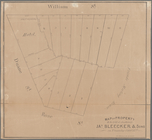
Map of property to be sold at…
parent:
b
9
d5c1f0-35bb-0136-44ca-06121bd98efa
m
Map of Maine: constructed fro…
m
Map of Stearns County, Minnes…
parent:
780c03e0-c403-0135-533f-4fa0a
9
d4f933
Post route map of the state o…
note:
… Division , v.
9
, page 534
Correct map of Texas
parent:
e2c22c20-e1e
9
-0135-3bba-435fc55ce49a
Houston Post map of the great…
parent:
15f851b0-e1ef-0135-b641-7186c
9
f522cb
Location and depths of the ar…
note:
… Division , v.
9
, page 538
1
2
3
4
5
Previous
Next
1
2
3
4
5
Previous
Next