Click to visit the main New York Public Library Homepage
The New York Public Library
Digital Collections
About Digital Collections
Browse
Search only public domain materials
Items
Collections
Divisions
Home
Search
Browse
About
Search only public domain materials
Items
Collections
Divisions
Digital Collections
Using Images
Using Data
Search
Filtered keyword search
Show filters
Hide filters
Show Only Public Domain
topic
Real property
608
Fire insurance
289
Cities & towns
285
Maps
55
Administrative and political divisions
47
More
Less
name
Sanborn Map Company
287
G.W. Bromley & Co
179
Ullitz, Hugo
85
E.B. Hyde & Co
79
E. Belcher Hyde Map Company
71
More
Less
collection
Atlases of New York City
708
Maps of North America
167
Maps of New York City and State
73
Atlases of the United States
64
Lawrence H. Slaughter Collection of English maps, charts, globes, books and atlases
27
More
Less
place
New York (State)
635
New York
260
New York (N.Y.)
205
Bronx (New York, N.Y.)
156
Brooklyn (New York, N.Y.)
115
More
Less
genre
Maps
1109
Atlases
62
Cadastral maps
45
Prints
23
Nautical charts
13
More
Less
publisher
Sanborn Map Company
288
G.W. Bromley & Co
172
E. Belcher Hyde
76
M.B. Brown Printing & Binding Co.,
38
New York (N.Y.). Dept. of City Planning
37
More
Less
division
Map Division
1049
Wallach Division: Print Collection
26
General Research Division
9
Manuscripts and Archives Division
8
Schomburg Jean Blackwell Hutson Research and Reference Division
5
More
Less
type
x
cartographic
still image
24
text
20
Date Range
to
1,109 results found for:
x
9
Filtering on:
x
Type
: cartographic
Sort by:
Relevance
Title
Date created
Date digitized
Sequence
4th Ward. [Map bounded by Roo…
first:
5e66b3e
9
-0734-d471-e040-e00a180654d7
5th Senatorial District 8,
9
, 15 and 16
parent:
6cea
9
e80-c5aa-012f-63d6-58d385a7bc34
A A plan of Boston in New Eng…
first:
510d47d
9
-7ae8-a3d
9
-e040-e00a18064a99
A geographically correct map …
note:
… Division , v.
9
, page 533
A geological and topographica…
note:
… Division, v.
9
, page 677
A landmark map of City Hall P…
parent:
6cea
9
e80-c5aa-012f-63d6-58d385a7bc34
m
A map of Schuylkill County, P…
first:
351c55c0-3261-0135-
9
a73-091263a7f0d8
m
A map of South Carolina : wit…
m
A map of South Carolina : con…
first:
9
c
9
f30d0-7a1c-0135-d31e-4561fe2c8693
m
A map of South Carolina and a…
parent:
32ca8880-3a5e-0135-dac3-0f
9
a3d5d919f
A map of the canals & rail ro…
first:
510d47da-ee29-a3d
9
-e040-e00a18064a99
m
… which broke out about
9
parent:
6cea
9
e80-c5aa-012f-63d6-58d385a7bc34
A mapp of Virginia discouered…
first:
510d47d
9
-7a7e-a3d
9
-e040-e00a18064a99
A new and correct map of Nort…
first:
510d47da-f0eb-a3d
9
-e040-e00a18064a99
A new and correct map of the …
first:
510d47d
9
-7b00-a3d
9
-e040-e00a18064a99
m
A new map of Arkansas with it…
m
A new map of the north parts …
first:
510d47da-f186-a3d
9
-e040-e00a18064a99
A new map of the whole contin…
first:
510d47da-ef6a-a3d
9
-e040-e00a18064a99
A new plan of ye great town o…
parent:
a9168a90-26ce-0136-4f04-21518a2aaaa
9
A perspective view of Lake Ge…
parent:
a1a
9
d830-c5a6-012f-00ec-58d385a7bc34
A perspective view of Lake Ge…
parent:
a1a
9
d830-c5a6-012f-00ec-58d385a7bc34
A topographical map of Hudson…
parent:
a1a
9
d830-c5a6-012f-00ec-58d385a7bc34
A topographical map of the no…
first:
510d47d
9
-7a8e-a3d
9
-e040-e00a18064a99
A.R. Roessler's latest map of…
note:
… Division , v.
9
, page 533
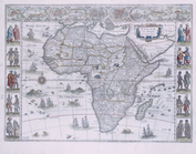
Africæ: nova descriptio
first:
510d47d
9
-3c7f-a3d
9
-e040-e00a18064a99
Alaska military expedition : …
note:
…. 172, map
9
…
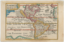
America
first:
510d47da-ef59-a3d
9
-e040-e00a18064a99
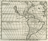
America
first:
510d47df-fb47-a3d
9
-e040-e00a18064a99
America noviter delineata.
first:
510d47d
9
-7bfb-a3d
9
-e040-e00a18064a99
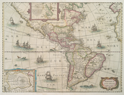
America.
first:
510d47da-f172-a3d
9
-e040-e00a18064a99
Americae septentrionalis tabu…
parent:
9
cfb5810-c5d5-012f-a599-58d385a7bc34
m
An accurate chart of the coas…
note:
…,
9
, 70 & 71 by George
An east perspective view of t…
first:
510d47d
9
-7ac4-a3d
9
-e040-e00a18064a99
An exact plan of Charles-town…
first:
510d47d
9
-7ae7-a3d
9
-e040-e00a18064a99
m
An improved map of the Hudson…
parent:
a1a
9
d830-c5a6-012f-00ec-58d385a7bc34
Annual passage of the herring…
first:
510d47da-ef21-a3d
9
-e040-e00a18064a99
Area District Map Section No.
9
parent:
de
9
cf0e0-c5f6-012f-c63b-58d385a7bc34
Area District Map Section No.
9
Area District Map Section No.
9
Area District Map Section No.
9
Area Zoning Map Section No. 1
note:
Scale of maps ca. 1:
9
,600.
Area Zoning Map Section No. 10
parent:
126b0ba0-c5f7-012f-
9
f0e-58d385a7bc34
Area Zoning Map Section No. 11
note:
Scale of maps ca. 1:
9
,600.
Area Zoning Map Section No. 12
note:
Scale of maps ca. 1:
9
,600.
Area Zoning Map Section No. 13
parent:
1380ba20-c5f7-012f-
9
f42-58d385a7bc34
Area Zoning Map Section No. 14
note:
Scale of maps ca. 1:
9
,600.
Area Zoning Map Section No. 15
parent:
142c2510-c5f7-012f-a8a
9
-58d385a7bc34
Area Zoning Map Section No. 16
note:
Scale of maps ca. 1:
9
,600.
Area Zoning Map Section No. 17
note:
Scale of maps ca. 1:
9
,600.
Area Zoning Map Section No. 18
note:
Scale of maps ca. 1:
9
,600.
1
2
3
4
5
Previous
Next
1
2
3
4
5
Previous
Next