Click to visit the main New York Public Library Homepage
The New York Public Library
Digital Collections
About Digital Collections
Browse
Search only public domain materials
Items
Collections
Divisions
Home
Search
Browse
About
Search only public domain materials
Items
Collections
Divisions
Digital Collections
Using Images
Using Data
Search
Filtered keyword search
Show filters
Hide filters
Show Only Public Domain
topic
Astronomy, 1681
52
Geography
52
Mathematics
52
Geology
17
Nautical charts
17
More
Less
name
Flamsteed, John, 1646-1719
52
Godbid, A
52
Hanway, William
52
Moore, Jonas, Sir, 1617-1679
52
Perkins, Peter, -1680
52
More
Less
collection
Maps of North America
114
Lawrence H. Slaughter Collection of English maps, charts, globes, books and atlases
69
Bancker plans
39
Maps of New York City and State
34
Atlases of the United States
7
More
Less
place
Pennsylvania
30
New York (State)
27
New York (N.Y.)
22
Virginia
16
Washington (D.C.)
14
More
Less
genre
Maps
282
Surveys
39
land surveys
36
Nautical charts
11
Cadastral maps
10
More
Less
publisher
Printed by A. Godbid and J. Playford, for R. Scott, bookseller
52
Geological Survey of Pennsylvania
13
publisher not identified
11
Government Printing Office
7
Second Geological Survey of Pennsylvania
7
More
Less
division
Map Division
233
Manuscripts and Archives Division
40
Wallach Division: Print Collection
8
General Research Division
2
Schomburg Jean Blackwell Hutson Research and Reference Division
1
type
x
cartographic
text
6
still image
3
Date Range
to
284 results found for:
x
Peters
Filtering on:
x
Type
: cartographic
Sort by:
Relevance
Title
Date created
Date digitized
Sequence
m
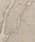
Map of the city of New York
….,
Peter
D. Henderson Plan
m
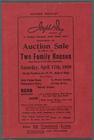
Auction Sale of thirty (30) T…
note:
West Farms Road, St.
Peters
Avenue, Montgomery
Sesana und St.
Peter
.
… by Glebe Ave., St.
Peter
… Ave., St.
Peter
's St.]
m
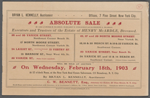
Absolute Sale by order of
Peter
H
m
Map[s] to accompany report "T…
m
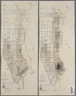
Map of the borough of Manhatt…
Karta Sibiri P.I. Godunova 16…
Kopiia s karty Sibiri P.I. Go…
A map of the county of Worces…
note:
Appears in :
Peter
Whitney's history
Map of Alaska
Explorations in Alaska, 1898 …
note:
…"W.J.
Peters
Alaska Peninsula and Aleutian…
Alaska Peninsula and Aleutian…
Map of the Albemarle and Ches…
Trade of the United States wi…
note:
…"The Norris
Peters
Co. Photo-Litho
m
Map of Lake Champlain, Fifth …
note:
… Champlain to Lake St.
Peter
The Hawaiian Islands: compile…
note:
…"The Norris
Peters
Co., photo-litho
Map of the city of Washington…
Map of the city of Washington…
Map of the city of Washington…
Map of the city of Washington…
Map of the city of Washington…
Map of the city of Washington…
Map of the city of Washington…
Pas-caart van de Suyd-Rivier …
note:
… copy by David
Peter
De
Kauai government survey, 1878
Map of Teller Reindeer Statio…
Map of Wilmington Harbor, Cal…
Hawaiian or Sandwich Islands
Part of the city of Honolulu,…
Map of Honolulu
m
Geological map of Pennsylvani…
Modification in the pierhead…
m
Bird's eye view of Chicago, 1…
note:
…"Copyright, 1892, by
Peter
Roy, Chicago, Ill."…
General map of the island of …
Oahu, Hawaiian Islands: repro…
Map of Hawaii
City of Washington
Detroit 1820
note:
Peter
B. Porter, Anthony Barclay
m
Map of the river Sainte Mary …
note:
Peter
B. Porter, Anthony Barclay
A map of Zambesia
Map of the city of Washington…
Map of the city of Washington…
m
Niagara 1819
note:
…"
Peter
B. Porter, Anthony Barclay
m
Map of the St. Clair River : …
note:
Peter
B. Porter, Anthony Barclay
Lake St. Clair
note:
Peter
B. Porter, Anthony Barclay
The second section of the sur…
note:
Peter
B. Porter, Anthony Barclay
1
2
Previous
Next
1
2
Previous
Next