Click to visit the main New York Public Library Homepage
The New York Public Library
Digital Collections
About Digital Collections
Browse
Search only public domain materials
Items
Collections
Divisions
Home
Search
Browse
About
Search only public domain materials
Items
Collections
Divisions
Digital Collections
Using Images
Using Data
Search
Filtered keyword search
Show filters
Hide filters
Show Only Public Domain
topic
Real property
386
Nautical charts
76
Railroads
67
Administrative and political divisions
46
Landowners
46
More
Less
name
Pidgeon, R. H. (Roger H.)
364
E. Robinson Co
312
Robinson, E. (Elisha)
263
United States Coast Survey
67
Bache, A. D. (Alexander Dallas), 1806-1867
61
More
Less
collection
Atlases of New York City
304
Atlases of the United States
223
Maps of New York City and State
196
Maps of North America
175
Lawrence H. Slaughter Collection of English maps, charts, globes, books and atlases
15
More
Less
place
New York (State)
465
New York (N.Y.)
313
New York
249
New Jersey
109
Brooklyn (New York, N.Y.)
72
More
Less
genre
Maps
936
Atlases
223
Nautical charts
60
Cadastral maps
33
Bathymetric maps
30
More
Less
publisher
E. Robinson Co
264
E. Robinson
49
J.M. Lathrop & Company
37
Bien, Joseph R
35
I.B. Culver & Co
32
More
Less
division
Map Division
923
Schomburg Jean Blackwell Hutson Research and Reference Division
6
Wallach Division: Print Collection
6
General Research Division
4
Milstein Division
2
More
Less
type
x
cartographic
text
13
still image
9
Date Range
to
945 results found for:
x
R. N
Filtering on:
x
Type
: cartographic
Sort by:
Relevance
Title
Date created
Date digitized
Sequence
m
Nuevo mapa topográfico de la …
note:
…ʹ/
N
18°39ʹ--
N
17°43ʹ).
…, Saratoga. Co.,
N
.Y
collection:
…, Saratoga. Co.,
N
A new map of Africa from the …
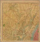
Map of the borough of Brookly…
note:
… 74°02ʹ18ʺ--W 73°52ʹ13ʺ/
N
40°44ʹ24ʺ--
N
40°33ʹ59ʺ).
Map of New York City and vici…
note:
… 73°42ʹ00ʺ/
N
40°54ʹ58ʺ--
N
The Cord Meyer Development Co…
note:
… 73°47ʹ17ʺ/
N
40°50ʹ48ʺ--
N
m
Petersen's map of Brooklyn
note:
…"A.
R
. Ohman Map Co. Map Publishers
Tracts and farms with street …
note:
…"Plate 10...
R
.D. 360."…
Rosedale Square, Rosedale : 4…
note:
Shows area south of Rosedale L.I.
R.R
. station.
Birdseye view of greater New …
note:
Shows L.I.
R.R
. railroad and Jamaica Bay
m
Map showing 100 miles around …
note:
…,
N
.Y."…
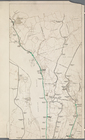
Railroad suburbs between Holl…
note:
…ʹ27ʺ--W 73°38ʹ16ʺ/
N
40°45ʹ13ʺ--
N
40°42ʹ20ʺ).
Hollis Terrace addition no. 1…
note:
… of L.I.
R.R
. line.
Map of the borough of Brookly…
note:
A.
R
. Ohman ; H.B. Petersen.
m
Map showing 50 miles around N…
note:
…ʹ/
N
41°24ʹ--
N
39°59ʹ).
m
View of the city of New York …
note:
August
R
. Ohman, map publisher
Freight terminal map of New Y…
collection:
… and Hartford
R.R
. Company
Center of New York, first cit…
note:
… 73°55ʹ31ʺ/
N
40°49ʹ28ʺ--
N
Sketch map of the city of New…
note:
…ʹ29ʺ/
N
40°54ʹ36ʺ--
N
m
… of Westchester County
N
.Y. …
note:
… 73°43ʹ09ʺ/
N
40°59ʹ58ʺ--
N
m
Map of the underground railwa…
note:
… York Central
R.R
.
m
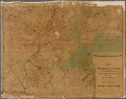
Map of the Passaic and Croton…
note:
… 73°36ʹ31ʺ/
N
41°19ʹ11ʺ--
N
m
Map of the metropolitan distr…
note:
… 73°42ʹ00ʺ/
N
40°54ʹ58ʺ--
N
Map of the borough of Manhatt…
m
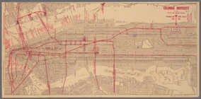
Columbia University in the Ci…
note:
… 74°01ʹ19ʺ--W 73°55ʹ11ʺ/
N
40°48ʹ45ʺ--
N
40°41ʹ42ʺ).
Map of New York City and vici…
note:
… 73°42ʹ00ʺ/
N
40°54ʹ58ʺ--
N
m
N
.Y.C. & H.
R
.
R
.
R
. Electric Zone - New York
collection:
N
.Y.C. & H.
R.R.R
. Electric Zone - New York
Upper Manhattan, comprising t…
The lower end of Manhattan Is…
The southeastern part of the …
The southwestern part of the …
The northwesterly part of the…
The district of Pelham Neck, …
Southeastern part of the boro…
Werpoes, a village of the Man…
Yorkville and East Harlem in …
Southern part of the borough …
The Long Island City and Newt…
Greater New York and contigou…
m
Map of Long Island and the so…
note:
…ʹ/
N
41°27ʹ--
N
40°31ʹ).
m
… County,
N
.Y.
note:
…ʹ/
N
40°56ʹ--
N
40°47ʹ)…
m
Map of Ulster County, New York
note:
…ʹ/
N
42°10ʹ--
N
41°34ʹ)…
Map of the rail roads of the …
note:
…ʹ/
N
45°42ʹ--
N
40°19ʹ).
… the location of the
N
.Y. & Oswego Midland
R
.
R
note:
… 80°20ʹ--W 71°20ʹ/
N
45°42ʹ--
N
40°19ʹ).
Map no. IV, Laos airfields
note:
… 100°01ʹ--E 108°22ʹ/
N
23°35ʹ--
N
14°00ʹ).
H Diagram of the state of Mis…
note:
… 95°46ʹ--W 89°05ʹ/
N
40°36ʹ--
N
35°59ʹ).
Map of the Rhode Island state…
note:
… 71°29ʹ--W 71°25ʹ/
N
41°47ʹ--
N
41°43ʹ).
Map of Conanicut Island, oppo…
note:
…ʹ/
N
41°34ʹ--
N
41°27ʹ).
Map showing the distribution …
note:
…ʹ/
N
41°20ʹ--
N
39°00ʹ).
Map of the boundary line betw…
note:
…ʹ/
N
40°44ʹ--
N
40°28ʹ).
1
2
3
4
Previous
Next
1
2
3
4
Previous
Next