Click to visit the main New York Public Library Homepage
The New York Public Library
Digital Collections
About Digital Collections
Browse
Search only public domain materials
Items
Collections
Divisions
Home
Search
Browse
About
Search only public domain materials
Items
Collections
Divisions
Digital Collections
Using Images
Using Data
Search
Filtered keyword search
Show filters
Hide filters
Show Only Public Domain
topic
Nautical charts
12
Navigation
3
Administrative and political divisions
2
Harbors
2
Coasts
1
More
Less
name
Bache, A. D. (Alexander Dallas), 1806-1867
12
United States Coast Survey
12
Adams, I. Hull
4
Blunt, Edmund M. (Edmund March), 1770-1862
4
McClery, M. I
4
More
Less
collection
Maps of North America
16
Lawrence H. Slaughter Collection of English maps, charts, globes, books and atlases
2
Maps of New York City and State
2
Atlases of New York City
1
Henry David Thoreau collection
1
More
Less
place
Atlantic Ocean
3
Virginia
3
Washington (D.C.)
3
California
2
Florida
2
More
Less
genre
Maps
24
Nautical charts
9
Bathymetric maps
4
Drawings
1
Manuscripts
1
More
Less
publisher
U.S. Coast Survey Office
5
United States Coast Survey
3
General Land Office
2
The Survey
2
Coast Survey Office
1
More
Less
division
Map Division
22
Berg Collection
1
Wallach Division: Print Collection
1
type
x
cartographic
text
1
Date Range
to
24 results found for:
x
W. I. M
Filtering on:
x
Type
: cartographic
Sort by:
Relevance
Title
Date created
Date digitized
Sequence
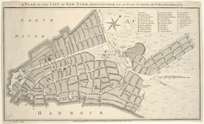
A plan of the city of New-Yor…
collection:
I
. N. Phelps Stokes Collection of American
Biloxi Bay, Mississippi : fro…
use:
Release Source File for Free (
i
.e., high-res
… Avenue, Avenue
M
use:
Release Source File for Free (
i
.e., high-res
Chart of the Atlantic Ocean, …
use:
Release Source File for Free (
i
.e., high-res
Harbor of Refuge, Dutch Islan…
use:
Release Source File for Free (
i
.e., high-res
Key West Harbor and its appro…
use:
Release Source File for Free (
i
.e., high-res
Little Egg Harbor
use:
Release Source File for Free (
i
.e., high-res
Little Egg Harbor
use:
Release Source File for Free (
i
.e., high-res
Long Island Sound (western sh…
use:
Release Source File for Free (
i
.e., high-res
Map of the city of Washington
use:
Release Source File for Free (
i
.e., high-res
Map of the city of Washington…
use:
Release Source File for Free (
i
.e., high-res
Map of the country thirty mil…
use:
Release Source File for Free (
i
.e., high-res
Map of the state of Kansas
use:
Release Source File for Free (
i
.e., high-res
Map of Virginia, Maryland and…
use:
Release Source File for Free (
i
.e., high-res
Part of United States west of…
use:
Release Source File for Free (
i
.e., high-res
Preliminary chart of Kennebec…
use:
Release Source File for Free (
i
.e., high-res
Preliminary chart of Mount Ho…
use:
Release Source File for Free (
i
.e., high-res
Preliminary chart of Rappahan…
use:
Release Source File for Free (
i
.e., high-res
Preliminary survey of Humbold…
use:
Release Source File for Free (
i
.e., high-res
Rappahannock River, Virginia …
use:
Release Source File for Free (
i
.e., high-res
Reconnaissance of the harbors…
use:
Release Source File for Free (
i
.e., high-res
State of Florida: compiled fr…
use:
Release Source File for Free (
i
.e., high-res
m
Walden Pond. A reduced plan. …
note:
W
. T. H. Howe.
Washington city
use:
Release Source File for Free (
i
.e., high-res
End of results
|
Top