Click to visit the main New York Public Library Homepage
The New York Public Library
Digital Collections
About Digital Collections
Browse
Search only public domain materials
Items
Collections
Divisions
Home
Search
Browse
About
Search only public domain materials
Items
Collections
Divisions
Digital Collections
Using Images
Using Data
Search
Filtered keyword search
Show filters
Hide filters
Show Only Public Domain
topic
Real property
468
Fire insurance
227
Cities & towns
225
Landowners
60
Administrative and political divisions
55
More
Less
name
Sanborn Map Company
225
Ullitz, Hugo
86
E.B. Hyde & Co
82
Beers, F. W. (Frederick W.)
73
E. Belcher Hyde Map Company
73
More
Less
collection
Atlases of New York City
452
Maps of North America
180
Maps of New York City and State
162
Atlases of the United States
82
Lawrence H. Slaughter Collection of English maps, charts, globes, books and atlases
46
More
Less
place
New York (State)
498
New York
159
New York (N.Y.)
137
Brooklyn (New York, N.Y.)
115
Manhattan (New York, N.Y.)
89
More
Less
genre
Maps
995
Atlases
78
Surveys
59
Manuscript maps
41
Cadastral maps
32
More
Less
publisher
Sanborn Map Company
226
E. Belcher Hyde
78
F. W. Beers, A. D. Ellis & others
48
G.W. Bromley & Co
37
Beers, Ellis & Soule
23
More
Less
division
Map Division
928
Manuscripts and Archives Division
34
General Research Division
8
Wallach Division: Print Collection
8
Rare Book Division
7
More
Less
type
x
cartographic
text
24
still image
13
Date Range
to
997 results found for:
x
14
Filtering on:
x
Type
: cartographic
Sort by:
Relevance
Title
Date created
Date digitized
Sequence
Results 501 - 550
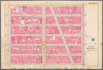
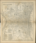
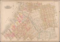
Plate 4: West Broadway, Canal…
collection:
Part of Wards 5, 6, 8 &
14
, New York
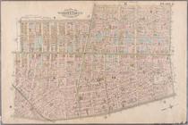
Plate 5: Map of New York and …
note:
… and West Farms, and #
14
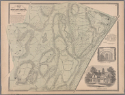
Plate 17: Map of the Woodlawn…
note:
… and West Farms, and #
14
Plate 24: Northern part of To…
note:
… and West Farms, and #
14
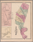
Plate 49: Town of North Castl…
note:
… and West Farms, and #
14
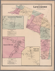
Plate 57: Town of Lewisboro, …
note:
… and West Farms, and #
14
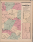
Plate 61: Town of Yorktown, W…
note:
… and West Farms, and #
14
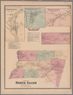
Plate 63: Town of North Salem…
note:
… and West Farms, and #
14
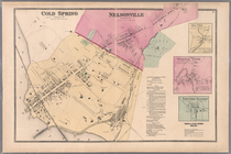
Plate 67: Cold Spring - Nelso…
note:
… and West Farms, and #
14
Plate 70: Patterson, Town of …
note:
… and West Farms, and #
14
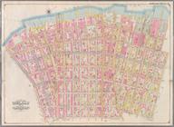
Bounded by Fountain Avenue, V…
collection:
….
14
. Volume 1
Bounded by Barbey Street, Van…
collection:
….
14
. Volume 1
Plate
14
: [Bounded by Sheridan Ave., Elliott Ave
Double Page Plate No.
14
, Part of Ward
m
Plate
14
, Part of Section 3: [Bounded by W
Plate
14
, Part of Ward 1 [Map bound by N
Queens, Vol. 2, Double Page Plate No.
14
The Hudson by daylight map fr…
Brooklyn, Vol. 4, Double Page Plate No.
14
…; Sections
14
; …
…; Sections
14
; …
Brooklyn, Vol. 6, Double Page Plate No.
14
Brooklyn, Vol. 7, Double Page Plate No.
14
Map of the country thirty thr…
note:
Scale 1:205,920; 3
1/4
miles to the inch
Map of the United States of A…
… No.
14
[Map bounded
… No.
14
[Map bounded
Jersey City, V. 1, Double Page Plate No.
14
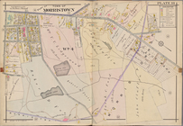
Morris County, Double Page Plate No.
14
Height Zoning Map Section No.
14
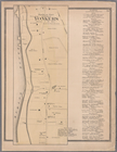
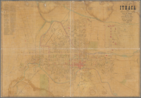
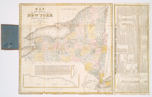
Map of City of Ithaca, N.Y.: …
note:
… distances in
1/4
mile
m
Map of the states of North Ca…
Preliminary chart of Nantucke…
note:
… in 1853
1/4
, assistants
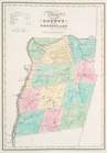
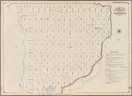
Map of the County of Renssela…
Map of the County of Renssela…
m
The Union News Company's new …
first:
cf4aa230-8687-0135-07c
1-4
dd0a91a84b1
Map of the country thirty-thr…
note:
… 1:205,920. 3
1/4
miles
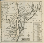
Map of Virginia and Maryland,…
City of New York.
Carta particolare della Virgi…
note:
….
14
.
Tierra nveva.
note:
NYPL copy has ms. "
14
" in ink in upper
The tourist's map of the stat…
parent:
bc2aa250-c5a6-012f-d
14
c-58d385a7bc34
Map of Pennsylvania, New Jers…
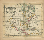
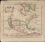
North America
Nouvelle carte de la Pensylva…
Philadelphia and environs.
North America
Plate 11: [Bounded by Noble S…
collection:
Plate 11: Part of Wards
14
, 15 & 17
Bounded by (East River Piers)…
collection:
Part of Wards 13 &
14
. Land Map Section
Bounded by Dumont Avenue, Sap…
collection:
….
14
. Volume 1
1
2
3
4
Previous
Next
1
2
3
4
Previous
Next