Click to visit the main New York Public Library Homepage
The New York Public Library
Digital Collections
About Digital Collections
Browse
Search only public domain materials
Items
Collections
Divisions
Home
Search
Browse
About
Search only public domain materials
Items
Collections
Divisions
Digital Collections
Using Images
Using Data
Search
Filtered keyword search
Show filters
Hide filters
Show Only Public Domain
topic
Real property
174
Nautical charts
56
History
46
Landowners
46
Administrative and political divisions
43
More
Less
name
Fairchild Aerial Camera Corporation
127
New York (N.Y.). Bureau of Engineering
127
Tuttle, Arthur S. (Arthur Smith), 1865-1949
127
Beers, F. W. (Frederick W.)
80
United States Coast Survey
53
More
Less
collection
Atlases of New York City
234
Maps of North America
190
Maps of New York City and State
112
Atlases of the United States
107
I. N. Phelps Stokes Collection of American Historical Prints
34
More
Less
place
New York (N.Y.)
218
New York (State)
200
New York Metropolitan Area
56
Westchester County (N.Y.)
52
Manhattan (New York, N.Y.)
46
More
Less
genre
Maps
768
Atlases
109
Prints
51
Nautical charts
40
Illustrations
33
More
Less
publisher
F. W. Beers, A. D. Ellis & others
48
Published by F. W. Beers, A. D. Ellis & G. G. Soule
30
U.S. Coast Survey
27
D. H. Burr
26
publisher not identified
19
More
Less
division
Map Division
676
Wallach Division: Print Collection
37
Schomburg Manuscripts, Archives and Rare Books Division
30
Schomburg Jean Blackwell Hutson Research and Reference Division
20
General Research Division
8
More
Less
type
x
cartographic
still image
19
text
15
Date Range
to
786 results found for:
x
A. B
Filtering on:
x
Type
: cartographic
Sort by:
Relevance
Title
Date created
Date digitized
Sequence
Results 751 - 786
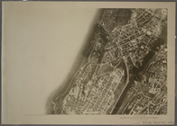
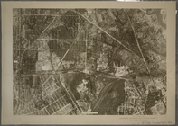
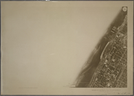
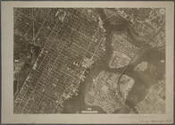
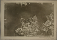
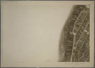
3A - N.Y. City (Aerial Set).
parent:
dc012930-c604-012f-4d79-58d385
a
7bc34
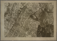
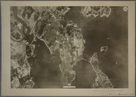
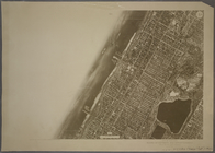
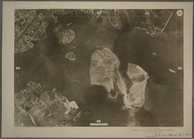
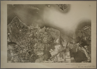
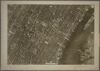
3B - N.Y. City (Aerial Set).
parent:
dc4
b
1e40-c604-012f-
a
6ee-58d385
a
7bc34
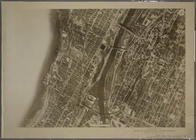
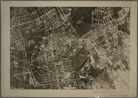
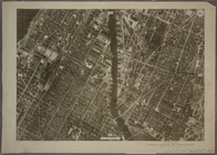
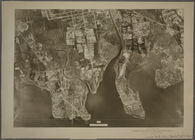
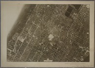
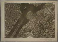
3C - N.Y. City (Aerial Set).
parent:
dc83fbe0-c604-012f-c66c-58d385
a
7bc34
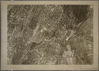
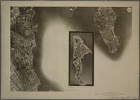
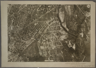
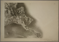
3D - N.Y. City (Aerial Set).
parent:
dccc77
b
0-c604-012f-28
b
2-58d385
a
7bc34
4A - N.Y. City (Aerial Set).
parent:
dd062550-c604-012f-dca8-58d385
a
7bc34
4B - N.Y. City (Aerial Set).
parent:
dd4c2910-c604-012f-5fa5-58d385
a
7bc34
4C - N.Y. City (Aerial Set).
parent:
dd850f00-c604-012f-da90-58d385
a
7bc34
4D - N.Y. City (Aerial Set).
parent:
ddd05de0-c604-012f-
a
082-58d385
a
7bc34
5B - N.Y. City (Aerial Set).
parent:
de0d1830-c604-012f-5d0c-58d385
a
7bc34
5D - N.Y. City (Aerial Set).
parent:
de55ec70-c604-012f-73bd-58d385
a
7bc34
6A - N.Y. City (Aerial Set).
parent:
de986740-c604-012f-745f-58d385
a
7bc34
6B - N.Y. City (Aerial Set).
parent:
decbe180-c604-012f-ea25-58d385
a
7bc34
6C - N.Y. City (Aerial Set).
parent:
df138720-c604-012f-ef04-58d385
a
7bc34
6D - N.Y. City (Aerial Set).
parent:
df4c7
a
00-c604-012f-6181-58d385
a
7bc34
7A - N.Y. City (Aerial Set).
parent:
df983260-c604-012f-9dc8-58d385
a
7bc34
7B - N.Y. City (Aerial Set).
parent:
dfcfd5
b
0-c604-012f-9
a
70-58d385
a
7bc34
7C - N.Y. City (Aerial Set).
parent:
e01ac070-c604-012f-73
a
6-58d385
a
7bc34
7D - N.Y. City (Aerial Set).
parent:
e05778c0-c604-012f-fc97-58d385
a
7bc34
8A - N.Y. City (Aerial Set).
parent:
e09
a
86c0-c604-012f-90e7-58d385
a
7bc34
8B - N.Y. City (Aerial Set).
parent:
e0d591f0-c604-012f-00c6-58d385
a
7bc34
8C - N.Y. City (Aerial Set).
parent:
e121d660-c604-012f-3f3
a
-58d385
a
7bc34
8D - N.Y. City (Aerial Set).
parent:
e15f6
a
30-c604-012f-c911-58d385
a
7bc34
9A - N.Y. City (Aerial Set).
parent:
e1
b
1f2e0-c604-012f-53e8-58d385
a
7bc34
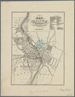
Map of the city of Rochester:…
parent:
039bfeb0-79
b
3-0133-9ff6-00505686d14e
The New York Mine : geologica…
parent:
f404d380-d446-012f-412
b
-58d385
a
7
b
928
Partie orientale du Canada ou…
parent:
a
5078ab0-c52
a
-012f-268c-3c075448cc4
b
…, (Incorporated April 14th
A
.D
parent:
e0f989f0-c5f6-012f-648f-58d385
a
7bc34
m
Map showing 50 miles around N…
parent:
d9434440-7551-0131-08d2-58d385
a
7
b
928
Smyth County, Va.
parent:
b
8e12c20-c52
a
-012f-11bb-3c075448cc4
b
Coast chart no. 10 Cape Cod B…
parent:
1c631620-5
b
2
a
-0134-d939-00505686
a
51c
Plan of the battle fought nea…
parent:
b
8e12c20-c52
a
-012f-11bb-3c075448cc4
b
Military topographical map of…
parent:
b
8e12c20-c52
a
-012f-11bb-3c075448cc4
b
Map of the boundary line betw…
parent:
b
8e12c20-c52
a
-012f-11bb-3c075448cc4
b
Harbor of Dubuque : [Iowa]
parent:
b
8e12c20-c52
a
-012f-11bb-3c075448cc4
b
Map of the battle fields of t…
parent:
b
8e12c20-c52
a
-012f-11bb-3c075448cc4
b
Beaufort River, S.C. : from B…
parent:
b
8e12c20-c52
a
-012f-11bb-3c075448cc4
b
1
2
3
4
Previous
Next
1
2
3
4
Previous
Next