Click to visit the main New York Public Library Homepage
The New York Public Library
Digital Collections
About Digital Collections
Browse
Search only public domain materials
Items
Collections
Divisions
Home
Search
Browse
About
Search only public domain materials
Items
Collections
Divisions
Digital Collections
Using Images
Using Data
Search
Filtered keyword search
Show filters
Hide filters
Show Only Public Domain
topic
Astronomy, 1681
52
Geography
52
Mathematics
52
Geology
17
Nautical charts
17
More
Less
name
Flamsteed, John, 1646-1719
52
Godbid, A
52
Hanway, William
52
Moore, Jonas, Sir, 1617-1679
52
Perkins, Peter, -1680
52
More
Less
collection
Maps of North America
114
Lawrence H. Slaughter Collection of English maps, charts, globes, books and atlases
69
Bancker plans
39
Maps of New York City and State
34
Atlases of the United States
7
More
Less
place
Pennsylvania
30
New York (State)
27
New York (N.Y.)
22
Virginia
16
Washington (D.C.)
14
More
Less
genre
Maps
282
Surveys
39
land surveys
36
Nautical charts
11
Cadastral maps
10
More
Less
publisher
Printed by A. Godbid and J. Playford, for R. Scott, bookseller
52
Geological Survey of Pennsylvania
13
publisher not identified
11
Government Printing Office
7
Second Geological Survey of Pennsylvania
7
More
Less
division
Map Division
233
Manuscripts and Archives Division
40
Wallach Division: Print Collection
8
General Research Division
2
Schomburg Jean Blackwell Hutson Research and Reference Division
1
type
x
cartographic
text
6
still image
3
Date Range
to
284 results found for:
x
Peters
Filtering on:
x
Type
: cartographic
Sort by:
Relevance
Title
Date created
Date digitized
Sequence
Results 251 - 284
Long Island Sound from New Yo…
note:
… / by
Peter
J. Guthorn. 1984
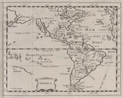
America.
Map of Beaver County showing …
General map of the anthracite…
Map of the Shenandoah Valley …
m
Plan of a survey for a rail-r…
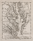
Carte de la Virginie et du Ma…
Virginia.
Plate 9: Map No. 641, old No.…
note:
… of the property known as the
Peter
m
Map of Ulster County, New York
Geological and topographical …
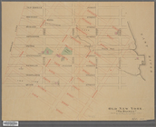
Old New York, "The Bouwery": …
abstract:
… residence of
Peter
G
General map of the anthracite…
Geological map of the environ…
A plan of the city of New-Yor…
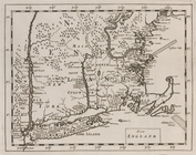
New England.
Preliminary chart of Portland…
m
A map of Schuylkill County, P…
Second Geological Survey of P…
Preliminary chart of Monomoy …
Topographical map in ten-foot…
Second Geological Survey of P…
Reconnaissance of the western…
Preliminary survey of harbors…
Preliminary chart of Muskeget…
Preliminary chart of lower pa…
Reconnaissance of the western…
Preliminary chart of entrance…
[S]econd Geolo[gical Survey o…
A series of columnar sections…
Preliminary chart of Frying P…
Preliminary chart of Beaufort…
Second Geological Survey of P…
Map of the mines of the Panth…
1
2
Previous
Next
1
2
Previous
Next