Click to visit the main New York Public Library Homepage
The New York Public Library
Digital Collections
About Digital Collections
Browse
Search only public domain materials
Items
Collections
Divisions
Home
Search
Browse
About
Search only public domain materials
Items
Collections
Divisions
Digital Collections
Using Images
Using Data
Search
Filtered keyword search
Show filters
Hide filters
Show Only Public Domain
topic
Real property
298
Administrative and political divisions
178
Nautical charts
127
History
121
Railroads
112
More
Less
name
E.B. Hyde & Co
204
United States Coast Survey
139
Bache, A. D. (Alexander Dallas), 1806-1867
121
Hyde, Merritt B
118
Ullitz, Hugo
86
More
Less
collection
Maps of North America
846
Atlases of New York City
247
Atlases of the United States
177
Maps of New York City and State
70
Lawrence H. Slaughter Collection of English maps, charts, globes, books and atlases
40
More
Less
place
New York (State)
270
New York
159
Virginia
142
Pennsylvania
139
Suffolk County (N.Y.)
121
More
Less
genre
Maps
1453
Atlases
177
Nautical charts
117
Bathymetric maps
90
Cadastral maps
86
More
Less
publisher
E. Belcher Hyde
191
publisher not identified
92
U.S. Coast Survey
76
Sanborn Map Company
51
U.S. Coast Survey Office
42
More
Less
division
Map Division
1398
Manuscripts and Archives Division
24
Rare Book Division
10
Wallach Division: Print Collection
7
Schomburg Jean Blackwell Hutson Research and Reference Division
5
More
Less
type
x
cartographic
still image
44
text
33
Date Range
to
1,455 results found for:
x
17
Filtering on:
x
Type
: cartographic
Sort by:
Relevance
Title
Date created
Date digitized
Sequence
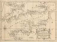
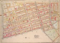
A chart of the English Channe…
The Jeannette ; Lost In the I…
abstract:
… expeditions from Oct.
17
, 1868
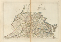
A correct map of Virginia
note:
In upper right corner:
17
.
…, Double Page Plate No.
17
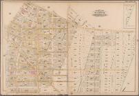
; Part of Wards 15,
17
… 16 et
17
Siecles.
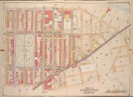
Geer's map of the city of Har…
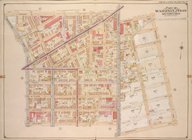
Map bounded by Bainbridge St.…
note:
v. 1 Sections
1-7
-- v. 2 Sections 8-l4
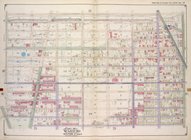
Map bounded by Pacific St., S…
note:
v. 1 Sections
1-7
-- v. 2 Sections 8-l4
Map of the New York world's f…
note:
Size:
17
X 22 1/4 inches.
Complete map of the cities of…
Map bounded by Fulton St., Ro…
note:
v. 1 Sections
1-7
-- v. 2 Sections 8-l4
Map bounded by Dean St., Roch…
note:
v. 1 Sections
1-7
-- v. 2 Sections 8-l4
Plate
17
: Bounded by 21st Street, Gravesend
collection:
Plate
17
: Bounded by 21st Street
Plate
17
: [Bounded by Flushing Avenue
m
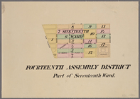
Maps of the 14, 15, 16,
17
, 20, 21
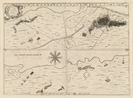
A Danish Iron Mine
note:
Dobson
17
; Paulson 41; Tilden II:56a
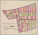
6th Senatorial District 10, 11,
17
Wards
Ville de Manathe ou Nouvelle-…
Plate 16: Map No.
17
[Bounded by Third
note:
Map No.
17
: Map of Port Morris, locatd
…, Double Page Plate No.
17
New pocket map of Boston prop…
note:
….,
17
Milk St., Boston."…
Carte nouvelle de l'Amerique …
note:
… right corner:
17
.
Carte de l'Europe et de l'Asi…
…; Part of Wards 15 &
17
…; Part of Ward
17
…; Part of Ward
17
…; Part of Ward
17
…; Part of Ward
17
Sketch of the Battle of Bunke…
note:
… of Bunker Hill on June
17
m
Wright's map of Kansas City, …
Bounded by Flushing Avenue, P…
collection:
Plate
17
Bounded by Malbone Street, Ki…
collection:
Plate
17
Map (figure
17
)…
Plate
17
: Map bounded by Atlantic Street
Map or Plan of Section
17
. [Bounded
…. Wards 13, 14, 15, 16,
17
first:
670dba69-1d
17
-448e-e040-e00a18063311
…; Part of Wards 14 &
17
…; Part of Ward
17
…; Part of Ward
17
& 18
…, Double Page Plate No.
17
Rand, McNally & Co.'s new sec…
abstract:
… (
17
cm
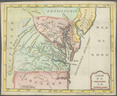
Carte de la Virginie et du Ma…
Height District Map Section No.
17
Use District Map Section No.
17
Lake George, Fort Ticonderoga…
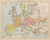
Europe im
17
. und 18. Jahrhundert (1740)…
m
Faust's map of city and count…
Plate
17
Plate
17
, Part of Section 2
Countries adjacent to the Med…
1
2
3
4
5
6
Previous
Next
1
2
3
4
5
6
Previous
Next