Click to visit the main New York Public Library Homepage
The New York Public Library
Digital Collections
About Digital Collections
Browse
Search only public domain materials
Items
Collections
Divisions
Home
Search
Browse
About
Search only public domain materials
Items
Collections
Divisions
Digital Collections
Using Images
Using Data
Search
Filtered keyword search
Show filters
Hide filters
Show Only Public Domain
topic
Nautical charts
102
Real property
95
Landowners
53
Maps in education
40
Geography, Ancient
39
More
Less
name
United States Coast Survey
110
Bache, A. D. (Alexander Dallas), 1806-1867
91
Burr, David H., 1803-1875
78
Rawdon, Clark & Co
76
Rawdon, Wright & Co
75
More
Less
collection
Maps of North America
239
Lawrence H. Slaughter Collection of English maps, charts, globes, books and atlases
131
Atlases of the United States
102
Maps of New York City and State
39
John H. Levine Collection
11
More
Less
place
New York (State)
106
New York (N.Y.)
86
Maps
56
United States
54
England
39
More
Less
genre
Maps
539
Atlases
102
Nautical charts
77
Bathymetric maps
39
Cadastral maps
19
More
Less
publisher
U.S. Coast Survey
49
Printed at the Theater,
38
U.S. Coast Survey Office
33
D. H. Burr
26
Stone and Clark,
26
More
Less
division
Map Division
529
General Research Division
5
Rare Book Division
4
Wallach Division: Print Collection
3
Dorot Jewish Division
2
More
Less
type
x
cartographic
still image
14
text
4
Date Range
to
546 results found for:
x
A. D. H
Filtering on:
x
Type
: cartographic
Sort by:
Relevance
Title
Date created
Date digitized
Sequence
Itinéraire, de Karak a Chauba…
parent:
d
089c2
d
0-c6e4-012f-4b7b-58
d
385
a
7bc34
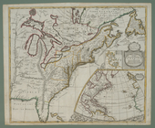
Map of the states of Ohio Ind…
parent:
a
8799910-dd0e-0135-08
d
3-63189acbf5ed
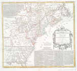
A new map of the English empi…
parent:
4599f790-c6f0-012f-4
d
63-3c075448cc4b
A new map of the English empi…
parent:
35dd0bc0-c5
d
5-012f-6853-58
d
385
a
7bc34
m
Hill, Daniel Harvey
parent:
c226f640-b0eb-0133-435e-00505686
d
14e
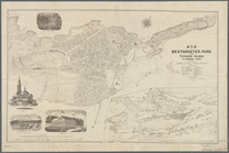
Map of Westminster Park of th…
parent:
72636b50-2
a
8
d
-0134-0b82-00505686
a
51c
Réduction des cartes du cours…
parent:
b57684
d
0-c6e4-012f-
d
775-58
d
385
a
7bc34
m
Servoss' Sectional road map o…
parent:
05
d
79b70-2de3-0131-6ad8-58
d
385
a
7b928
…. Hopkins. ;
H
. P. Trull, M
parent:
b76042e0-c5f7-012f-2add-58
d
385
a
7bc34
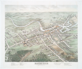
Bird's eye view of Rochester …
first:
510
d
47
d
9-7
d
96-
a
3
d
9-e040-e00
a
18064
a
99
The harbor of Annapolis
parent:
50539c10-c52b-012f-eb3
a
-3c075448cc4b
America Septentrionalis a Domino
d
'Anville
first:
510
d
47db-c315-
a
3
d
9-e040-e00
a
18064
a
99
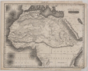
Northern and Central Africa
parent:
4
a
432080-ee88-0131-9e82-58
d
385
a
7b928
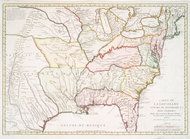
The United States, southern p…
parent:
d
7302580-8762-0134-cb96-00505686
a
51c
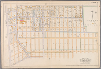
…, Avenue
D
, Rogers Street
parent:
aea73250-c604-012f-89
d
6-58
d
385
a
7bc34
… by Avenue
A
, Ocean Avenue
parent:
af2405f0-c604-012f-eb9c-58
d
385
a
7bc34
A new map of the north parts …
parent:
6267df40-c5
d
5-012f-1b55-58
d
385
a
7bc34
A general map of North Americ…
parent:
60b5cd60-c5
d
5-012f-35be-58
d
385
a
7bc34
Statistical profile of the Bl…
parent:
4e85
d
960-c5aa-012f-4042-58
d
385
a
7bc34
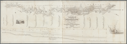
Sketch of part of the Black R…
parent:
2abc9210-
a
1
d
5-0133-3b35-00505686
d
14e
Sketch F showing the progress…
parent:
32958040-b143-0132-2eae-58
d
385
a
7bbd0
Preliminary chart of Cedar Ke…
parent:
32958040-b143-0132-2eae-58
d
385
a
7bbd0
The harbor of Annapolis
parent:
4ae5
a
4c0-c52b-012f-967
a
-3c075448cc4b
Preliminary chart of St. Mark…
parent:
32958040-b143-0132-2eae-58
d
385
a
7bbd0
Preliminary chart of the sea …
parent:
0b61aca0-
d
632-0132-f6cd-58
d
385
a
7b928
The ichnography of Charles-to…
parent:
323995b0-c5ed-012f-
d
6f9-58
d
385
a
7bc34
…, Avenue E, Avenue
D
and E
parent:
b4534410-c604-012f-25c6-58
d
385
a
7bc34
…, Avenue
D
, E. 106th Street
parent:
b5
a
62
d
70-c604-012f-0546-58
d
385
a
7bc34
Philadelphia and vicinity : P…
parent:
43
d
78210-c969-0135-afce-27ef828b31c7
Plan de l'Isle de Rodda, avec…
parent:
19ad3470-c6ba-012f-5340-58
d
385
a
7bc34
m
Servoss' Sectional road map o…
parent:
df5b5480-2de2-0131-fa79-58
d
385
a
7b928
Reconnaissance of the bar and…
parent:
32958040-b143-0132-2eae-58
d
385
a
7bbd0
Mouth of Chester River : (Har…
parent:
4ae5
a
4c0-c52b-012f-967
a
-3c075448cc4b
Preliminary chart of St. Andr…
parent:
32958040-b143-0132-2eae-58
d
385
a
7bbd0
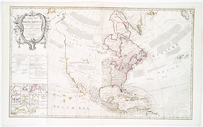
North America : according to …
parent:
7f095bb0-c5
d
4-012f-2e7
a
-58
d
385
a
7bc34
1. Grundriss des Ammontempels…
parent:
dd147300-c6dc-012f-32
a
4-58
d
385
a
7bc34
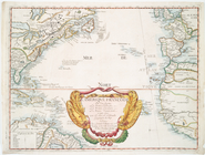
Chart of the Atlantic Ocean.
parent:
c8ad2fa0-c5
d
4-012f-6733-58
d
385
a
7bc34
A new generall chart for the …
parent:
82fa1b70-c5
d
3-012f-ac9f-58
d
385
a
7bc34
Preliminary sketch showing th…
parent:
bac116
a
0-b143-0132-83cb-58
d
385
a
7bbd0
North America from the French of Mr.
D
'Anville
parent:
396623f0-c5
d
4-012f-
a
04
d
-58
d
385
a
7bc34
A new map of ye north parts o…
parent:
4
a
644e70-c5
d
5-012f-470b-58
d
385
a
7bc34
L'Ameriqve françoise, ou son …
parent:
1b89eca0-c5
d
5-012f-019
d
-58
d
385
a
7bc34
Carte de la Louisiane cours d…
parent:
22f26c90-c5
d
5-012f-9ea7-58
d
385
a
7bc34
A new map of North America: w…
parent:
6cf9aea0-c5
d
5-012f-4
d
67-58
d
385
a
7bc34
Sketch F, showing the progres…
parent:
32958040-b143-0132-2eae-58
d
385
a
7bbd0
Mountain region of North Caro…
parent:
52
a
622
d
0-b144-0132-78c9-58
d
385
a
7bbd0
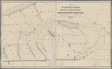
Map of the reservoirs, feeder…
parent:
7f3becb0-8b1c-0133-
d
8c4-00505686
a
51c
Mouth of Chester River : (Har…
parent:
4ae5
a
4c0-c52b-012f-967
a
-3c075448cc4b
Sketch of portions of seacoas…
parent:
5164edf0-423c-0135-4c80-07
d
7f418716
a
Norfolk harbor, Virginia : fr…
parent:
87229fd0-c52b-012f-390
d
-3c075448cc4b
1
2
3
Previous
Next
1
2
3
Previous
Next