Click to visit the main New York Public Library Homepage
The New York Public Library
Digital Collections
About Digital Collections
Browse
Search only public domain materials
Items
Collections
Divisions
Home
Search
Browse
About
Search only public domain materials
Items
Collections
Divisions
Digital Collections
Using Images
Using Data
Search
Filtered keyword search
Show filters
Hide filters
Show Only Public Domain
topic
Nautical charts
174
Harbors
38
Coasts
35
Real property
32
Navigation
26
More
Less
name
Bache, A. D. (Alexander Dallas), 1806-1867
209
United States Coast Survey
209
Mathiot, G
45
Maffitt, John Newland, 1819-1886
24
Bien, Julius, 1826-1909
22
More
Less
collection
Maps of North America
250
Atlases of New York City
18
Maps of New York City and State
17
Atlases of the United States
9
Lawrence H. Slaughter Collection of English maps, charts, globes, books and atlases
4
More
Less
place
New York (State)
37
Florida
28
Virginia
28
Massachusetts
27
California
23
More
Less
genre
Maps
316
Nautical charts
150
Bathymetric maps
76
Atlases
9
Surveys
8
More
Less
publisher
U.S. Coast Survey
108
U.S. Coast Survey Office
51
United States Coast Survey
18
Department of the Interior, General Land Office
10
Sanborn Map Company
9
More
Less
division
Map Division
303
General Research Division
7
Manuscripts and Archives Division
4
Rare Book Division
2
Schomburg Jean Blackwell Hutson Research and Reference Division
1
type
x
cartographic
still image
7
text
5
Date Range
to
317 results found for:
x
Alexander,
Filtering on:
x
Type
: cartographic
Sort by:
Relevance
Title
Date created
Date digitized
Sequence
… granted
Alexander
Macomb …
m
Petrovskai︠a︡ zhel. doroga : …
m
Obʺi︠a︡snitelʹnai︠a︡ zapiska …
m
Prilozhenīe 2-oe kʺ proektu s…
Alexander
( P.O
… C. Newton,
Alexander
m
Osnovnyi︠a︡ soobrazhenīi︠a︡ k…
… Riddle,
Alexander
Preliminary chart of Kennebec…
m
Alexander
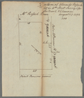
Hossock's lot in William Street
…, Atlantic Ocean,
Alexander
m
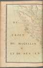
Detroit du Magellan et de ses…
Telegraph and rail road map o…
note:
… in the year 1854 by
Alexander
m
… of James
Alexander
)…
m
… of James
Alexander
, 1752)…
m
… of James
Alexander
)…
Oahu, Hawaiian Islands: repro…
note:
…"W.D.
Alexander
, Surveyor General."…
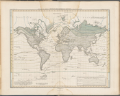
A Map of America between lati…
Map of the buildings and grou…
note:
…" by
Alexander
Sandier.
m
…
Alexander
)…
m
…, by order of James
Alexander
)…
m
… of James
Alexander
)…
General map of the island of …
note:
….
Alexander
Surveyor General.
m
Queen and Rutgers Street
note:
…, and
Alexander
Ogilvie
Plan Borodinskago srazheniia,…
Part of the city of Honolulu,…
note:
…] W.D.
Alexander
.
Map of South America, extendi…
Map of the country between Bu…
Sketch of Frying-Pan Shoals a…
Plan of the city of New Orlea…
Ethnographic map of the world…
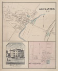
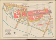
Bronx plat map,
Alexander
to Willow Avenues
Preliminary chart of St. John…
York River and Cape Neddick h…
Upper Nubia and Abyssinia
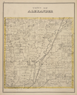
Town of
Alexander
[Township]
Metomkin Inlet, Virginia : fr…
Preliminary chart of Mount Ho…
Alexander
von Humboldt's System Der
Entrance to Columbia River, O…
Reconnaissance of Romerly Mar…
Preliminary chart of Portland…
Preliminary chart of Waccasas…
Plan of the cemetery of Mount…
… Street,
Alexander
Avenue
Patuxent River from Pt. Judit…
Preliminary chart of St. John…
Harbor of Refuge, Dutch Islan…
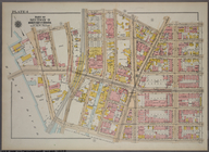
Double Page Plate No. 3, Part…
Plan of the cemetery of Mount…
1
2
Previous
Next
1
2
Previous
Next