Click to visit the main New York Public Library Homepage
The New York Public Library
Digital Collections
About Digital Collections
Browse
Search only public domain materials
Items
Collections
Divisions
Home
Search
Browse
About
Search only public domain materials
Items
Collections
Divisions
Digital Collections
Using Images
Using Data
Search
Filtered keyword search
Show filters
Hide filters
Show Only Public Domain
topic
Administrative and political divisions
3
Real property
3
Boundaries
2
Baptist associations
1
City planning
1
More
Less
name
A. Hoen & Co
5
Tanner, Henry Schenck, 1786-1858
5
Hopkins, Griffith Morgan, Jr
4
Mac Cormac, Walter S
4
E. Sachse & Co
3
More
Less
collection
Maps of North America
37
Atlases of the United States
3
I. N. Phelps Stokes Collection of American Historical Prints
2
Atlases, gazetteers, guidebooks and other books
1
Maps of New York City and State
1
More
Less
place
Baltimore (Md.)
27
Maryland
17
Baltimore
8
Anne Arundel County (Md.)
3
Baltimore Metropolitan Area (Md.)
3
More
Less
genre
Maps
45
Cadastral maps
5
Prints
2
Aerial views
1
Plans
1
publisher
G.M. Hopkins
4
A. Hoen & Co
2
Henry Schenck Tanner
2
John F. Weishampel, Jr
2
Maryland General Assembly
2
More
Less
division
Map Division
42
Wallach Division: Print Collection
2
General Research Division
1
type
x
cartographic
still image
3
Date Range
to
45 results found for:
x
Baltimore (Md.)
Filtering on:
x
Type
: cartographic
Sort by:
Relevance
Title
Date created
Date digitized
Sequence
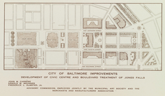
City of
Baltimore
improvements, proposed civic
Map of the City of
Baltimore
abstract:
… to The Sun,
Baltimore
, April
Map of Mount Vernon Place,
Baltimore
m
Rippey's index map of
Baltimore
Md
. 1888
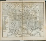
Map of the City of
Baltimore
and suburbs
Baltimore
and its neighborhood
Plan of
Baltimore
.
note:
… of
Baltimore
.
Plan of the town of
Baltimore
and it's environs
note:
Print is dedicated to the citizens of
Baltimore
.
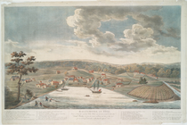
m
Baltimore
in 1752
Revised design for the improv…
note:
…"Lith. by A. Hoen & Co.
Baltimore
."…
m
Map of
Baltimore
abstract:
… of
Baltimore
.
Baltimore
in 1889
m
Map of
Baltimore
, 1891 …
Map of
Baltimore
abstract:
…. Inset: Map of
Baltimore
City of
Baltimore
Improved plan of the city of
Baltimore
.
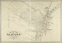
Map of Albany, New York
Map of Maryland: showing the …
Baltimore
.
Baltimore
.
Baltimore
m
Map of
Baltimore
…
Plan of the town of
Baltimore
and it's [sic
note:
… to the citizens of
Baltimore
.
New and enlarged map of
Baltimore
city
abstract:
… location of
Baltimore
Baltimore
.
m
This plan of the city of
Baltimore
abstract:
… of
Baltimore
taken from
This plan of the city of
Baltimore
abstract:
… of
Baltimore
taken from
New and enlarged map of
Baltimore
city …
abstract:
… location of
Baltimore
A new map of Maryland and Del…
note:
Inset map:
Baltimore
[scale ca
m
New map of that portion of No…
m
Charleston District, South Ca…
Map shewing the position of t…
… miles around
Baltimore
note:
…
Baltimore
."…
Baltimore
, Annapolis, and adjacent
Baltimore
, Annapolis, and adjacent
Baltimore
, Annapolis, and adjacent
Noua Terrae-Mariae tabula
abstract:
…
Baltimore
's map
… in Alleghany County,
Md
.
Lord Balitmore's own plan : p…
note:
…
Baltimore
's own plan, annext
Principal cities of the Unite…
Principal cities of the Unite…
City of Annapolis
note:
…
Baltimore
."…
Eighth District Anne Arundel …
note:
…
Baltimore
."…
First District Anne Arundel C…
note:
…
Baltimore
."…
Patapsco River and the approa…
abstract:
… to
Baltimore
Harbor from
End of results
|
Top