Click to visit the main New York Public Library Homepage
The New York Public Library
Digital Collections
About Digital Collections
Browse
Search only public domain materials
Items
Collections
Divisions
Home
Search
Browse
About
Search only public domain materials
Items
Collections
Divisions
Digital Collections
Using Images
Using Data
Search
Filtered keyword search
Show filters
Hide filters
Show Only Public Domain
topic
Real property
33
Fire insurance
22
Cities & towns
19
Administrative and political divisions
10
Landowners
8
More
Less
name
Sanborn Map Company
22
Tanner, Henry Schenck, 1786-1858
9
E. Robinson Co
8
Bourquin, F. (Frederick), 1808-
6
Darby, William, 1775-1854
5
More
Less
collection
Atlases of New York City
37
Maps of North America
18
Atlases of the United States
8
Maps of New York City and State
7
Lawrence H. Slaughter Collection of English maps, charts, globes, books and atlases
5
More
Less
place
New York (State)
33
Staten Island (New York, N.Y.)
8
Pennsylvania
7
United States
7
New York
4
More
Less
genre
Maps
79
Atlases
8
Cadastral maps
8
Surveys
4
land surveys
4
More
Less
publisher
Sanborn Map Company
19
E. Belcher Hyde
7
H.S. Tanner
5
E. Robinson Co
4
E. Robinson & Co
3
More
Less
division
Map Division
75
Manuscripts and Archives Division
4
type
x
cartographic
still image
2
Date Range
to
79 results found for:
x
Chestnuts
Filtering on:
x
Type
: cartographic
Sort by:
Relevance
Title
Date created
Date digitized
Sequence
m
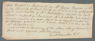
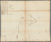
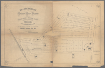
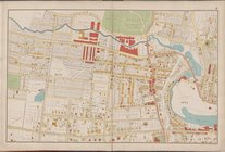
Pearl Street
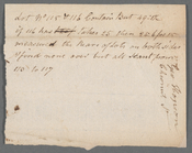
note:
George Hopson. Includes
Chestnut
Street.
m
Chestnut
Street
m
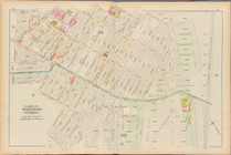
Dugan's near the Arch
note:
…), and Meadow to
Chestnut
Street.
m
Abijah Hammond's meadow,
Chestnut
, Meadow
…., Inglewood Ave.,
Chestnut
St
….,
Chestnut
St., Waterford St
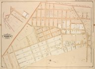
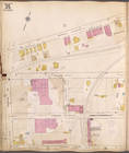
Brighton park: Brighton distr…
note:
Covers
Chestnut
Hill Reservoir
… by
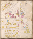
Chestnut
Ave., Tompkins Ave
… by Front,
Chestnut
Ave
… by
Chestnut
Ave., Clifton Ave.]
….,
Chestnut
St., Garfield St.]
….,
Chestnut
St., Palisade Ave
collection:
….,
Chestnut
St., Palisade
….,
Chestnut
St., Avenue H
….,
Chestnut
Ave., Tompkins Ave.]
…., Edgewater,
Chestnut
]
… bounded by
Chestnut
St
… bounded by
Chestnut
St
… bounded by
Chestnut
St
…., Etna Ave.,
Chestnut
St
…., Ridgewood Ave.,
Chestnut
St
…., Fulton St.,
Chestnut
St
… by Springfield Rd.,
Chestnut
St
… by Meacham Ave.,
Chestnut
Ave
….,
Chestnut
Ave., Tompkins Ave.]
…., Edgewater,
Chestnut
Ave.]
…., Virginia Ave.,
Chestnut
Ave
… by Parsons Ave.,
Chestnut
St
…, Leavitt St.,
Chestnut
St.]
… by
Chestnut
Ave., New York Ave
… by
Chestnut
St., Westfield Ave
….,
Chestnut
St.]
… bounded by
Chestnut
Ave
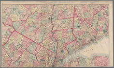
Map of Virginia and Maryland,…
Plate 28, Part of Wards 2 & 4…
Plate 29, Part of Wards 2 & 3…
… bounded by
Chestnut
Ave
….,
Chestnut
Ave., Todt Hill Rd
….,
Chestnut
St., Highland Ave
…, Westfield Ave.,
Chestnut
St
m
Map of the City of Utica, One…
… York Ave),
Chestnut
Ave
… by
Chestnut
Ave, Bay St (New
Florida Land and Improvement …
Atlantic and Gulf Coast Canal…
Map of the roads, canals and …
…., Locust Ave.,
Chestnut
St
… Terrace,
Chestnut
Ave
….,
Chestnut
St.; Including
m
… on the
Chestnut
Grove Division
m
Map of New York and vicinity:…
note:
engraved by Worley & Bracher, 320
Chestnut
St