Click to visit the main New York Public Library Homepage
The New York Public Library
Digital Collections
About Digital Collections
Browse
Search only public domain materials
Items
Collections
Divisions
Home
Search
Browse
About
Search only public domain materials
Items
Collections
Divisions
Digital Collections
Using Images
Using Data
Search
Filtered keyword search
Show filters
Hide filters
Show Only Public Domain
topic
Real property
54
Landowners
40
Administrative and political divisions
19
Real propery auctions
13
Fire insurance
12
More
Less
name
Walling, Henry Francis, 1825-1888
25
Sanborn Map Company
11
Perris, William
8
James Bleecker & Sons
7
H.F. Walling's Map Establishment
6
More
Less
collection
Atlases of New York City
31
Maps of North America
27
Maps of New York City and State
26
Collection of broadside real estate maps announcing auctions of lots in early 19th century New York City
13
Atlases of the United States
1
More
Less
place
New York (State)
58
New York
38
Manhattan (New York, N.Y.)
25
United States
15
Lower Manhattan (New York, N.Y.)
14
More
Less
genre
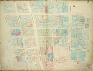
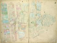
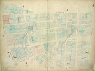
Maps
100
Cadastral maps
30
Illustrations
5
Wall maps
4
Road maps
2
More
Less
publisher
Sanborn Map Company
9
Lith. by Korff Brothers
4
Perris & Browne
4
William Perris, Civil Engineer
4
E. Robinson Co
3
More
Less
division
Map Division
96
Manuscripts and Archives Division
1
Rare Book Division
1
type
x
cartographic
still image
6
Date Range
to
100 results found for:
x
City walls
Filtering on:
x
Type
: cartographic
Sort by:
Relevance
Title
Date created
Date digitized
Sequence
Map of Jersey
City
…,
Wall
Street, Broadway
…,
Wall
St,
Wall
St Ferry
note:
Surveyed by I.C. Buckhout,
city
surveyor
…,
Wall
Street, Broad
…, Coffee House Slip,
Wall
S
collection:
…, Coffee House Slip,
Wall
…, Nassau Street,
Wall
…,
Wall
Street, Broad
…, Pine Street,
Wall
…, Rector St.,
Wall
St
…., William St.,
Wall
St
…, William Street,
Wall
… Street,
Wall
Street
… Street,
Wall
Street
…, South Street,
Wall
m
…, New York
City
, from
…., Belvidere St.,
Wall
St
note:
Cover title:
City
atlas of Brooklyn, N.Y.
Wall
St. New York
City
, U.S.A. over
m
Map of the Passaic and Croton…
collection:
New York
City
& Vicinity
m
Map of the
City
of New York and its
note:
… of H.F.
Walling
.
m
Map of the
City
of New York and its
note:
… of H.F.
Walling
.
…, Fletcher St,
Wall
St
m
Financial district map of New York
City
…
note:
… York
City
".
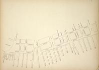
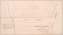
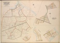
Map of property in the 2nd ward of the
city
note:
surveyed Edwin Smith,
city
surveyor
m
… York
City
…
note:
….
City
Hall.
… to
Wall
St. New York, East
…, Joralemon St., Ferry To
Wall
m
…, in the
City
of New-York
note:
…, south of
Wall
Street.
Map showing location of works…
note:
… and rail roads, no. 7
Wall
Queens, Vol. 2, Double Page P…
collection:
… by Walnut St.,
Walling
St
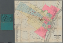
City
of Albany, New York
note:
…. Bingham,
city
surveyor
Map of the proposed widening …
note:
New York, May 1849, Joseph F. Bridges,
city
m
Map of the State of Rhode Isl…
note:
Shows county,
city
and town boundaries, roads
Map of the
city
note:
by H.F.
Walling
… by
Wall
, Johns Lane
note:
Fire insurance plans of
cities
m
The five boroughs of the
city
of New York
… at intersection of
Wall
, Broad
… St., Broadway,
Wall
note:
Fire insurance plans of
cities
… Pl.,
Wall
, Westervelt
note:
Fire insurance plans of
cities
… by
Wall
, Richmond Ter
note:
Fire insurance plans of
cities
… of the
city
of New York
… bounded by
Wall
St., East
note:
Fire insurance plans of
cities
… by
Wall
St., Broad St
note:
Fire insurance plans of
cities
… by Bushwick Ave.,
Wall
St
note:
Fire insurance plans of
cities
… by
Wall
, St. Mark's Pl
note:
Fire insurance plans of
cities
… [Map bounded by
Wall
St
note:
Fire insurance plans of
cities
Map of property in the 2nd ward of the
city
… miles from the
city
m
… of
Wall
Street : Grants
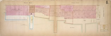
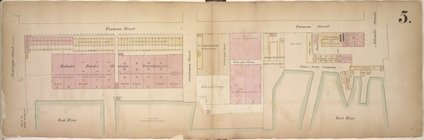
Map of property in the 1st ward of the
city
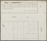
Map of property in the 1st ward of the
city