Click to visit the main New York Public Library Homepage
The New York Public Library
Digital Collections
About Digital Collections
Browse
Search only public domain materials
Items
Collections
Divisions
Home
Search
Browse
About
Search only public domain materials
Items
Collections
Divisions
Digital Collections
Using Images
Using Data
Search
Filtered keyword search
Show filters
Hide filters
Show Only Public Domain
topic
Real property
30
Cities & towns
17
Fire insurance
17
History
7
Administrative and political divisions
2
More
Less
name
Sanborn Map Company
17
G.M. Hopkins & Co
4
E. Robinson Co
3
E.B. Hyde & Co
3
Montrésor, John, 1736-1799
3
More
Less
collection
Atlases of New York City
31
Bancker plans
17
Maps of New York City and State
12
Lawrence H. Slaughter Collection of English maps, charts, globes, books and atlases
4
Maps of North America
3
place
New York (State)
37
Brooklyn (New York, N.Y.)
15
New York
13
New York (N.Y.)
6
Fort Saint Frederic (Crown Point, N.Y.)
4
More
Less
genre
Maps
67
Surveys
17
land surveys
15
Documents
2
Military maps
2
More
Less
publisher
Sanborn Map Company
17
G.M. Hopkins & Co
4
E. Belcher Hyde
3
E. Robinson Co
3
G. W. Bromley & E. Robinson
2
More
Less
division
Map Division
50
Manuscripts and Archives Division
17
type
x
cartographic
text
3
still image
1
Date Range
to
67 results found for:
x
Crowns
Filtering on:
x
Type
: cartographic
Sort by:
Relevance
Title
Date created
Date digitized
Sequence
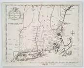
An exact mapp of New England …
m
…'s Ropewalk near
Crown
Point
note:
… Street to
Crown
Point
m
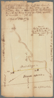
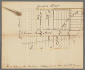
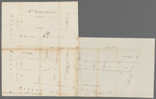
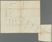
Broadway, Nassau, Green and
Crown
Streets
note:
….
Crown
Street, Green
m
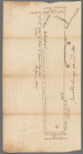
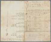
Computation of ground at
Crown
Point
m
Quackenboss and G. Abeel land at
Crown
m
Crown
Point
m
Little Queen,
Crown
and Cortland Streets
m
Maiden Lane and
Crown
Street
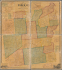
Map of Essex Co., New York
note:
… County --
Crown
Point
m
Crown
Street and Little Queen Street
m
Lot in
Crown
Street or Maiden Lane
m
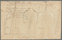
Washington Street
note:
Wilkins and Brush. Cortland to
Crown
Street
m
Vacant lot and Romine's land at
Crown
m
Lots at the North River
note:
…
Crown
Street and Little
m
Draft of the estate of the la…
note:
Crown
to Market Street, and Greenwich
m
R. Leake and Rutgers - Pryor'…
note:
… Street, and
Crown
Street
m
Thomas Gardner's lots at
Crown
Point
m
…,
Crown
, and Green Streets
m
Corlears Hook and surrounds
note:
… and Grand Streets to
Crown
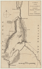
A map of the county between
Crown
Point
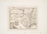
A map of the eastern part of …
note:
Inset: Fort Frederic at
Crown
Point
A map of the eastern part of …
note:
Inset: Fort Frederic at
Crown
Point
A map of New England & ye cou…
abstract:
… Frederick at
Crown
Point
m
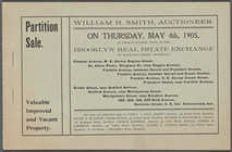
Partition Sale
note:
…; President St;
Crown
street
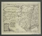
A new and accurate map of the…
note:
… at
Crown
or Scalp Point
…,
Crown
Heights
… Avenue,
Crown
Street
… [Map bounded by
Crown
… by President St.,
Crown
St
….,
Crown
St., Bedford Ave.]
…, New York Ave.,
Crown
…, Brooklyn Ave.,
Crown
St
…, Kingston Ave.,
Crown
St
…, Albany Ave.,
Crown
St
…, Troy Ave.,
Crown
St
…, Schenectady Ave.,
Crown
St
…, Utica Ave.,
Crown
St
…, Rochester Ave.,
Crown
St
….,
Crown
St., Brooklyn Ave
… bounded by
Crown
St
… bounded by
Crown
St
… bounded by
Crown
St., Troy
… bounded by
Crown
St
….,
Crown
St., E. New York
m
Borough of Brooklyn, 5th cong…
abstract:
Covers parts of
Crown
Heights, Flatbush
… Avenue,
Crown
Street
… Avenue,
Crown
Street
A map of the country between
Crown
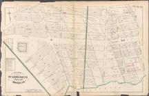
Plate 33: Bounded by Atlantic…
collection:
…, Schenectady Avenue,
Crown
Map of Brooklyn during the Ba…