Click to visit the main New York Public Library Homepage
The New York Public Library
Digital Collections
About Digital Collections
Browse
Search only public domain materials
Items
Collections
Divisions
Home
Search
Browse
About
Search only public domain materials
Items
Collections
Divisions
Digital Collections
Using Images
Using Data
Search
Filtered keyword search
Show filters
Hide filters
Show Only Public Domain
topic
Administrative and political divisions
38
Nautical charts
34
Railroads
32
Indian reservations
21
History
18
More
Less
name
United States Coast Survey
53
Bache, A. D. (Alexander Dallas), 1806-1867
40
Bien, Julius, 1826-1909
36
Roeser, C. (Charles)
34
United States. General Land Office
31
More
Less
collection
Maps of North America
186
Maps of New York City and State
21
I. N. Phelps Stokes Collection of American Historical Prints
8
Lawrence H. Slaughter Collection of English maps, charts, globes, books and atlases
7
C. W. McAlpin Collection
1
More
Less
place
United States
25
South Carolina
20
Virginia
20
New York (State)
18
Michigan
17
More
Less
genre
Maps
227
Nautical charts
30
Topographic maps
21
Bathymetric maps
18
Geological maps
11
More
Less
publisher
U.S. Coast Survey Office
22
U.S. Coast Survey
20
General Land Office
16
publisher not identified
15
U.S. Geological Survey
12
More
Less
division
Map Division
215
Wallach Division: Print Collection
10
Manuscripts and Archives Division
1
Rare Book Division
1
type
x
cartographic
still image
8
text
1
Date Range
to
227 results found for:
x
D'Oyly, Charles
Filtering on:
x
Type
: cartographic
Sort by:
Relevance
Title
Date created
Date digitized
Sequence
Geological map of Isle Royale…
parent:
c2e47e80-b143-0132-9cdd-58
d
385a7bbd0
Map of east Tennessee & weste…
parent:
94b0f9f0-4f8f-0135-30a3-2782e4b6822
d
Tennessee Wartburg quadrangle…
parent:
c090c1a0-4f7e-0135-53
d
4-07
d
53ffb20ce
Tennessee Pikeville sheet
parent:
2834
d
760-4f7
d
-0135-4b12-09c7885cf0dd
Tidal currents of Long Island…
parent:
587bdb60-c5aa-012f-f824-58
d
385a7bc34
New Jersey (Sussex County) Fr…
parent:
6026
d
090-c52b-012f-3261-3c075448cc4b
Alaska military expedition : …
parent:
2666cdf0-fd40-0135-31b8-4f6e13b4
d
05f
Omaha and vicinity : Nebraska…
parent:
3b516680-
d
21b-0135-953f-04ddc41
d
582e
California, Nevada City speci…
note:
… Survey,
Charles
D
Map of Richmond, Va. : and su…
parent:
d
267b940-6eff-0135-c5
d
7-03f550e8f677
Map showing the direction of …
note:
…
D
. Salisbury and
Charles
E. Peet ; John C
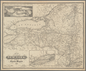
Map of the State of New York
parent:
a202b2e0-c5a6-012f-9190-58
d
385a7bc34
Map of Honolulu
parent:
42059fc0-b143-0132-75
d
8-58
d
385a7bbd0
Map of Alaska : showing explo…
parent:
d
4fe8590-b142-0132-
d
8c1-58
d
385a7bbd0
A preliminary map of the surf…
first:
58e7ebf0-1339-0135-446a-2
d
50c98e9590
Map of Pacific Railroad Free …
note:
…., auctioneers; J.
D
. Stevenson
A plan of the town of Newport…
parent:
7eae8350-df45-0134-
d
6
d
8-694853178371
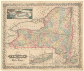
Map of the State of New York
parent:
a202b2e0-c5a6-012f-9190-58
d
385a7bc34
Colorado, Tenmile District sp…
parent:
ea34df80-209
d
-0136-50a2-779
d
4f4
d
1
d
93
Alaska military expedition : …
parent:
758c72f0-fd41-0135-5
d
4
d
-4b5f5de67af2
Colorado (Dolores County), Ri…
parent:
7ccc7730-209c-0136-e438-1bdfeff6
d
1a2
California (Los Angeles Co.) …
parent:
8e056520-1401-0136-0989-0436223a19
d
5
Fac simile of Holmes' map of …
note:
Republished by
Charles
L. Warner ; eng'
d
… acquisitions gain'
d
by the late
parent:
7
d
109db0-c52a-012f-b115-3c075448cc4b
Tybee Bay and Calibogue Sound…
parent:
b5897740-b144-0132-f312-58
d
385a7bbd0
Explorations in Alaska, 1898 …
parent:
6e4a64c0-fd42-0135-0672-691
d
6893db83
California (Nevada Co.), Neva…
note:
… Survey,
Charles
D
Explorations in Alaska, 1898 …
parent:
61464810-fd3b-0135-
d
31c-05b17c1bfab8
Explorations in Alaska, 1898 …
parent:
d
4fe8590-b142-0132-
d
8c1-58
d
385a7bbd0
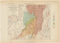
Land classification map, New …
parent:
f67242a0-bd63-0133-1f93-00505686
d
14e
Charles
XII at Bender
parent:
f9fe1800-93e7-0130-b03e-58
d
385a7b928
Explorations in Alaska, 1898 …
parent:
d
4fe8590-b142-0132-
d
8c1-58
d
385a7bbd0
Explorations in Alaska, 1898 …
parent:
a3fdc6e0-fd3
d
-0135-e2b6-0bb5c166aabe
m
A new map of Arkansas with it…
parent:
d
63e8560-e18
d
-0134-6
d
4e-001b1a456a5e
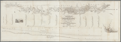
Sketch of part of the Black R…
parent:
2abc9210-a1
d
5-0133-3b35-00505686
d
14e
Map of the Oregon Territory
parent:
5cf856f0-2a29-0136-6
d
70-2138
d
07
d
3e57
Upper Geyser Basin
parent:
739ca6
d
0-e742-0135-b8ad-43b834ec1ad8
Geologic map of parts of Beek…
parent:
5ee48f80-c5aa-012f-0b70-58
d
385a7bc34
Military topographical map of…
parent:
93faf260-52b0-0135-
d
6ad-1f8a89972be0
Philadelphia and vicinity : P…
parent:
43
d
78210-c969-0135-afce-27ef828b31c7
Alaska route of military expe…
parent:
d
6
d
5c350-fd3e-0135-
d
061-5
d
18a13c74ff
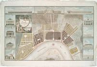
Plan of the city and suburbs …
parent:
7e1869a0-c5ed-012f-2749-58
d
385a7bc34
Stono Inlet, South Carolina
parent:
b5897740-b144-0132-f312-58
d
385a7bbd0
Mt. Washington and vicinity: …
parent:
48983f10-b144-0132-e269-58
d
385a7bbd0
Tidal currents of Nantucket S…
parent:
bac116a0-b143-0132-83cb-58
d
385a7bbd0
… of the French gener. Count
d
parent:
3b2ec720-b143-0132-959c-58
d
385a7bbd0
Chart of Narraganset Bay : su…
parent:
90c6a5c0-b144-0132-
d
3e3-58
d
385a7bbd0
Map of a reconnoissance betwe…
first:
d
40e0540-df1f-0134-e79a-0f3fa39c9c46
Beaufort River, S.C. : from B…
parent:
df6311b0-4243-0135-6583-0c3a782
d
10cb
Boston Harbor, Massachusetts
parent:
bac116a0-b143-0132-83cb-58
d
385a7bbd0