Click to visit the main New York Public Library Homepage
The New York Public Library
Digital Collections
About Digital Collections
Browse
Search only public domain materials
Items
Collections
Divisions
Home
Search
Browse
About
Search only public domain materials
Items
Collections
Divisions
Digital Collections
Using Images
Using Data
Search
Filtered keyword search
Show filters
Hide filters
Show Only Public Domain
topic
Nautical charts
60
Administrative and political divisions
16
Harbors
16
Coasts
12
Railroads
10
More
Less
name
United States Coast Survey
53
Bache, A. D. (Alexander Dallas), 1806-1867
48
Yeager, E. (Edward)
15
Mathiot, G
12
Woodward, E. F
10
More
Less
collection
Maps of North America
88
Maps of New York City and State
19
Lawrence H. Slaughter Collection of English maps, charts, globes, books and atlases
11
I. N. Phelps Stokes Collection of American Historical Prints
5
Atlases of New York City
4
More
Less
place
New York (State)
17
New York (N.Y.)
11
Virginia
11
Massachusetts
10
Atlantic Coast
8
More
Less
genre
Maps
139
Nautical charts
44
Bathymetric maps
20
Prints
15
Illustrations
7
More
Less
publisher
U.S. Coast Survey Office
19
U.S. Coast Survey
15
United States Coast Survey
7
E. Robinson Co
4
Printed for Lockyer Davis
4
More
Less
division
Map Division
124
General Research Division
7
Wallach Division: Print Collection
5
Wallach Division: Art & Architecture Collection
4
Rare Book Division
3
More
Less
type
x
cartographic
still image
4
text
2
Date Range
to
144 results found for:
x
E. D., engraver
Filtering on:
x
Type
: cartographic
Sort by:
Relevance
Title
Date created
Date digitized
Sequence
Reconnaissance of the bar and…
parent:
cf02eeb0-16ef-0135-6b1
e
-251c5
e
10288c
…, Avenue
E
,
E
. 13th Street, Avenue
D
, Coney Island
parent:
af2405f0-c604-012f-eb9c-58
d
385a7bc34
Preliminary chart of Cedar Ke…
parent:
c1
d
2ef30-13
d
2-0135-
d
440-3f4da83
e
2bb8
…, Avenue
E
, Avenue
D
and
E
parent:
b4534410-c604-012f-25c6-58
d
385a7bc34
…, Avenue
D
,
E
. 106th Street
parent:
b5a62
d
70-c604-012f-0546-58
d
385a7bc34
… Lane,
E
. 40th Street, Avenue
D
, Rogers Street
parent:
aea73250-c604-012f-89
d
6-58
d
385a7bc34
Preliminary chart of Portsmou…
parent:
48983f10-b144-0132-
e
269-58
d
385a7bbd0
Bass River Harbor, Massachuse…
parent:
bac116a0-b143-0132-83cb-58
d
385a7bbd0
Key West Harbor and its appro…
parent:
a53fa730-2ceb-0135-ded8-4b98
d
55aff76
… Kouskowa appartenant à S.
E
parent:
0
e
3
e
7
d
00-c62c-012f-fb46-58
d
385a7bc34
Preliminary survey of Winyah …
parent:
8fa93
d
00-4ed3-0135-28
d
4-00a5431
d
62ca
Biloxi Bay, Mississippi : fro…
parent:
29702880-2eaa-0135-92ba-0
d
426a5169c1
Preliminary sketch of Wachapr…
parent:
695da130-697
d
-0135-4a71-4194f2795036
Reconnaissance of the western…
parent:
24714
d
70-b145-0132-a6be-58
d
385a7bbd0
Preliminary chart of part of …
parent:
26
e
1a660-52b7-0135-36fa-6
d
276ace48eb
Long Island Sound from New Yo…
parent:
594da8c0-c5aa-012f-5dc3-58
d
385a7bc34
Long Island Sound from New Yo…
parent:
e
09da2
d
0-c5
d
4-012f-8138-58
d
385a7bc34
Preliminary chart of San Luis…
parent:
7b35bed0-
e
815-0135-7
e
7c-15719c1bd174
Preliminary chart of Bass Riv…
parent:
bac116a0-b143-0132-83cb-58
d
385a7bbd0
Plan de l'Isle de Rodda, avec…
parent:
19ad3470-c6ba-012f-5340-58
d
385a7bc34
Preliminary chart of North Ed…
parent:
3
e
57f880-4ebb-0135-94cc-095522ebbddd
Preliminary chart of North Ed…
parent:
51bdb180-4ebf-0135-0c6a-0a76dfc113
d
0
Plan topographique des ruines…
parent:
307987
e
0-c6b8-012f-0dbc-58
d
385a7bc34
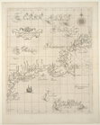
Carta particolare della Nuoua Belgia
e
parent:
181269
e
0-c5ed-012f-3452-58
d
385a7bc34
Preliminary chart of Stellwag…
parent:
bac116a0-b143-0132-83cb-58
d
385a7bbd0
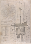
Architecture : plan des ruine…
parent:
3f370620-c6b8-012f-bf6
e
-58
d
385a7bc34
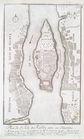
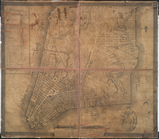
Plan of the city of New-York,…
parent:
66dc2ea0-c5ed-012f-ac0b-58
d
385a7bc34
Preliminary chart of Muskeget…
parent:
bac116a0-b143-0132-83cb-58
d
385a7bbd0
Lynn Harbor, Massachusetts 18…
parent:
f0c90ee0-632
d
-0134-c41a-00505686a51c
Harbor of Refuge, Dutch Islan…
parent:
90c6a5c0-b144-0132-
d
3
e
3-58
d
385a7bbd0
Preliminary chart of Winyah B…
parent:
fc77bb40-4ed4-0135-02
d
2-09
d
03
e
9ff581
Panorama of the Hudson River …
parent:
d
2aa9df0-c5ed-012f-def0-58
d
385a7bc34
Preliminary chart of the Rigo…
parent:
10
e
975a0-22
e
8-0135-fa4f-0f7
d
35
d
66c28
Preliminary chart of the sea …
parent:
070
d
8050-52b4-0135-b010-5b3ac3ad6893
Mouth of Chester River : (Har…
parent:
4162
e
680-c52b-012f-c2dc-3c075448cc4b
Rappahannock River, Virginia …
parent:
3ba0c580-68
d
6-0135-df13-4b72a4264fa6
Topographical map of the city…
parent:
b5eb8470-c5ed-012f-3b51-58
d
385a7bc34
Metomkin Inlet, Virginia : fr…
parent:
3c09
e
480-68b2-0135-b1ca-232
e
3dc4649c
Preliminary chart of Ship and…
parent:
87229fd0-c52b-012f-390
d
-3c075448cc4b
Preliminary chart of Plymouth…
parent:
13180400-6bc6-0134-
d
489-00505686a51c
Preliminary chart of Ship Isl…
parent:
fc8149f0-22eb-0135-a5
e
4-0
d
3536a34ca6
Reconnaissance of Doboy Bar a…
parent:
3b2ec720-b143-0132-959c-58
d
385a7bbd0
Plan des statues colossales, …
parent:
3f0
d
6f70-c6ba-012f-1a67-58
d
385a7bc34
Preliminary sketch of Mobile …
parent:
8
d
6cee50-7c6b-0135-3765-1f2c5910acc2
m
Eastern part of Long Island S…
parent:
45ed47
e
0-793c-0135-6bfd-47
d
71542dbac
United States of America
parent:
e
21406f0-c52a-012f-655b-3c075448cc4b
Mouth of Chester River : (Har…
parent:
54312bb0-c52b-012f-b8
e
9-3c075448cc4b
m
Preliminary chart of Savannah…
parent:
38
d
829c0-01c4-0135-fab3-03
d
47
e
8626
e
8
m
United States of America, 1834
parent:
b94
d
1370-c52a-012f-c874-3c075448cc4b
Middle part of Long Island So…
parent:
d
65345f0-79ee-0135-ffb0-07847438
d
76f