Click to visit the main New York Public Library Homepage
The New York Public Library
Digital Collections
About Digital Collections
Browse
Search only public domain materials
Items
Collections
Divisions
Home
Search
Browse
About
Search only public domain materials
Items
Collections
Divisions
Digital Collections
Using Images
Using Data
Search
Filtered keyword search
Show filters
Hide filters
Show Only Public Domain
topic
Discovery and exploration
108
Explorations and surveys
25
Pacific railroads
25
Geology
24
Railroads
18
More
Less
name
United States. War Department. Office of P.R.R. Surveys
21
Sarychev, Gavriil Andreevich, 1763-1831
15
United States. War Department
15
Blake, William P. (William Phipps), 1826-1910
12
Warren, G. K. (Gouverneur Kemble), 1830-1882
11
More
Less
collection
Maps of North America
106
Puteshestvie flota kapitana Sarycheva po sieverovostochnoi chasti Sibiri, Ledovitomu moriu i Vostochnomu okeanu, v prodolzhenie osmi liet, pri Geograficheskoi i astronomicheskoi morskoi ekspeditsii, byvshei pod nachalstvom flota kapitana Billingsa s 1785 po 1793 god
15
Histoire complète des voyages et découvertes en Afrique, depuis les siècles les plus reculés jusqu'a nos jours
7
Lawrence H. Slaughter Collection of English maps, charts, globes, books and atlases
7
A history of the colonization of Africa by alien races
6
More
Less
place
California
25
Arctic regions
23
United States
21
West (U.S.)
21
Africa
20
More
Less
genre
Maps
175
pages (components)
16
Topographic maps
10
Geological cross-sections
9
Geological maps
9
More
Less
publisher
Tip. Shnora
15
War Department
12
U.S. Congress
10
publisher not identified
10
A. Bertrand
9
More
Less
division
Map Division
126
General Research Division
28
Schomburg Jean Blackwell Hutson Research and Reference Division
9
Rare Book Division
8
Schomburg Manuscripts, Archives and Rare Books Division
4
More
Less
type
x
cartographic
still image
14
text
14
Date Range
to
177 results found for:
x
Explorers
Filtering on:
x
Type
: cartographic
Sort by:
Relevance
Title
Date created
Date digitized
Sequence
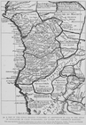
Florida, with the march of He…
abstract:
…
exploration
routes in the 1530
A map of the Congo regions pu…
collection:
…, and Flemish
explorers
[mainly
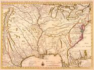
Carte de la Louisiane et du c…
abstract:
Shows some
explorers
' routes. Includes
Carte de la Louisiane et du c…
note:
Shows some
explorers
' routes.
Map no. 2, from the northern …
note:
Appears in Reports of
explorations
and surveys
Military map of Nebraska and …
note:
… the
explorations
made by him
…
explored
in 1849, 50, 51
note:
From the author's
Exploration
of the Red River
Geological section along the …
note:
… Road
Explorations
Rio Colorado of the West.
note:
Also shows routes of
exploration
.
Geological section along the route
explored
note:
… Road
Exploration
Geological section of the Ber…
note:
…
Exploration
& Surveys, War
Geological map of the route
explored
by Capt
note:
… Road
Exploration
Geological sections of the Bernardino Pass,
explored
note:
… Rail Road
Exploration
Geological section of the Sie…
note:
… Road
Explorations
Geological section from the C…
note:
…
Exploration
& Surveys, War
Itinéraire, de Karak a Chauba…
collection:
Voyage d'
exploration
a la mer Morte
Military map of Nebraska and …
note:
… the
explorations
made by him
Sections of the Colorado Dese…
note:
… Rail Road
Exploration
m
Military map of Nebraska and …
note:
…., from the
explorations
Map of
explorations
in north western Alaska
topic:
Discovery and
exploration
Geological section of the Coa…
topic:
Explorations
and surveys
Map exhibiting the routes bet…
topic:
Discovery and
exploration
Map of wagon routes in Utah T…
abstract:
… of
explorations
across the great
A general sketch of the coast…
collection:
Narrative of an expedition to
explore
Map of the route passed over …
topic:
Discovery and
exploration
… of the
explorations
for a railroad
note:
compiled from authorized
explorations
m
Map of the states of Kansas a…
note:
Shows routes of
exploring
expeditions
m
Territory of the United State…
note:
Compiled from authorized
explorations
Réduction des cartes du cours…
collection:
Voyage d'
exploration
a la mer Morte
Map and profile of the Cañada…
note:
From
explorations
and surveys made under
m
Map of the territory of the U…
note:
Compiled from authorized
explorations
Map and profile of the Tejon …
note:
From
explorations
and surveys made under
m
Milk R. to the crossing of th…
topic:
Explorations
and surveys
Reconnoissances in the Dacota…
note:
Shows routes of government
explorations
from
Map of parts of Montana, Idah…
abstract:
… of
exploring
expeditions
m
Territory of the United State…
note:
Compiled from authorized
explorations
Map no. 2, from the mouth of …
note:
Appears in Reports of
explorations
and surveys
m
Map of the territory of the U…
note:
compiled from authorized
explorations
… of California
explored
in 1855
abstract:
…:
Explorations
and surveys
Geological section from the M…
note:
… Road
Explorations
Territory of the United State…
note:
Compiled from authorized
explorations
Explorations
and surveys south of Central
note:
… report of
explorations
Map of Alaska : showing explo…
topic:
Discovery and
exploration
m
Map of an
exploring
expedition to the Rocky
note:
…"Published in Report of the
exploring
Montana and Wyoming Territori…
topic:
Discovery and
exploration
Geroicheskiĭ pokhod
topic:
Discovery and
exploration
Map of
explorations
and surveys in New Mexico
abstract:
…, and
exploration
trails. Relief
Map no. 1, from San Francisco…
note:
From
explorations
and surveys made under
Map of the country upon the B…
topic:
Discovery and
exploration
Map of an
exploring
expedition to the Rocky
topic:
Discovery and
exploration